Atlantic Topo Map Iowa
To zoom in, hover over the map of Atlantic
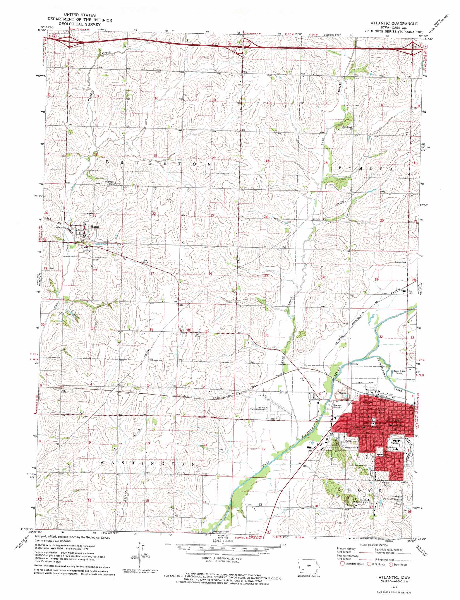
USGS Topo Quad 41095d1 - 1:24,000 scale
| Topo Map Name: | Atlantic |
| USGS Topo Quad ID: | 41095d1 |
| Print Size: | ca. 21 1/4" wide x 27" high |
| Southeast Coordinates: | 41.375° N latitude / 95° W longitude |
| Map Center Coordinates: | 41.4375° N latitude / 95.0625° W longitude |
| U.S. State: | IA |
| Filename: | o41095d1.jpg |
| Download Map JPG Image: | Atlantic topo map 1:24,000 scale |
| Map Type: | Topographic |
| Topo Series: | 7.5´ |
| Map Scale: | 1:24,000 |
| Source of Map Images: | United States Geological Survey (USGS) |
| Alternate Map Versions: |
Atlantic IA 1971, updated 1973 Download PDF Buy paper map Atlantic IA 2010 Download PDF Buy paper map Atlantic IA 2013 Download PDF Buy paper map Atlantic IA 2015 Download PDF Buy paper map |
1:24,000 Topo Quads surrounding Atlantic
Harlan |
Jacksonville |
Kimballton |
Audubon |
Gardner |
Corley |
Prairie Rose Lake |
Elk Horn |
Exira West |
Exira East |
Avoca |
Walnut |
Atlantic |
Wiota |
Anita |
Avoca Se |
Atlantic Sw |
Lewis |
Anita Sw |
Massena |
Carson Ne |
Griswold |
Griswold Ne |
Grant |
Dewey |
> Back to 41095a1 at 1:100,000 scale
> Back to 41094a1 at 1:250,000 scale
> Back to U.S. Topo Maps home
Atlantic topo map: Gazetteer
Atlantic: Airports
Atlantic Municipal Airport elevation 351m 1151′Atlantic: Crossings
Interchange 51 elevation 381m 1250′Interchange 54 elevation 402m 1318′
Interchange 57 elevation 390m 1279′
Atlantic: Mines
Atlantic Quarry elevation 350m 1148′Atlantic: Parks
Atlantic City Park elevation 367m 1204′Pellet Memorial Woods State Preserve elevation 352m 1154′
Site of First House in Atlantic Historical Marker elevation 365m 1197′
Soldiers Monument elevation 367m 1204′
Sunnyside Park elevation 359m 1177′
Atlantic: Populated Places
Atlantic elevation 369m 1210′Marne elevation 386m 1266′
Atlantic: Post Offices
Atlantic Post Office elevation 359m 1177′Marne Post Office elevation 376m 1233′
Atlantic: Streams
Buck Creek elevation 345m 1131′Troublesome Creek elevation 347m 1138′
Atlantic digital topo map on disk
Buy this Atlantic topo map showing relief, roads, GPS coordinates and other geographical features, as a high-resolution digital map file on DVD: