Shelby Topo Map Iowa
To zoom in, hover over the map of Shelby
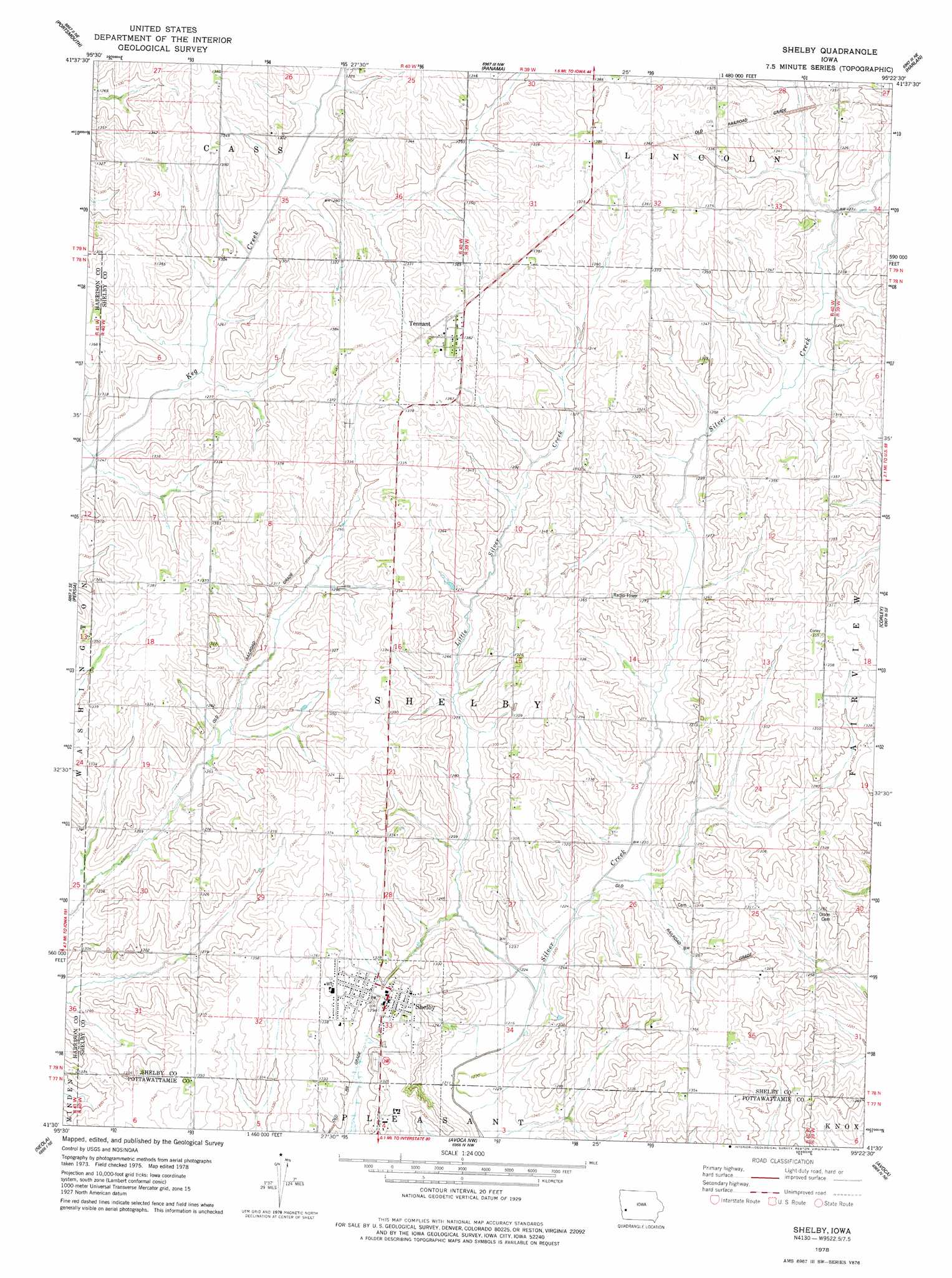
USGS Topo Quad 41095e4 - 1:24,000 scale
| Topo Map Name: | Shelby |
| USGS Topo Quad ID: | 41095e4 |
| Print Size: | ca. 21 1/4" wide x 27" high |
| Southeast Coordinates: | 41.5° N latitude / 95.375° W longitude |
| Map Center Coordinates: | 41.5625° N latitude / 95.4375° W longitude |
| U.S. State: | IA |
| Filename: | o41095e4.jpg |
| Download Map JPG Image: | Shelby topo map 1:24,000 scale |
| Map Type: | Topographic |
| Topo Series: | 7.5´ |
| Map Scale: | 1:24,000 |
| Source of Map Images: | United States Geological Survey (USGS) |
| Alternate Map Versions: |
Shelby IA 1978, updated 1978 Download PDF Buy paper map Shelby IA 2010 Download PDF Buy paper map Shelby IA 2013 Download PDF Buy paper map Shelby IA 2015 Download PDF Buy paper map |
1:24,000 Topo Quads surrounding Shelby
Dunlap Sw |
Dunlap |
Earling |
Defiance |
Irwin |
Woodbine |
Portsmouth |
Panama |
Harlan |
Jacksonville |
Hard Scratch |
Persia |
Shelby |
Corley |
Prairie Rose Lake |
Underwood |
Neola |
Avoca Nw |
Avoca |
Walnut |
Mcclelland |
Taylor |
Oakland |
Avoca Se |
Atlantic Sw |
> Back to 41095e1 at 1:100,000 scale
> Back to 41094a1 at 1:250,000 scale
> Back to U.S. Topo Maps home
Shelby topo map: Gazetteer
Shelby: Bridges
Old Stone Arch Bridge elevation 374m 1227′Shelby: Populated Places
Shelby elevation 400m 1312′Tennant elevation 421m 1381′
Shelby: Post Offices
Shelby Post Office elevation 402m 1318′Tennant Post Office elevation 421m 1381′
Shelby: Streams
Little Silver Creek elevation 371m 1217′Shelby: Trails
Rock Island Old Stone Arch Trail elevation 395m 1295′Shelby digital topo map on disk
Buy this Shelby topo map showing relief, roads, GPS coordinates and other geographical features, as a high-resolution digital map file on DVD: