Jacksonville Topo Map Iowa
To zoom in, hover over the map of Jacksonville
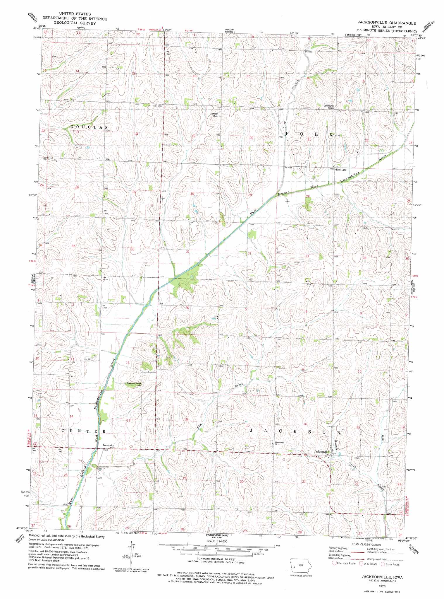
USGS Topo Quad 41095f2 - 1:24,000 scale
| Topo Map Name: | Jacksonville |
| USGS Topo Quad ID: | 41095f2 |
| Print Size: | ca. 21 1/4" wide x 27" high |
| Southeast Coordinates: | 41.625° N latitude / 95.125° W longitude |
| Map Center Coordinates: | 41.6875° N latitude / 95.1875° W longitude |
| U.S. State: | IA |
| Filename: | o41095f2.jpg |
| Download Map JPG Image: | Jacksonville topo map 1:24,000 scale |
| Map Type: | Topographic |
| Topo Series: | 7.5´ |
| Map Scale: | 1:24,000 |
| Source of Map Images: | United States Geological Survey (USGS) |
| Alternate Map Versions: |
Jacksonville IA 1978, updated 1978 Download PDF Buy paper map Jacksonville IA 2010 Download PDF Buy paper map Jacksonville IA 2013 Download PDF Buy paper map Jacksonville IA 2015 Download PDF Buy paper map |
1:24,000 Topo Quads surrounding Jacksonville
Dow City |
Earling Ne |
Manilla |
Manning |
Templeton |
Earling |
Defiance |
Irwin |
Manning Se |
Gray |
Panama |
Harlan |
Jacksonville |
Kimballton |
Audubon |
Shelby |
Corley |
Prairie Rose Lake |
Elk Horn |
Exira West |
Avoca Nw |
Avoca |
Walnut |
Atlantic |
Wiota |
> Back to 41095e1 at 1:100,000 scale
> Back to 41094a1 at 1:250,000 scale
> Back to U.S. Topo Maps home
Jacksonville topo map: Gazetteer
Jacksonville: Parks
Oaks Habitat Area elevation 416m 1364′Jacksonville: Populated Places
Jacksonville elevation 389m 1276′Red Line elevation 384m 1259′
Jacksonville: Post Offices
Botany Post Office (historical) elevation 373m 1223′Jacksonville Post Office (historical) elevation 389m 1276′
Redline Post Office (historical) elevation 384m 1259′
Jacksonville: Streams
Bonnie Creek elevation 378m 1240′Elm Creek elevation 365m 1197′
Long Branch elevation 373m 1223′
Jacksonville digital topo map on disk
Buy this Jacksonville topo map showing relief, roads, GPS coordinates and other geographical features, as a high-resolution digital map file on DVD: