Cedar Creek Topo Map Nebraska
To zoom in, hover over the map of Cedar Creek
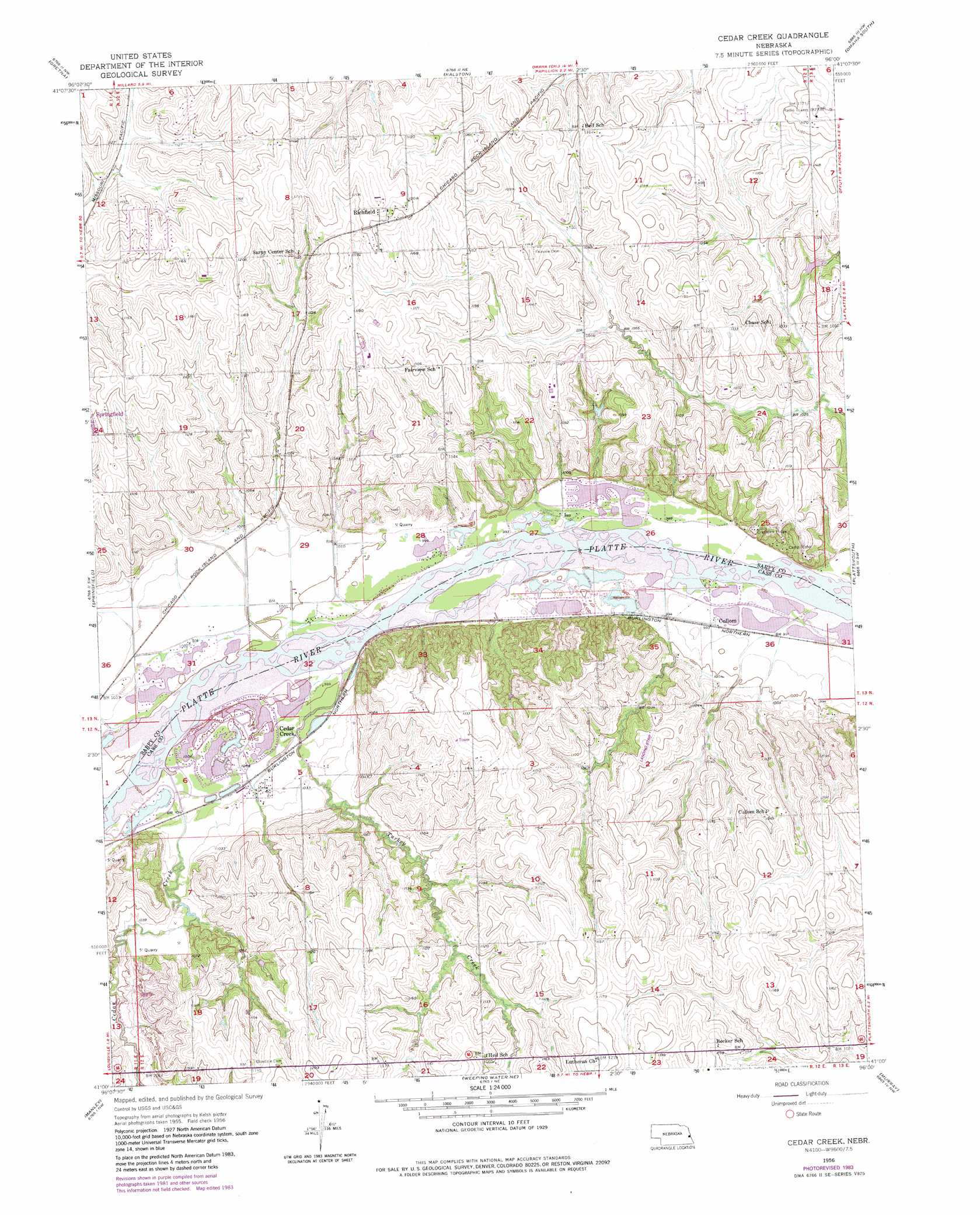
USGS Topo Quad 41096a1 - 1:24,000 scale
| Topo Map Name: | Cedar Creek |
| USGS Topo Quad ID: | 41096a1 |
| Print Size: | ca. 21 1/4" wide x 27" high |
| Southeast Coordinates: | 41° N latitude / 96° W longitude |
| Map Center Coordinates: | 41.0625° N latitude / 96.0625° W longitude |
| U.S. State: | NE |
| Filename: | O41096A1.jpg |
| Download Map JPG Image: | Cedar Creek topo map 1:24,000 scale |
| Map Type: | Topographic |
| Topo Series: | 7.5´ |
| Map Scale: | 1:24,000 |
| Source of Map Images: | United States Geological Survey (USGS) |
| Alternate Map Versions: |
Cedar Creek NE 1956, updated 1957 Download PDF Buy paper map Cedar Creek NE 1956, updated 1966 Download PDF Buy paper map Cedar Creek NE 1956, updated 1970 Download PDF Buy paper map Cedar Creek NE 1956, updated 1977 Download PDF Buy paper map Cedar Creek NE 1956, updated 1983 Download PDF Buy paper map Cedar Creek NE 2011 Download PDF Buy paper map Cedar Creek NE 2014 Download PDF Buy paper map |
1:24,000 Topo Quads surrounding Cedar Creek
Valley |
Elkhorn |
Irvington |
Omaha North |
Council Bluffs North |
Wann |
Gretna |
Ralston |
Omaha South |
Council Bluffs South |
Ashland East |
Springfield |
Cedar Creek |
Plattsmouth |
Pacific Junction |
Murdock |
Manley |
Weeping Water Ne |
Murray |
Rock Bluff |
Elmwood |
Weeping Water |
Avoca |
Nehawka |
Mcpaul |
> Back to 41096a1 at 1:100,000 scale
> Back to 41096a1 at 1:250,000 scale
> Back to U.S. Topo Maps home
Cedar Creek topo map: Gazetteer
Cedar Creek: Airports
P and R Airport elevation 338m 1108′Cedar Creek: Dams
Harvey Dam elevation 318m 1043′Cedar Creek: Mines
Springfield Quarry elevation 334m 1095′Cedar Creek: Populated Places
Cedar Creek elevation 311m 1020′Cullom elevation 302m 990′
Fairview (historical) elevation 353m 1158′
Richfield elevation 370m 1213′
Cedar Creek: Post Offices
Cedar Creek Post Office elevation 311m 1020′Fairview Post Office (historical) elevation 353m 1158′
Richfield Post Office (historical) elevation 370m 1213′
Cedar Creek: Reservoirs
Harvey Reservoir elevation 318m 1043′Cedar Creek: Streams
Cedar Creek elevation 302m 990′Glendale Creek elevation 298m 977′
Springfield Creek elevation 306m 1003′
Turkey Creek elevation 302m 990′
Younker Creek elevation 316m 1036′
Cedar Creek digital topo map on disk
Buy this Cedar Creek topo map showing relief, roads, GPS coordinates and other geographical features, as a high-resolution digital map file on DVD: