Valparaiso Topo Map Nebraska
To zoom in, hover over the map of Valparaiso
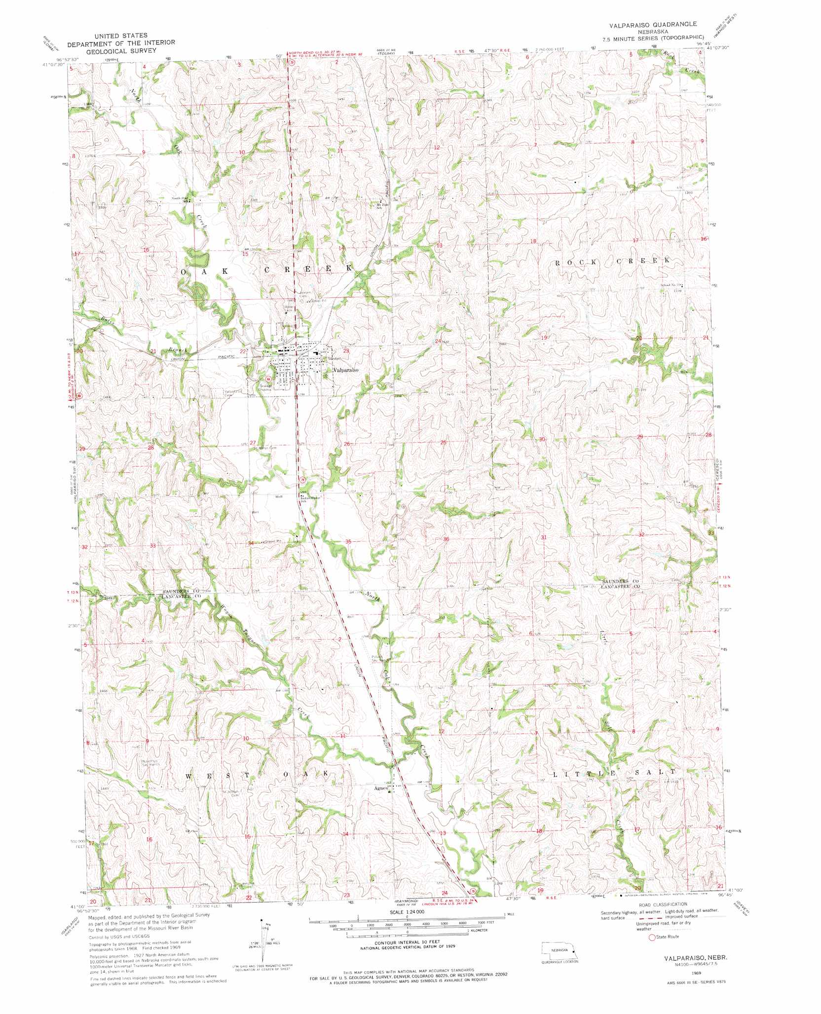
USGS Topo Quad 41096a7 - 1:24,000 scale
| Topo Map Name: | Valparaiso |
| USGS Topo Quad ID: | 41096a7 |
| Print Size: | ca. 21 1/4" wide x 27" high |
| Southeast Coordinates: | 41° N latitude / 96.75° W longitude |
| Map Center Coordinates: | 41.0625° N latitude / 96.8125° W longitude |
| U.S. State: | NE |
| Filename: | O41096A7.jpg |
| Download Map JPG Image: | Valparaiso topo map 1:24,000 scale |
| Map Type: | Topographic |
| Topo Series: | 7.5´ |
| Map Scale: | 1:24,000 |
| Source of Map Images: | United States Geological Survey (USGS) |
| Alternate Map Versions: |
Valparaiso NE 1969, updated 1971 Download PDF Buy paper map Valparaiso NE 1969, updated 1978 Download PDF Buy paper map Valparaiso NE 2011 Download PDF Buy paper map Valparaiso NE 2014 Download PDF Buy paper map |
1:24,000 Topo Quads surrounding Valparaiso
David City East |
Bruno |
Prague |
Malmo |
Colon |
Brainard |
Loma |
Touhy |
Wahoo West |
Wahoo East |
Dwight |
Valparaiso Sw |
Valparaiso |
Ceresco |
Wahoo Se |
Seward |
Garland |
Raymond |
Davey |
Waverly |
Milford |
Pleasant Dale |
Emerald |
Lincoln |
Walton |
> Back to 41096a1 at 1:100,000 scale
> Back to 41096a1 at 1:250,000 scale
> Back to U.S. Topo Maps home
Valparaiso topo map: Gazetteer
Valparaiso: Airports
Novotny-Tonar Farms Airport elevation 430m 1410′Polaks Sky Ranch elevation 385m 1263′
Valparaiso: Dams
North Oak Creek Dam 1-A elevation 388m 1272′North Oak Creek Dam 2-C elevation 402m 1318′
Valparaiso: Parks
Wildwood Lake State Wildlife Management Area elevation 399m 1309′Valparaiso: Populated Places
Agnew elevation 386m 1266′Valparaiso elevation 400m 1312′
Valparaiso: Post Offices
Agnew Post Office elevation 386m 1266′Valparaiso Post Office elevation 400m 1312′
Valparaiso: Reservoirs
North Oak Creek Reservoir 1-A elevation 388m 1272′North Oak Creek Reservoir 2-C elevation 402m 1318′
Wildwood Lake elevation 399m 1309′
Valparaiso: Streams
Bates Branch elevation 388m 1272′North Oak Creek elevation 383m 1256′
Wagon Tongue Creek elevation 378m 1240′
Valparaiso digital topo map on disk
Buy this Valparaiso topo map showing relief, roads, GPS coordinates and other geographical features, as a high-resolution digital map file on DVD: