Rogers Topo Map Nebraska
To zoom in, hover over the map of Rogers
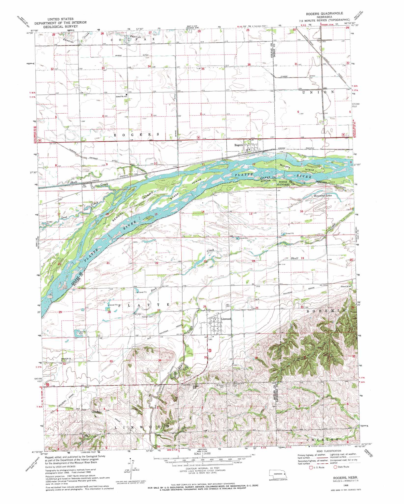
USGS Topo Quad 41096d8 - 1:24,000 scale
| Topo Map Name: | Rogers |
| USGS Topo Quad ID: | 41096d8 |
| Print Size: | ca. 21 1/4" wide x 27" high |
| Southeast Coordinates: | 41.375° N latitude / 96.875° W longitude |
| Map Center Coordinates: | 41.4375° N latitude / 96.9375° W longitude |
| U.S. State: | NE |
| Filename: | O41096D8.jpg |
| Download Map JPG Image: | Rogers topo map 1:24,000 scale |
| Map Type: | Topographic |
| Topo Series: | 7.5´ |
| Map Scale: | 1:24,000 |
| Source of Map Images: | United States Geological Survey (USGS) |
| Alternate Map Versions: |
Rogers NE 1968, updated 1971 Download PDF Buy paper map Rogers NE 2011 Download PDF Buy paper map Rogers NE 2014 Download PDF Buy paper map |
1:24,000 Topo Quads surrounding Rogers
Leigh |
Clarkson |
Dodge |
Snyder |
Scribner |
Clarkson Sw |
Clarkson Se |
Dodge Sw |
Webster |
Scribner Sw |
Richland |
Schuyler |
Rogers |
North Bend |
Malmo Nw |
David City West |
David City East |
Bruno |
Prague |
Malmo |
Garrison |
Brainard |
Loma |
Touhy |
Wahoo West |
> Back to 41096a1 at 1:100,000 scale
> Back to 41096a1 at 1:250,000 scale
> Back to U.S. Topo Maps home
Rogers topo map: Gazetteer
Rogers: Canals
Byrne Ditch elevation 402m 1318′O'Hare Ditch elevation 396m 1299′
Rogers: Islands
Murphy Island elevation 396m 1299′School Island elevation 402m 1318′
Sheep Island elevation 401m 1315′
Rogers: Lakes
Husenetter Lakes elevation 395m 1295′Rogers: Populated Places
Linwood elevation 408m 1338′Rogers elevation 399m 1309′
Rogers: Post Offices
Linwood Post Office elevation 408m 1338′Rogers Post Office elevation 399m 1309′
Rogers: Streams
Duck Creek elevation 396m 1299′Lost Creek elevation 401m 1315′
Shell Creek elevation 402m 1318′
Rogers: Summits
Indian Hill elevation 464m 1522′Rogers digital topo map on disk
Buy this Rogers topo map showing relief, roads, GPS coordinates and other geographical features, as a high-resolution digital map file on DVD: