Lyons Topo Map Nebraska
To zoom in, hover over the map of Lyons
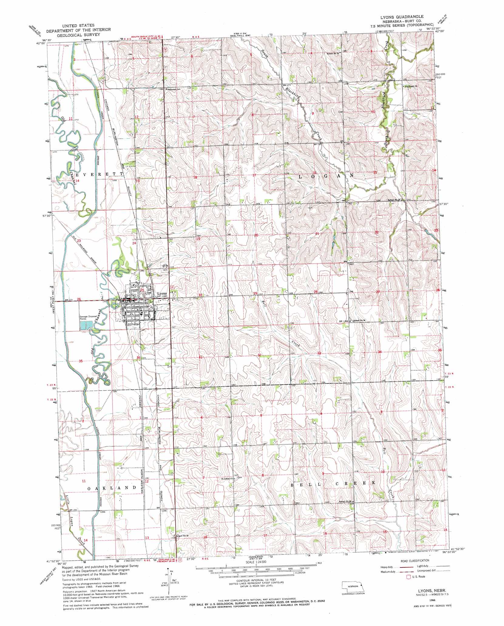
USGS Topo Quad 41096h4 - 1:24,000 scale
| Topo Map Name: | Lyons |
| USGS Topo Quad ID: | 41096h4 |
| Print Size: | ca. 21 1/4" wide x 27" high |
| Southeast Coordinates: | 41.875° N latitude / 96.375° W longitude |
| Map Center Coordinates: | 41.9375° N latitude / 96.4375° W longitude |
| U.S. State: | NE |
| Filename: | O41096H4.jpg |
| Download Map JPG Image: | Lyons topo map 1:24,000 scale |
| Map Type: | Topographic |
| Topo Series: | 7.5´ |
| Map Scale: | 1:24,000 |
| Source of Map Images: | United States Geological Survey (USGS) |
| Alternate Map Versions: |
Lyons NE 1966, updated 1967 Download PDF Buy paper map Lyons NE 2011 Download PDF Buy paper map Lyons NE 2014 Download PDF Buy paper map |
1:24,000 Topo Quads surrounding Lyons
Thurston |
Pender Ne |
Walthill |
Albaton |
Sloan |
Pender |
Bancroft |
Walthill Sw |
Macy |
Onawa Sw |
West Point Nw |
West Point Ne |
Lyons |
Bertha |
Tekamah Nw |
West Point |
West Point Se |
Oakland |
Craig |
Tekamah |
Scribner |
Uehling |
Nickerson Nw |
Nickerson Ne |
Herman |
> Back to 41096e1 at 1:100,000 scale
> Back to 41096a1 at 1:250,000 scale
> Back to U.S. Topo Maps home
Lyons topo map: Gazetteer
Lyons: Parks
Lyons Ballpark elevation 392m 1286′Lyons City Park elevation 392m 1286′
Lyons: Populated Places
Lyons elevation 394m 1292′Lyons: Post Offices
Lyons Posot Office elevation 394m 1292′Lyons: Streams
Little Logan Creek elevation 376m 1233′Lyons digital topo map on disk
Buy this Lyons topo map showing relief, roads, GPS coordinates and other geographical features, as a high-resolution digital map file on DVD: