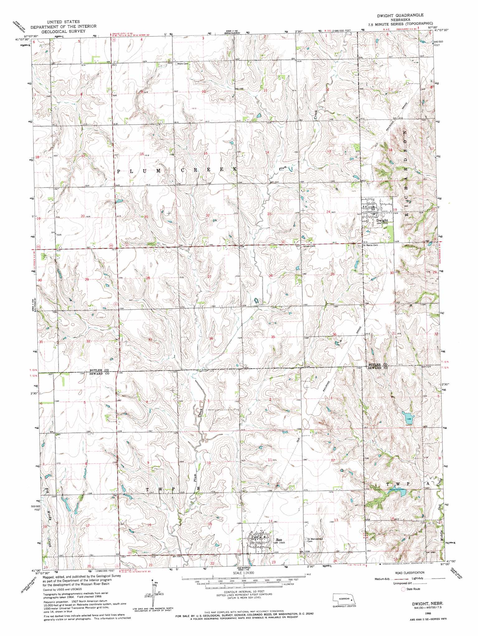
Dwight Topo Map Nebraska
To zoom in, hover over the map of Dwight
USGS Topo Quad 41097a1 - 1:24,000 scale
| Topo Map Name: | Dwight |
| USGS Topo Quad ID: | 41097a1 |
| Print Size: | ca. 21 1/4" wide x 27" high |
| Southeast Coordinates: | 41° N latitude / 97° W longitude |
| Map Center Coordinates: | 41.0625° N latitude / 97.0625° W longitude |
| U.S. State: | NE |
| Filename: | O41097A1.jpg |
| Download Map JPG Image: | Dwight topo map 1:24,000 scale |
| Map Type: | Topographic |
| Topo Series: | 7.5´ |
| Map Scale: | 1:24,000 |
| Source of Map Images: | United States Geological Survey (USGS) |
| Alternate Map Versions: |
Dwight NE 1966, updated 1967 Download PDF Buy paper map Dwight NE 2011 Download PDF Buy paper map Dwight NE 2014 Download PDF Buy paper map |
1:24,000 Topo Quads surrounding Dwight
Columbus Se |
David City West |
David City East |
Bruno |
Prague |
Rising City |
Garrison |
Brainard |
Loma |
Touhy |
Surprise |
Ulysses |
Dwight |
Valparaiso Sw |
Valparaiso |
Utica |
Staplehurst |
Seward |
Garland |
Raymond |
Beaver Crossing |
Goehner |
Milford |
Pleasant Dale |
Emerald |
> Back to 41097a1 at 1:100,000 scale
> Back to 41096a1 at 1:250,000 scale
> Back to U.S. Topo Maps home
Dwight topo map: Gazetteer
Dwight: Dams
Detention Dam 82-B elevation 449m 1473′Detention Dam 86-A elevation 452m 1482′
Detention Dam 87-A elevation 442m 1450′
Pekarek Dam elevation 486m 1594′
Pruss Dam elevation 457m 1499′
Skolnik Dam elevation 472m 1548′
Skolnik Dams Dam elevation 471m 1545′
Stastny Dam elevation 479m 1571′
Vandenberg Dam elevation 486m 1594′
Dwight: Populated Places
Bee elevation 475m 1558′Dwight elevation 495m 1624′
Dwight: Post Offices
Bee Post Office elevation 475m 1558′Dwight Post Office elevation 495m 1624′
Dwight: Reservoirs
Oak Middle Reservoir 87-A elevation 442m 1450′Oak-Middle Reservoir 82-B elevation 449m 1473′
Oak-Middle Reservoir 86-A elevation 452m 1482′
Pekarek Reservoir elevation 486m 1594′
Pruss Reservoir elevation 457m 1499′
Skolnik Reservoir elevation 471m 1545′
Skolnik Reservoir elevation 472m 1548′
Stastny Reservoir elevation 479m 1571′
Vandenberg Reservoir elevation 486m 1594′
Dwight digital topo map on disk
Buy this Dwight topo map showing relief, roads, GPS coordinates and other geographical features, as a high-resolution digital map file on DVD: