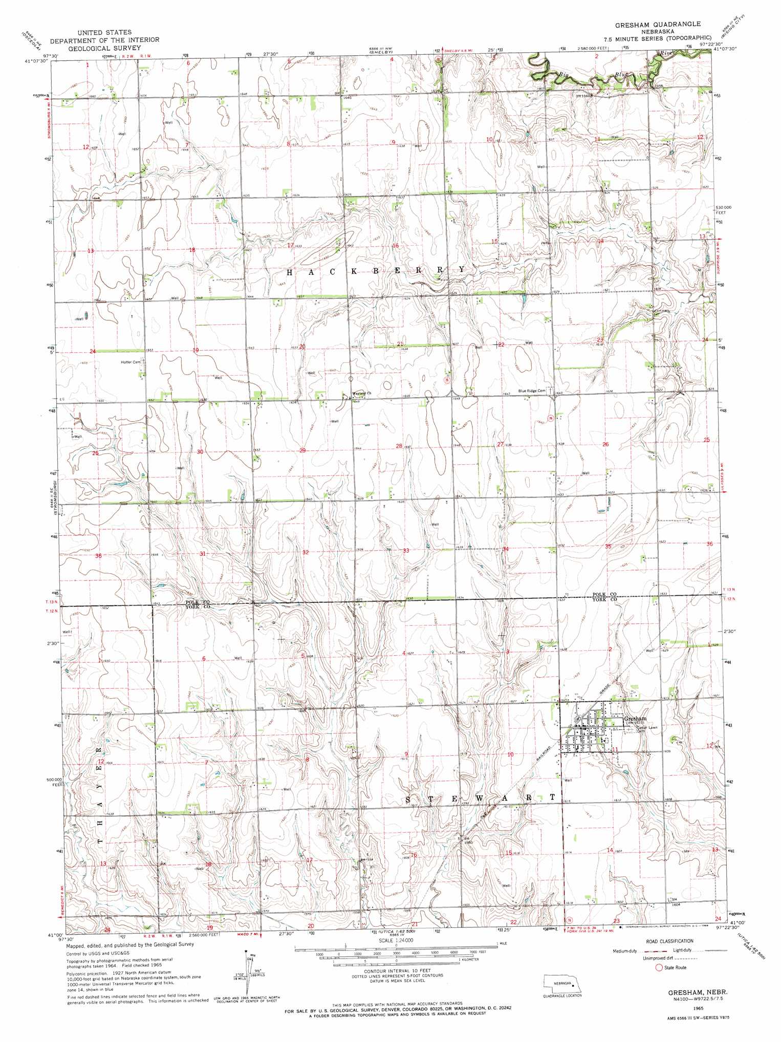
Gresham Topo Map Nebraska
To zoom in, hover over the map of Gresham
USGS Topo Quad 41097a4 - 1:24,000 scale
| Topo Map Name: | Gresham |
| USGS Topo Quad ID: | 41097a4 |
| Print Size: | ca. 21 1/4" wide x 27" high |
| Southeast Coordinates: | 41° N latitude / 97.375° W longitude |
| Map Center Coordinates: | 41.0625° N latitude / 97.4375° W longitude |
| U.S. State: | NE |
| Filename: | O41097A4.jpg |
| Download Map JPG Image: | Gresham topo map 1:24,000 scale |
| Map Type: | Topographic |
| Topo Series: | 7.5´ |
| Map Scale: | 1:24,000 |
| Source of Map Images: | United States Geological Survey (USGS) |
| Alternate Map Versions: |
Gresham NE 1965, updated 1966 Download PDF Buy paper map Gresham NE 2011 Download PDF Buy paper map Gresham NE 2014 Download PDF Buy paper map |
1:24,000 Topo Quads surrounding Gresham
Silver Creek |
Silver Creek Se |
Columbus Sw |
Columbus Se |
David City West |
Swedehome |
Osceola |
Shelby |
Rising City |
Garrison |
Durant |
Stromsburg |
Gresham |
Surprise |
Ulysses |
Bradshaw |
York North |
Waco |
Utica |
Staplehurst |
York Sw |
York South |
Utica Sw |
Beaver Crossing |
Goehner |
> Back to 41097a1 at 1:100,000 scale
> Back to 41096a1 at 1:250,000 scale
> Back to U.S. Topo Maps home
Gresham topo map: Gazetteer
Gresham: Airports
Moab Heliport elevation 500m 1640′Gresham: Dams
Don Alt Dam elevation 495m 1624′Hopwood Dam elevation 493m 1617′
Miller Dam elevation 500m 1640′
Torell Dam elevation 500m 1640′
Gresham: Parks
Gresham Municipal Park elevation 493m 1617′Gresham: Populated Places
Gresham elevation 493m 1617′Gresham: Post Offices
Gresham Post Office elevation 493m 1617′Gresham: Reservoirs
Hopwood Reservoir elevation 493m 1617′Miller Reservoir elevation 500m 1640′
Torell Reservoir elevation 500m 1640′
Gresham digital topo map on disk
Buy this Gresham topo map showing relief, roads, GPS coordinates and other geographical features, as a high-resolution digital map file on DVD: