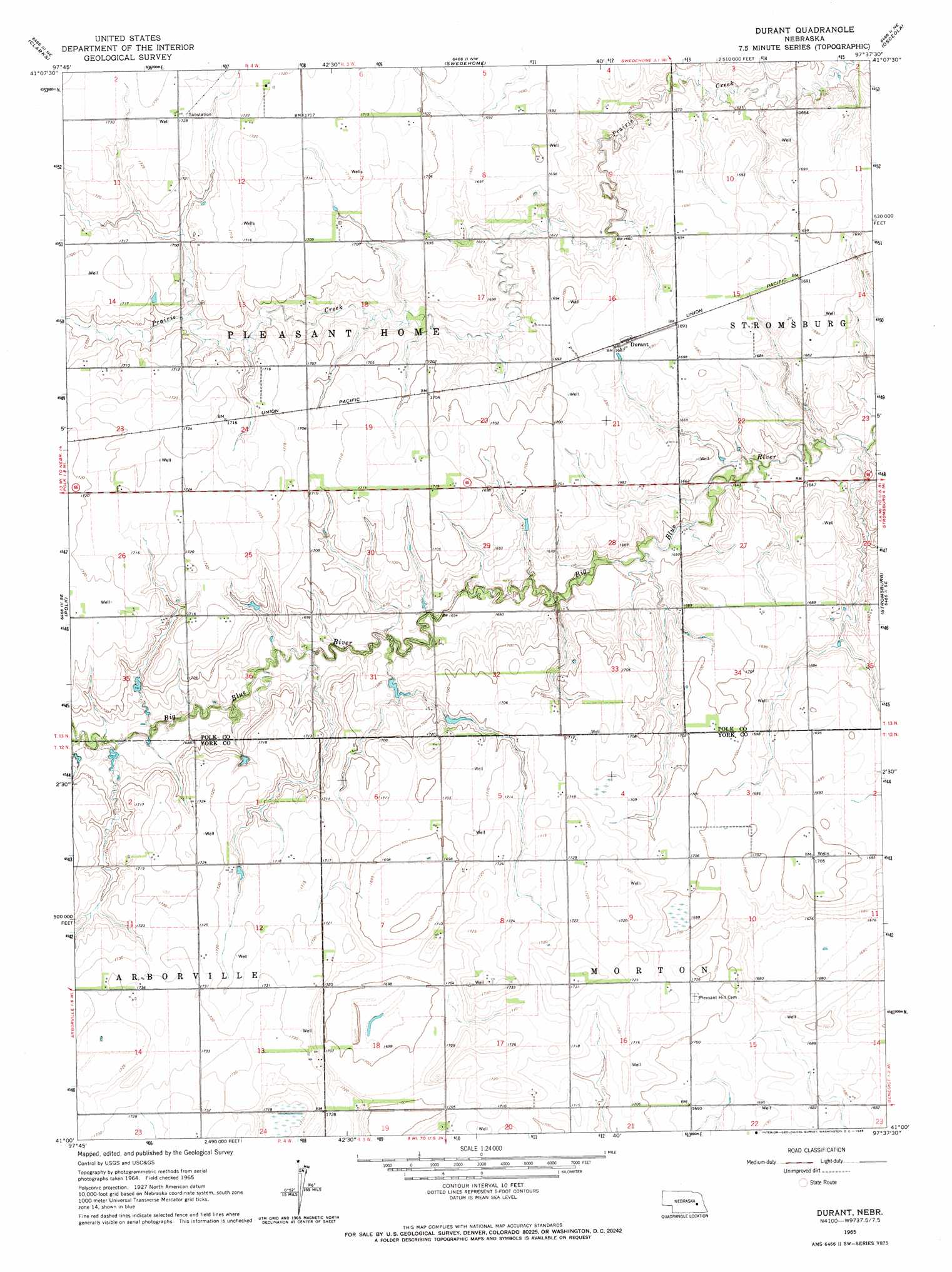
Durant Topo Map Nebraska
To zoom in, hover over the map of Durant
USGS Topo Quad 41097a6 - 1:24,000 scale
| Topo Map Name: | Durant |
| USGS Topo Quad ID: | 41097a6 |
| Print Size: | ca. 21 1/4" wide x 27" high |
| Southeast Coordinates: | 41° N latitude / 97.625° W longitude |
| Map Center Coordinates: | 41.0625° N latitude / 97.6875° W longitude |
| U.S. State: | NE |
| Filename: | O41097A6.jpg |
| Download Map JPG Image: | Durant topo map 1:24,000 scale |
| Map Type: | Topographic |
| Topo Series: | 7.5´ |
| Map Scale: | 1:24,000 |
| Source of Map Images: | United States Geological Survey (USGS) |
| Alternate Map Versions: |
Durant NE 1965, updated 1966 Download PDF Buy paper map Durant NE 2011 Download PDF Buy paper map Durant NE 2014 Download PDF Buy paper map |
1:24,000 Topo Quads surrounding Durant
Fullerton |
Havens |
Silver Creek |
Silver Creek Se |
Columbus Sw |
Polk Nw |
Clarks |
Swedehome |
Osceola |
Shelby |
Central City East |
Polk |
Durant |
Stromsburg |
Gresham |
Hampton |
Henderson Ne |
Bradshaw |
York North |
Waco |
Aurora East |
Henderson |
York Sw |
York South |
Utica Sw |
> Back to 41097a1 at 1:100,000 scale
> Back to 41096a1 at 1:250,000 scale
> Back to U.S. Topo Maps home
Durant topo map: Gazetteer
Durant: Dams
Bjerrum Dam elevation 514m 1686′Durant: Parks
Renquist Basin State Wildlife Management Area elevation 519m 1702′Durant: Populated Places
Durant elevation 515m 1689′Durant: Reservoirs
Bjerrum Reservoir elevation 514m 1686′Durant digital topo map on disk
Buy this Durant topo map showing relief, roads, GPS coordinates and other geographical features, as a high-resolution digital map file on DVD: