Osceola Topo Map Nebraska
To zoom in, hover over the map of Osceola
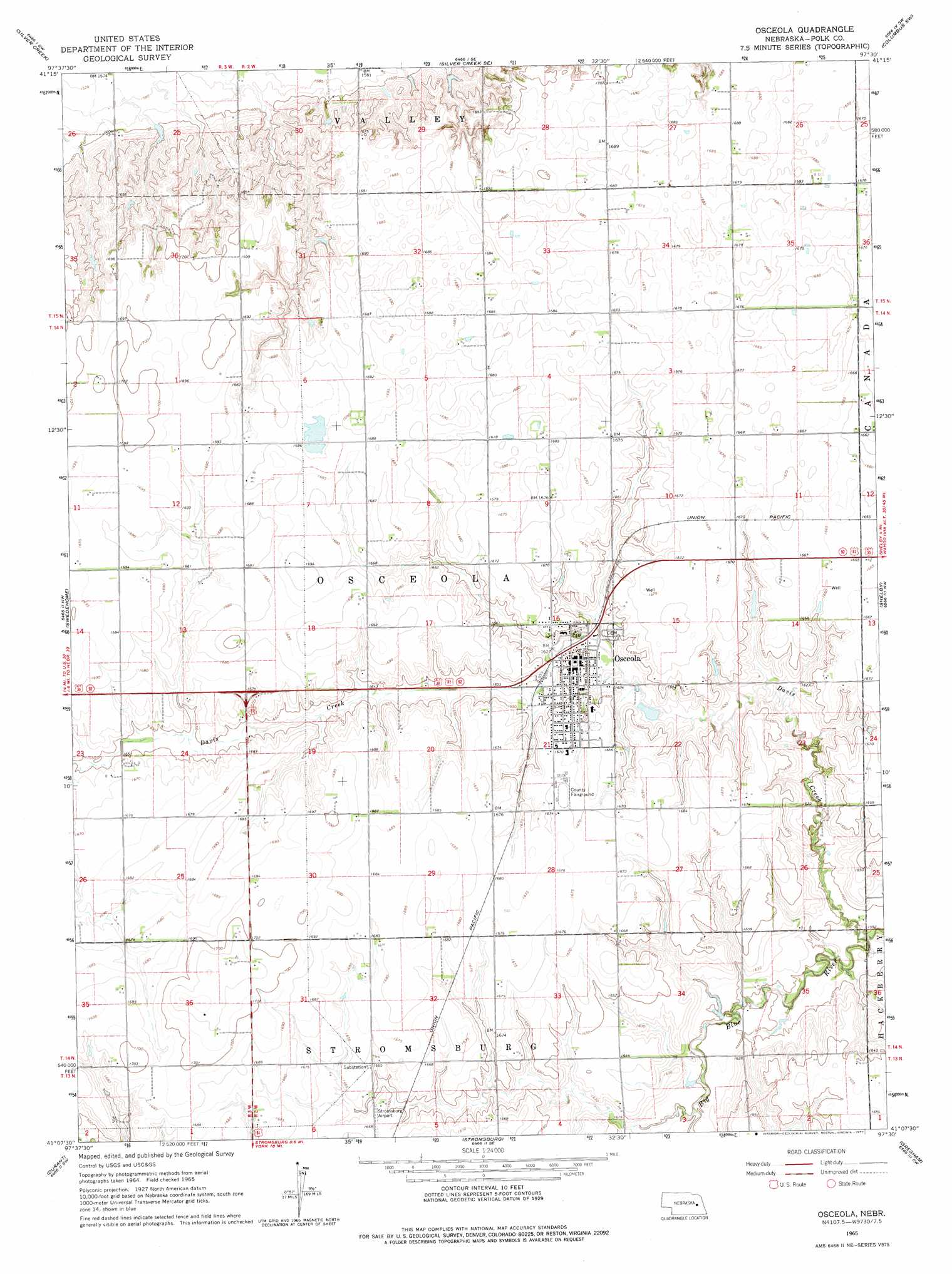
USGS Topo Quad 41097b5 - 1:24,000 scale
| Topo Map Name: | Osceola |
| USGS Topo Quad ID: | 41097b5 |
| Print Size: | ca. 21 1/4" wide x 27" high |
| Southeast Coordinates: | 41.125° N latitude / 97.5° W longitude |
| Map Center Coordinates: | 41.1875° N latitude / 97.5625° W longitude |
| U.S. State: | NE |
| Filename: | O41097B5.jpg |
| Download Map JPG Image: | Osceola topo map 1:24,000 scale |
| Map Type: | Topographic |
| Topo Series: | 7.5´ |
| Map Scale: | 1:24,000 |
| Source of Map Images: | United States Geological Survey (USGS) |
| Alternate Map Versions: |
Osceola NE 1965, updated 1966 Download PDF Buy paper map Osceola NE 1965, updated 1977 Download PDF Buy paper map Osceola NE 2011 Download PDF Buy paper map Osceola NE 2014 Download PDF Buy paper map |
1:24,000 Topo Quads surrounding Osceola
Fullerton Ne |
Genoa |
Monroe |
Duncan |
Columbus |
Havens |
Silver Creek |
Silver Creek Se |
Columbus Sw |
Columbus Se |
Clarks |
Swedehome |
Osceola |
Shelby |
Rising City |
Polk |
Durant |
Stromsburg |
Gresham |
Surprise |
Henderson Ne |
Bradshaw |
York North |
Waco |
Utica |
> Back to 41097a1 at 1:100,000 scale
> Back to 41096a1 at 1:250,000 scale
> Back to U.S. Topo Maps home
Osceola topo map: Gazetteer
Osceola: Airports
Stromsburg Municipal Airport elevation 506m 1660′Osceola: Dams
Anderson Dam elevation 489m 1604′Burritt Dam elevation 488m 1601′
Mentink Dam elevation 505m 1656′
Norman Leach Dam elevation 509m 1669′
Ransom Dam elevation 501m 1643′
Rosenquist Dam elevation 506m 1660′
Osceola: Parks
Osceola and the Early Pioneer: 1867-1967 Historical Marker elevation 494m 1620′Osceola: Populated Places
Osceola elevation 508m 1666′Osceola: Post Offices
Osceola Post Office elevation 505m 1656′Osceola: Reservoirs
Anderson Reservoir elevation 489m 1604′Burritt Reservoir elevation 488m 1601′
Mentink Reservoir elevation 505m 1656′
Norman Leach Reservoir elevation 509m 1669′
Ransom Reservoir elevation 501m 1643′
Rosenquist Reservoir elevation 506m 1660′
Osceola: Streams
Davis Creek elevation 486m 1594′Prairie Creek elevation 503m 1650′
Osceola digital topo map on disk
Buy this Osceola topo map showing relief, roads, GPS coordinates and other geographical features, as a high-resolution digital map file on DVD: