David City East Topo Map Nebraska
To zoom in, hover over the map of David City East
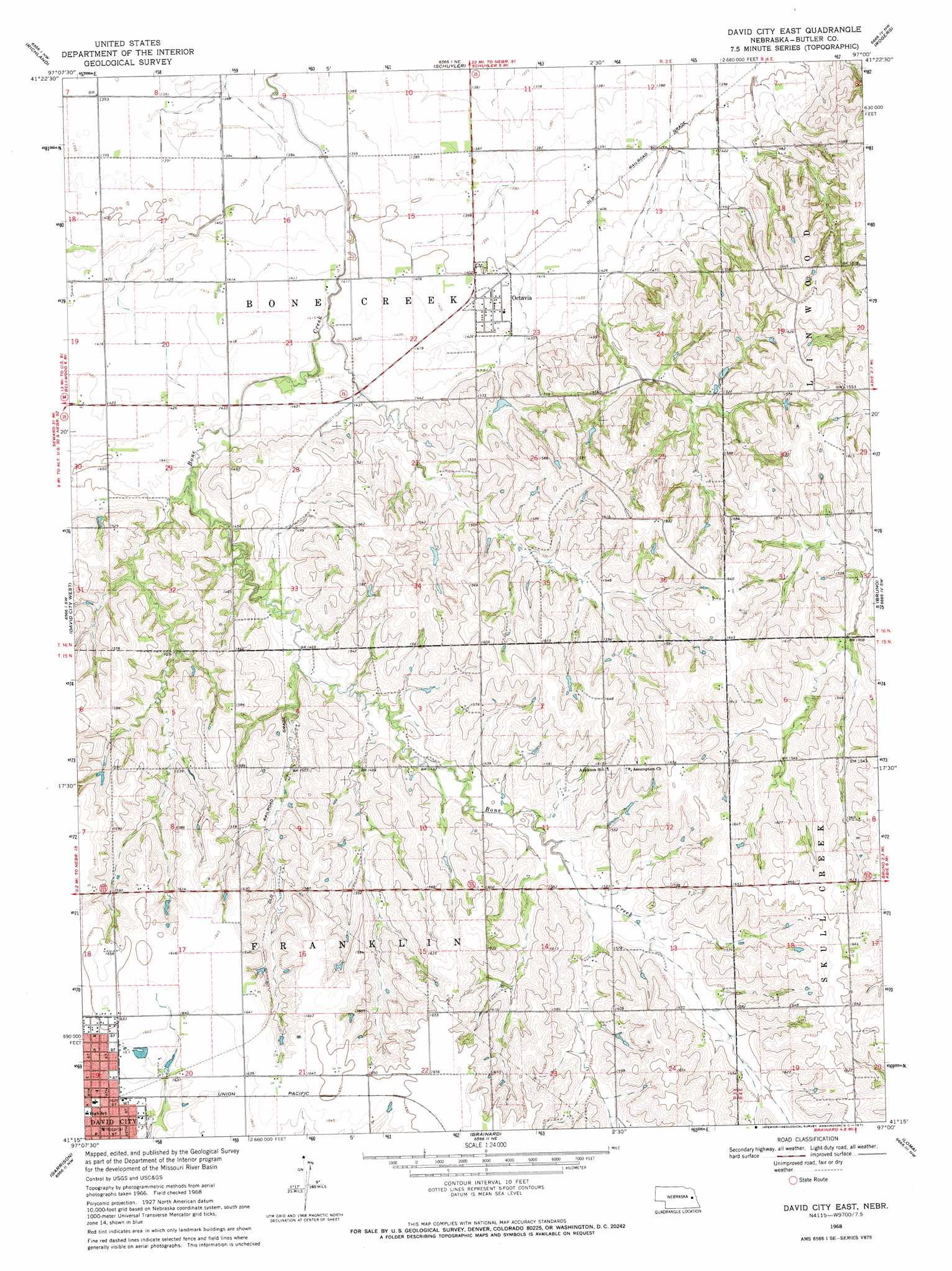
USGS Topo Quad 41097c1 - 1:24,000 scale
| Topo Map Name: | David City East |
| USGS Topo Quad ID: | 41097c1 |
| Print Size: | ca. 21 1/4" wide x 27" high |
| Southeast Coordinates: | 41.25° N latitude / 97° W longitude |
| Map Center Coordinates: | 41.3125° N latitude / 97.0625° W longitude |
| U.S. State: | NE |
| Filename: | O41097C1.jpg |
| Download Map JPG Image: | David City East topo map 1:24,000 scale |
| Map Type: | Topographic |
| Topo Series: | 7.5´ |
| Map Scale: | 1:24,000 |
| Source of Map Images: | United States Geological Survey (USGS) |
| Alternate Map Versions: |
David City East NE 1968, updated 1971 Download PDF Buy paper map David City East NE 2011 Download PDF Buy paper map David City East NE 2014 Download PDF Buy paper map |
1:24,000 Topo Quads surrounding David City East
Humphrey Se |
Clarkson Sw |
Clarkson Se |
Dodge Sw |
Webster |
Columbus |
Richland |
Schuyler |
Rogers |
North Bend |
Columbus Se |
David City West |
David City East |
Bruno |
Prague |
Rising City |
Garrison |
Brainard |
Loma |
Touhy |
Surprise |
Ulysses |
Dwight |
Valparaiso Sw |
Valparaiso |
> Back to 41097a1 at 1:100,000 scale
> Back to 41096a1 at 1:250,000 scale
> Back to U.S. Topo Maps home
David City East topo map: Gazetteer
David City East: Dams
Brezina Dam elevation 450m 1476′David City East: Populated Places
Octavia elevation 430m 1410′David City East: Post Offices
Appleton Post Office (historical) elevation 493m 1617′Octavia Post Office elevation 430m 1410′
David City East: Reservoirs
Brezina Reservoir elevation 450m 1476′David City East digital topo map on disk
Buy this David City East topo map showing relief, roads, GPS coordinates and other geographical features, as a high-resolution digital map file on DVD: