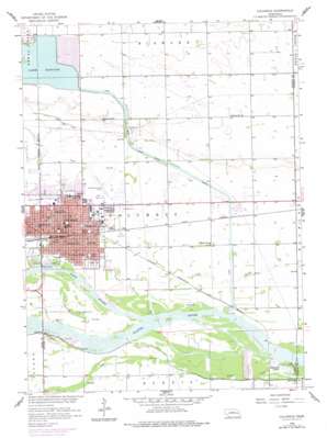
Columbus Topo Map Nebraska
To zoom in, hover over the map of Columbus
USGS Topo Quad 41097d3 - 1:24,000 scale
| Topo Map Name: | Columbus |
| USGS Topo Quad ID: | 41097d3 |
| Print Size: | ca. 21 1/4" wide x 27" high |
| Southeast Coordinates: | 41.375° N latitude / 97.25° W longitude |
| Map Center Coordinates: | 41.4375° N latitude / 97.3125° W longitude |
| U.S. State: | NE |
| Filename: | O41097D3.jpg |
| Download Map JPG Image: | Columbus topo map 1:24,000 scale |
| Map Type: | Topographic |
| Topo Series: | 7.5´ |
| Map Scale: | 1:24,000 |
| Source of Map Images: | United States Geological Survey (USGS) |
| Alternate Map Versions: |
Columbus NE 1958, updated 1959 Download PDF Buy paper map Columbus NE 1958, updated 1977 Download PDF Buy paper map Columbus NE 2011 Download PDF Buy paper map Columbus NE 2014 Download PDF Buy paper map |
1:24,000 Topo Quads surrounding Columbus
> Back to 41097a1 at 1:100,000 scale
> Back to 41096a1 at 1:250,000 scale
> Back to U.S. Topo Maps home
Columbus topo map: Gazetteer
Columbus: Airports
Columbus Municipal Airport elevation 439m 1440′Loseke Airstrip elevation 451m 1479′
Columbus: Bridges
Columbus Loup River Bridge elevation 438m 1437′Columbus: Channels
South Channel Platte River elevation 438m 1437′Columbus: Dams
Lake Babcock and Lake North-Columbus Dam elevation 443m 1453′Columbus: Lakes
Bellwood Lake elevation 428m 1404′Columbus: Parks
Adamy Park elevation 442m 1450′Agricultural Park Historical Marker elevation 440m 1443′
Airport Park elevation 439m 1440′
Berne Square Park elevation 439m 1440′
Buffalo Square elevation 439m 1440′
Centennial Park Baseball Complex elevation 438m 1437′
Columbus Races Thoroughbred Track elevation 438m 1437′
Early Era of Railroading Monument elevation 439m 1440′
Frankfort Square elevation 440m 1443′
Glur Park elevation 440m 1443′
Hanover Square elevation 439m 1440′
Korean Veterans Memorial elevation 439m 1440′
Lost Creek Soccer Complex elevation 442m 1450′
Loup Park elevation 470m 1541′
Memory Meadows elevation 439m 1440′
North Brothers Historical Marker elevation 439m 1440′
Pawnee Park elevation 439m 1440′
Powerhouse Park elevation 451m 1479′
Quincentenary Belltower elevation 439m 1440′
Spanish-American War Veterans Memorial elevation 439m 1440′
Statue of Liberty Replica elevation 439m 1440′
Statue of the Prairie Pioneer elevation 439m 1440′
Tailrace Park elevation 432m 1417′
Union Veterans of the Civil War Memorial elevation 440m 1443′
Veterans of All Wars Memorial elevation 439m 1440′
Villasur Expedition 1720 Historical Marker elevation 439m 1440′
Wilderness Park Soccer Complex elevation 440m 1443′
Columbus: Populated Places
Carriage House Estates elevation 437m 1433′Columbus elevation 441m 1446′
Country Mobile Villa elevation 433m 1420′
Columbus: Post Offices
Columbus Post Office elevation 441m 1446′Columbus: Reservoirs
Lake Babcock elevation 461m 1512′Lake Babcock-Lake North elevation 443m 1453′
Lake North elevation 463m 1519′
Columbus: Streams
Barnum Creek elevation 434m 1423′Loup River elevation 434m 1423′
Wilson Creek elevation 431m 1414′
Columbus digital topo map on disk
Buy this Columbus topo map showing relief, roads, GPS coordinates and other geographical features, as a high-resolution digital map file on DVD:


