Saint Edward Topo Map Nebraska
To zoom in, hover over the map of Saint Edward
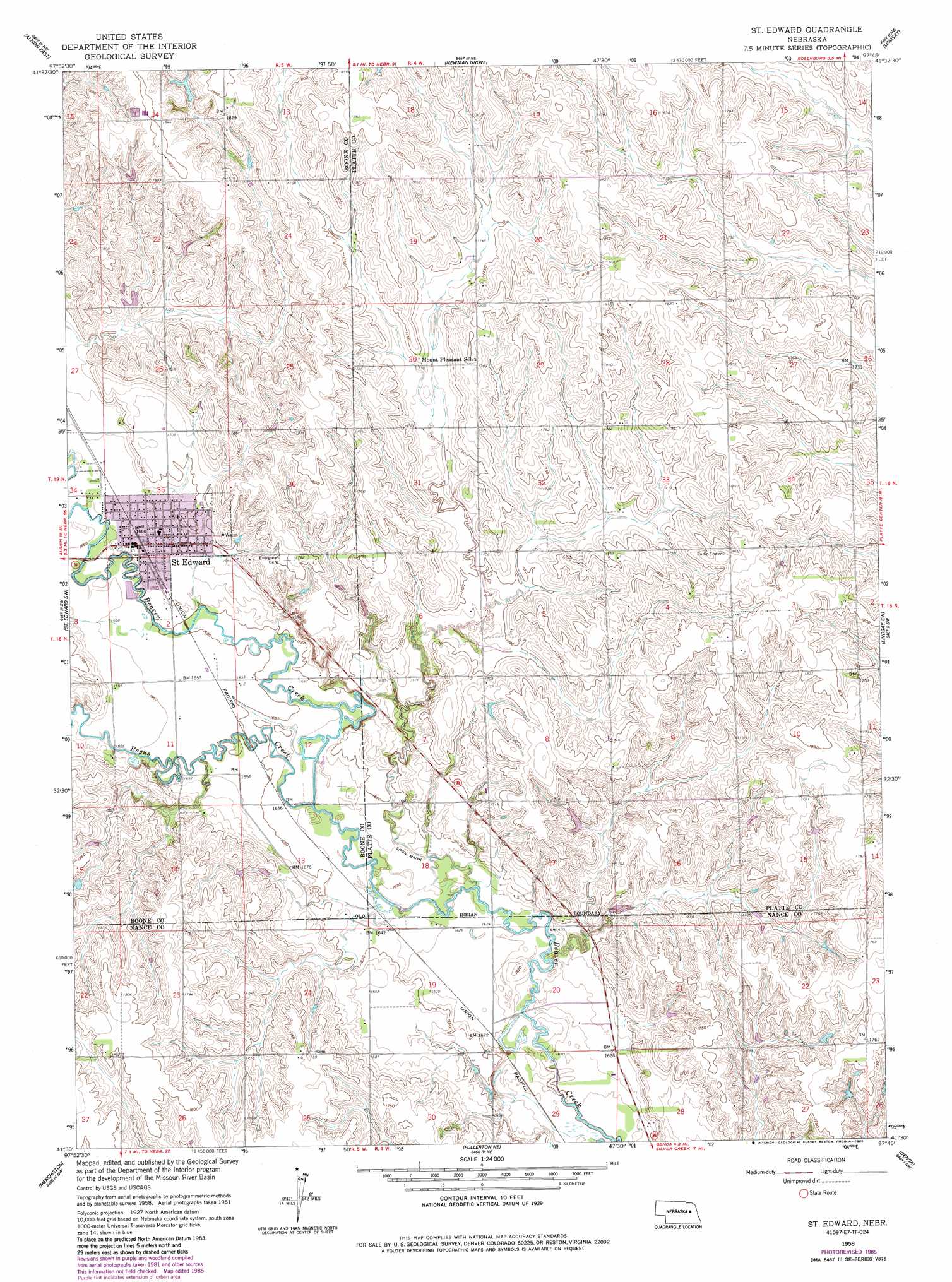
USGS Topo Quad 41097e7 - 1:24,000 scale
| Topo Map Name: | Saint Edward |
| USGS Topo Quad ID: | 41097e7 |
| Print Size: | ca. 21 1/4" wide x 27" high |
| Southeast Coordinates: | 41.5° N latitude / 97.75° W longitude |
| Map Center Coordinates: | 41.5625° N latitude / 97.8125° W longitude |
| U.S. State: | NE |
| Filename: | O41097E7.jpg |
| Download Map JPG Image: | Saint Edward topo map 1:24,000 scale |
| Map Type: | Topographic |
| Topo Series: | 7.5´ |
| Map Scale: | 1:24,000 |
| Source of Map Images: | United States Geological Survey (USGS) |
| Alternate Map Versions: |
St. Edward NE 1958, updated 1960 Download PDF Buy paper map St. Edward NE 1958, updated 1977 Download PDF Buy paper map St. Edward NE 1958, updated 1985 Download PDF Buy paper map Saint Edward NE 2011 Download PDF Buy paper map Saint Edward NE 2014 Download PDF Buy paper map |
1:24,000 Topo Quads surrounding Saint Edward
Petersburg |
Closter Sw |
Closter Se |
Battle Creek Sw |
Battle Creek Se |
Albion West |
Albion East |
Newman Grove |
Lindsay |
Cornlea |
Cedar Rapids Se |
Saint Edward Sw |
Saint Edward |
Lindsay Sw |
Tarnov |
Belgrade |
Merchiston |
Fullerton Ne |
Genoa |
Monroe |
Belgrade Se |
Fullerton |
Havens |
Silver Creek |
Silver Creek Se |
> Back to 41097e1 at 1:100,000 scale
> Back to 41096a1 at 1:250,000 scale
> Back to U.S. Topo Maps home
Saint Edward topo map: Gazetteer
Saint Edward: Parks
Saint Edward City Park elevation 508m 1666′Saint Edward Historical Marker elevation 508m 1666′
Saint Edward: Populated Places
Saint Edward elevation 507m 1663′Saint Edward: Post Offices
Saint Edward Post Office elevation 507m 1663′Saint Edward: Streams
Bogus Creek elevation 496m 1627′Saint Edward digital topo map on disk
Buy this Saint Edward topo map showing relief, roads, GPS coordinates and other geographical features, as a high-resolution digital map file on DVD: