Saint Edward Sw Topo Map Nebraska
To zoom in, hover over the map of Saint Edward Sw
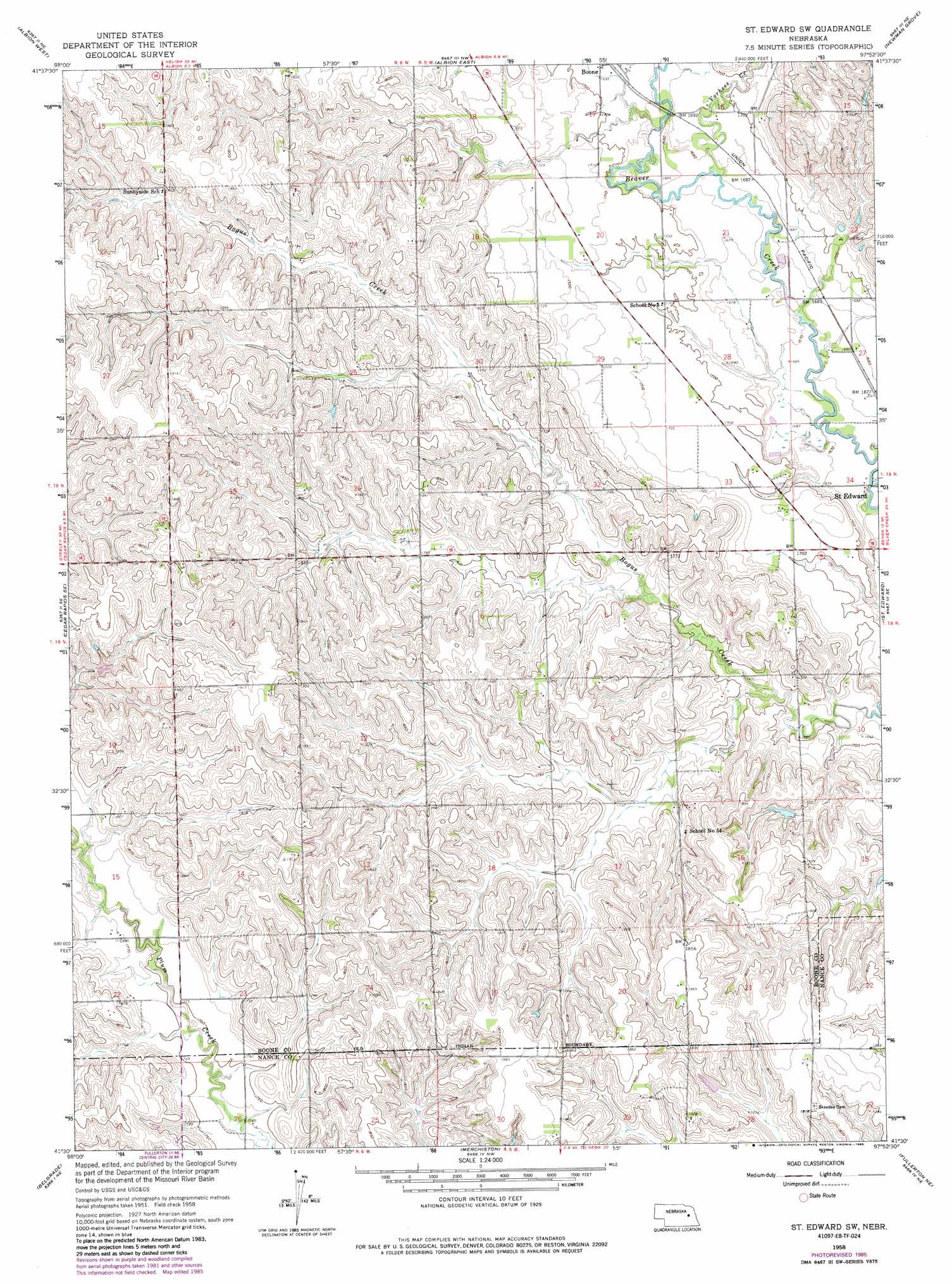
USGS Topo Quad 41097e8 - 1:24,000 scale
| Topo Map Name: | Saint Edward Sw |
| USGS Topo Quad ID: | 41097e8 |
| Print Size: | ca. 21 1/4" wide x 27" high |
| Southeast Coordinates: | 41.5° N latitude / 97.875° W longitude |
| Map Center Coordinates: | 41.5625° N latitude / 97.9375° W longitude |
| U.S. State: | NE |
| Filename: | O41097E8.jpg |
| Download Map JPG Image: | Saint Edward Sw topo map 1:24,000 scale |
| Map Type: | Topographic |
| Topo Series: | 7.5´ |
| Map Scale: | 1:24,000 |
| Source of Map Images: | United States Geological Survey (USGS) |
| Alternate Map Versions: |
St. Edward SW NE 1958, updated 1960 Download PDF Buy paper map St. Edward SW NE 1958, updated 1976 Download PDF Buy paper map St. Edward SW NE 1958, updated 1985 Download PDF Buy paper map Saint Edward SW NE 2011 Download PDF Buy paper map Saint Edward SW NE 2014 Download PDF Buy paper map |
1:24,000 Topo Quads surrounding Saint Edward Sw
Elgin Sw |
Petersburg |
Closter Sw |
Closter Se |
Battle Creek Sw |
Akron |
Albion West |
Albion East |
Newman Grove |
Lindsay |
Cedar Rapids |
Cedar Rapids Se |
Saint Edward Sw |
Saint Edward |
Lindsay Sw |
Belgrade Nw |
Belgrade |
Merchiston |
Fullerton Ne |
Genoa |
Belgrade Sw |
Belgrade Se |
Fullerton |
Havens |
Silver Creek |
> Back to 41097e1 at 1:100,000 scale
> Back to 41096a1 at 1:250,000 scale
> Back to U.S. Topo Maps home
Saint Edward Sw topo map: Gazetteer
Saint Edward Sw: Airports
Mount Echo Airport elevation 559m 1833′Saint Edward Sw: Dams
Goodwater Dam elevation 558m 1830′Jasa Dam elevation 528m 1732′
Roberts Dam elevation 536m 1758′
Saint Edward Sw: Parks
Beaver Bend State Wildlife Management Area elevation 508m 1666′Saint Edward Sw: Reservoirs
Goodwater Reservoir elevation 558m 1830′Jasa Reservoir elevation 528m 1732′
Roberts Reservoir elevation 536m 1758′
Saint Edward Sw: Streams
Vorhees Creek elevation 512m 1679′Saint Edward Sw digital topo map on disk
Buy this Saint Edward Sw topo map showing relief, roads, GPS coordinates and other geographical features, as a high-resolution digital map file on DVD: