Saint Lebory Topo Map Nebraska
To zoom in, hover over the map of Saint Lebory
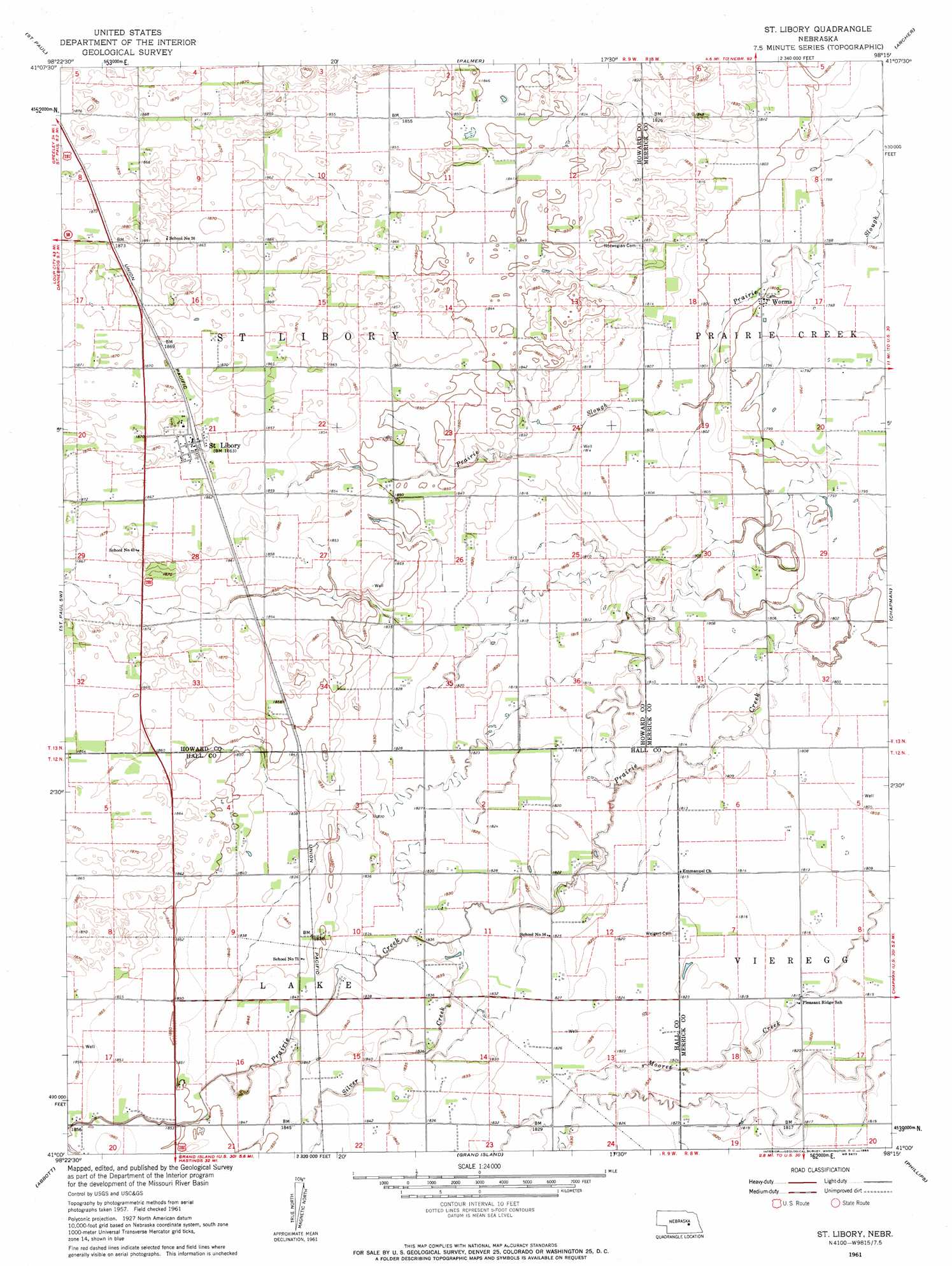
USGS Topo Quad 41098a3 - 1:24,000 scale
| Topo Map Name: | Saint Lebory |
| USGS Topo Quad ID: | 41098a3 |
| Print Size: | ca. 21 1/4" wide x 27" high |
| Southeast Coordinates: | 41° N latitude / 98.25° W longitude |
| Map Center Coordinates: | 41.0625° N latitude / 98.3125° W longitude |
| U.S. State: | NE |
| Filename: | O41098A3.jpg |
| Download Map JPG Image: | Saint Lebory topo map 1:24,000 scale |
| Map Type: | Topographic |
| Topo Series: | 7.5´ |
| Map Scale: | 1:24,000 |
| Source of Map Images: | United States Geological Survey (USGS) |
| Alternate Map Versions: |
St. Libory NE 1961, updated 1963 Download PDF Buy paper map Saint Libory NE 2011 Download PDF Buy paper map Saint Libory NE 2014 Download PDF Buy paper map |
1:24,000 Topo Quads surrounding Saint Lebory
Elba |
Wolbach Sw |
Cushing |
Belgrade Sw |
Belgrade Se |
Nysted |
Saint Paul |
Palmer |
Archer |
Hord |
Dannebrog |
Saint Paul Sw |
Saint Lebory |
Chapman |
Central City West |
Shelton Ne |
Abbott |
Grand Island |
Phillips |
Murphy |
Wood River |
Alda |
Doniphan |
Giltner |
Aurora West |
> Back to 41098a1 at 1:100,000 scale
> Back to 41098a1 at 1:250,000 scale
> Back to U.S. Topo Maps home
Saint Lebory topo map: Gazetteer
Saint Lebory: Populated Places
Saint Libory elevation 568m 1863′Worms elevation 549m 1801′
Saint Lebory: Post Offices
Saint Libory Post Office elevation 568m 1863′Worms Post Office (historical) elevation 549m 1801′
Saint Lebory: Streams
Silver Creek elevation 556m 1824′Saint Lebory digital topo map on disk
Buy this Saint Lebory topo map showing relief, roads, GPS coordinates and other geographical features, as a high-resolution digital map file on DVD: