Saint Paul Sw Topo Map Nebraska
To zoom in, hover over the map of Saint Paul Sw
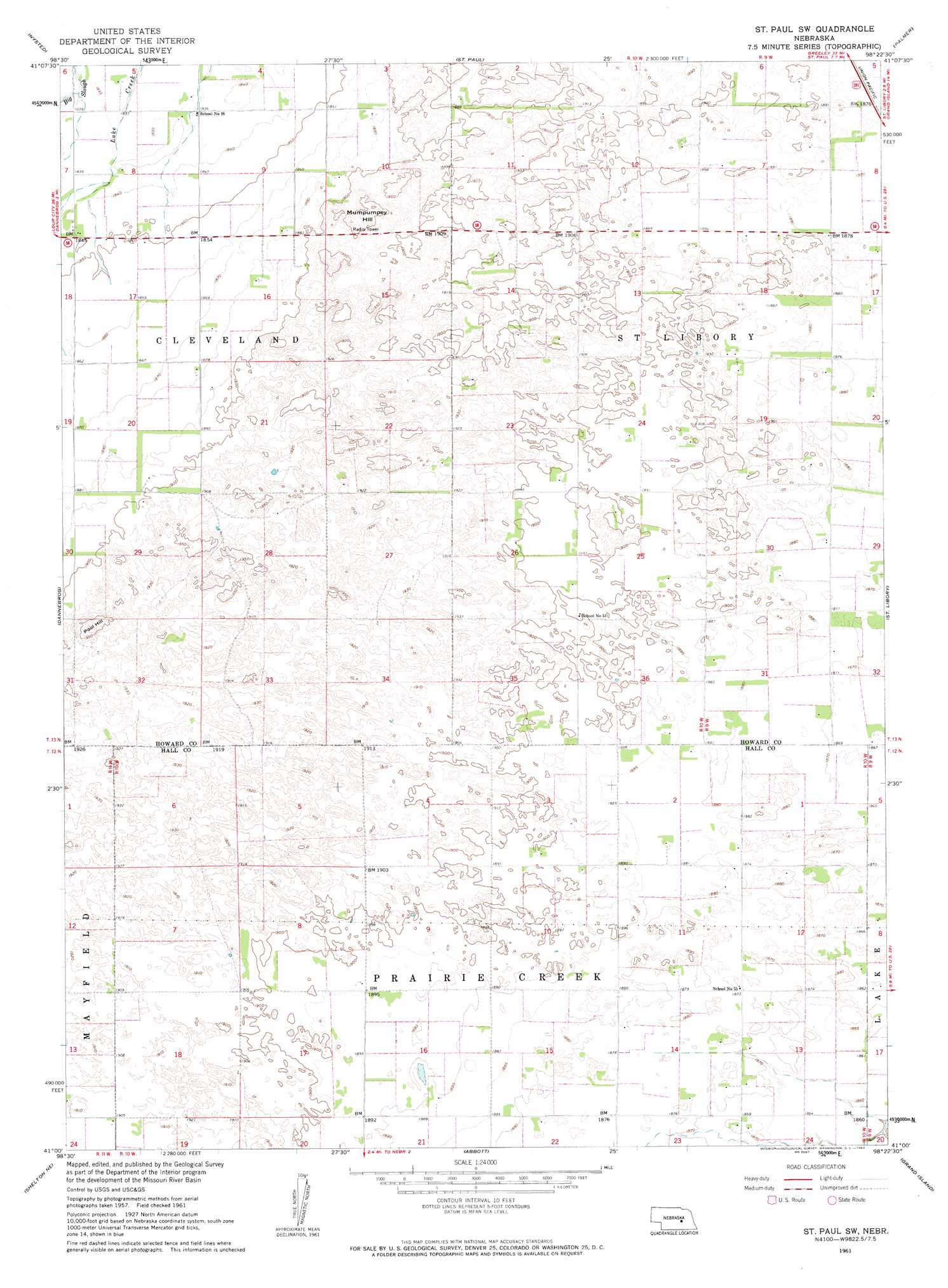
USGS Topo Quad 41098a4 - 1:24,000 scale
| Topo Map Name: | Saint Paul Sw |
| USGS Topo Quad ID: | 41098a4 |
| Print Size: | ca. 21 1/4" wide x 27" high |
| Southeast Coordinates: | 41° N latitude / 98.375° W longitude |
| Map Center Coordinates: | 41.0625° N latitude / 98.4375° W longitude |
| U.S. State: | NE |
| Filename: | O41098A4.jpg |
| Download Map JPG Image: | Saint Paul Sw topo map 1:24,000 scale |
| Map Type: | Topographic |
| Topo Series: | 7.5´ |
| Map Scale: | 1:24,000 |
| Source of Map Images: | United States Geological Survey (USGS) |
| Alternate Map Versions: |
St. Paul SW NE 1961, updated 1963 Download PDF Buy paper map Saint Paul SW NE 2011 Download PDF Buy paper map Saint Paul SW NE 2014 Download PDF Buy paper map |
1:24,000 Topo Quads surrounding Saint Paul Sw
Cotesfield |
Elba |
Wolbach Sw |
Cushing |
Belgrade Sw |
Farwell |
Nysted |
Saint Paul |
Palmer |
Archer |
Boelus |
Dannebrog |
Saint Paul Sw |
Saint Lebory |
Chapman |
Cameron |
Shelton Ne |
Abbott |
Grand Island |
Phillips |
Shelton |
Wood River |
Alda |
Doniphan |
Giltner |
> Back to 41098a1 at 1:100,000 scale
> Back to 41098a1 at 1:250,000 scale
> Back to U.S. Topo Maps home
Saint Paul Sw topo map: Gazetteer
Saint Paul Sw: Streams
Big Slough elevation 558m 1830′Saint Paul Sw: Summits
Mumpumpey Hill elevation 603m 1978′Pool Hill elevation 601m 1971′
Saint Paul Sw digital topo map on disk
Buy this Saint Paul Sw topo map showing relief, roads, GPS coordinates and other geographical features, as a high-resolution digital map file on DVD: