Loup City Topo Map Nebraska
To zoom in, hover over the map of Loup City
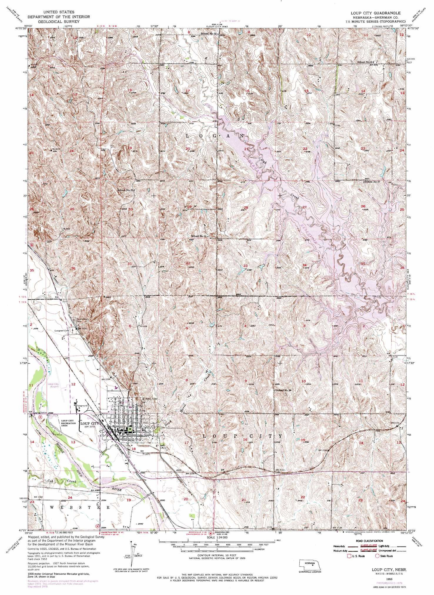
USGS Topo Quad 41098c8 - 1:24,000 scale
| Topo Map Name: | Loup City |
| USGS Topo Quad ID: | 41098c8 |
| Print Size: | ca. 21 1/4" wide x 27" high |
| Southeast Coordinates: | 41.25° N latitude / 98.875° W longitude |
| Map Center Coordinates: | 41.3125° N latitude / 98.9375° W longitude |
| U.S. State: | NE |
| Filename: | O41098C8.jpg |
| Download Map JPG Image: | Loup City topo map 1:24,000 scale |
| Map Type: | Topographic |
| Topo Series: | 7.5´ |
| Map Scale: | 1:24,000 |
| Source of Map Images: | United States Geological Survey (USGS) |
| Alternate Map Versions: |
Loup City NE 1953, updated 1955 Download PDF Buy paper map Loup City NE 1953, updated 1978 Download PDF Buy paper map Loup City NE 2011 Download PDF Buy paper map Loup City NE 2014 Download PDF Buy paper map |
1:24,000 Topo Quads surrounding Loup City
Comstock |
Comstock Se |
Ord |
Ord Se |
Horace |
Arcadia West |
Arcadia East |
Loup City Nw |
North Loup |
Scotia |
Arcadia Sw |
Arcadia Se |
Loup City |
Loup City Se |
Cotesfield |
Litchfield |
Litchfield Ne |
Ravenna Nw |
Ashton |
Farwell |
Litchfield Sw |
Hazard |
Ravenna |
Rockville |
Boelus |
> Back to 41098a1 at 1:100,000 scale
> Back to 41098a1 at 1:250,000 scale
> Back to U.S. Topo Maps home
Loup City topo map: Gazetteer
Loup City: Airports
Loup City Municipal Airport elevation 631m 2070′Loup City: Bays
Shaughnessy Bay elevation 668m 2191′Loup City: Bridges
Fishermans Bridge elevation 658m 2158′Loup City: Islands
Big Thunder Island elevation 668m 2191′Loup City: Parks
Dead Horse Creek Historical Marker elevation 630m 2066′Jenners Park elevation 638m 2093′
Loup City Recreation Area elevation 628m 2060′
Loup City Riot Historical Marker elevation 632m 2073′
Sherman Reservoir State Recreation Area elevation 658m 2158′
Sherman Reservoir State Wildlife Management Area elevation 658m 2158′
Loup City: Populated Places
Loup City elevation 632m 2073′Loup City: Post Offices
Loup City Post Office elevation 632m 2073′Loup City: Reservoirs
Sherman Reservoir elevation 649m 2129′Loup City: Streams
Cob Creek elevation 625m 2050′Dead Horse Creek elevation 625m 2050′
Loup City: Summits
Muddy Point elevation 675m 2214′Loup City digital topo map on disk
Buy this Loup City topo map showing relief, roads, GPS coordinates and other geographical features, as a high-resolution digital map file on DVD: