Spalding 2 Se Topo Map Nebraska
To zoom in, hover over the map of Spalding 2 Se
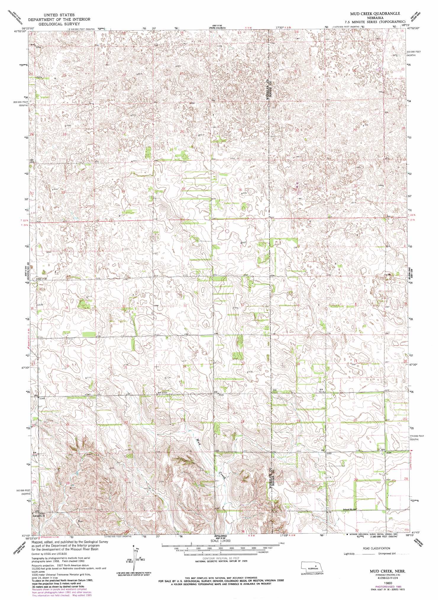
USGS Topo Quad 41098g3 - 1:24,000 scale
| Topo Map Name: | Spalding 2 Se |
| USGS Topo Quad ID: | 41098g3 |
| Print Size: | ca. 21 1/4" wide x 27" high |
| Southeast Coordinates: | 41.75° N latitude / 98.25° W longitude |
| Map Center Coordinates: | 41.8125° N latitude / 98.3125° W longitude |
| U.S. State: | NE |
| Filename: | O41098G3.jpg |
| Download Map JPG Image: | Spalding 2 Se topo map 1:24,000 scale |
| Map Type: | Topographic |
| Topo Series: | 7.5´ |
| Map Scale: | 1:24,000 |
| Source of Map Images: | United States Geological Survey (USGS) |
| Alternate Map Versions: |
Spalding 2 SE NE 1960, updated 1962 Download PDF Buy paper map Spalding 2 SE NE 1960, updated 1985 Download PDF Buy paper map Mud Creek NE 1960, updated 1993 Download PDF Buy paper map Mud Creek NE 2011 Download PDF Buy paper map Mud Creek NE 2014 Download PDF Buy paper map |
1:24,000 Topo Quads surrounding Spalding 2 Se
Goose Lake |
Deloit Sw |
Deloit |
Neligh Sw |
Neligh Se |
Bartlett |
Spalding 2 Nw |
Spalding 2 Ne |
Elgin Nw |
Elgin |
Bartlett Se |
Spalding 2 Sw |
Spalding 2 Se |
Elgin Sw |
Petersburg |
Greeley Ne |
Spalding Nw |
Spalding |
Akron |
Albion West |
Greeley |
Spalding Sw |
Spalding Se |
Cedar Rapids |
Cedar Rapids Se |
> Back to 41098e1 at 1:100,000 scale
> Back to 41098a1 at 1:250,000 scale
> Back to U.S. Topo Maps home
No gazetteer data is available for the Spalding 2 Se topo map sheet.
Spalding 2 Se digital topo map on disk
Buy this Spalding 2 Se topo map showing relief, roads, GPS coordinates and other geographical features, as a high-resolution digital map file on DVD: