Round Valley Topo Map Nebraska
To zoom in, hover over the map of Round Valley
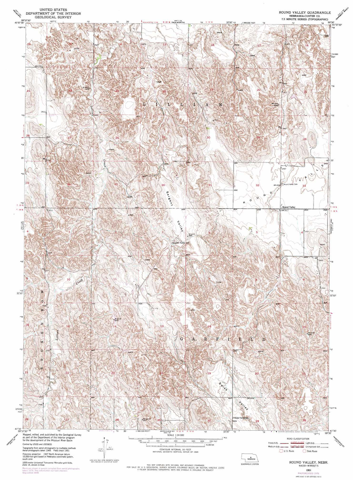
USGS Topo Quad 41099e5 - 1:24,000 scale
| Topo Map Name: | Round Valley |
| USGS Topo Quad ID: | 41099e5 |
| Print Size: | ca. 21 1/4" wide x 27" high |
| Southeast Coordinates: | 41.5° N latitude / 99.5° W longitude |
| Map Center Coordinates: | 41.5625° N latitude / 99.5625° W longitude |
| U.S. State: | NE |
| Filename: | O41099E5.jpg |
| Download Map JPG Image: | Round Valley topo map 1:24,000 scale |
| Map Type: | Topographic |
| Topo Series: | 7.5´ |
| Map Scale: | 1:24,000 |
| Source of Map Images: | United States Geological Survey (USGS) |
| Alternate Map Versions: |
Round Valley NE 1951, updated 1953 Download PDF Buy paper map Round Valley NE 1951, updated 1978 Download PDF Buy paper map Round Valley NE 2011 Download PDF Buy paper map Round Valley NE 2014 Download PDF Buy paper map |
1:24,000 Topo Quads surrounding Round Valley
Brewster Se |
Almeria Sw |
Almeria |
Taylor |
Taylor Se |
Anselmo Ne |
Milburn |
Walworth |
Sargent West |
Sargent East |
Anselmo |
Lillian |
Round Valley |
Sargent Sw |
Sargent Se |
Merna |
Broken Bow |
Broken Bow Ne |
Westerville |
Ansley Ne |
Callaway Se |
Broken Bow Sw |
Broken Bow Se |
Ansley |
Ansley Se |
> Back to 41099e1 at 1:100,000 scale
> Back to 41098a1 at 1:250,000 scale
> Back to U.S. Topo Maps home
Round Valley topo map: Gazetteer
Round Valley: Basins
Round Valley elevation 760m 2493′Round Valley: Populated Places
Round Valley elevation 766m 2513′Round Valley: Post Offices
Round Valley Post Office (historical) elevation 766m 2513′Round Valley: Valleys
Sargent Valley elevation 776m 2545′Swiss Valley elevation 759m 2490′
Round Valley digital topo map on disk
Buy this Round Valley topo map showing relief, roads, GPS coordinates and other geographical features, as a high-resolution digital map file on DVD: