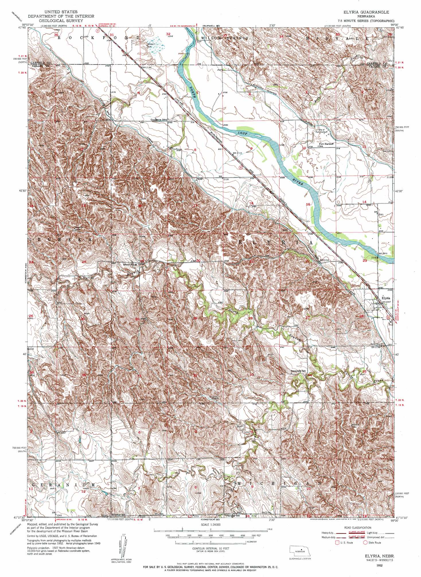
Elyria Topo Map Nebraska
To zoom in, hover over the map of Elyria
USGS Topo Quad 41099f1 - 1:24,000 scale
| Topo Map Name: | Elyria |
| USGS Topo Quad ID: | 41099f1 |
| Print Size: | ca. 21 1/4" wide x 27" high |
| Southeast Coordinates: | 41.625° N latitude / 99° W longitude |
| Map Center Coordinates: | 41.6875° N latitude / 99.0625° W longitude |
| U.S. State: | NE |
| Filename: | O41099F1.jpg |
| Download Map JPG Image: | Elyria topo map 1:24,000 scale |
| Map Type: | Topographic |
| Topo Series: | 7.5´ |
| Map Scale: | 1:24,000 |
| Source of Map Images: | United States Geological Survey (USGS) |
| Alternate Map Versions: |
Elyria NE 1952, updated 1954 Download PDF Buy paper map Elyria NE 2011 Download PDF Buy paper map Elyria NE 2014 Download PDF Buy paper map |
1:24,000 Topo Quads surrounding Elyria
Taylor Ne |
Burwell Nw |
Burwell Ne |
Gables Nw |
Gables |
Taylor Se |
Burwell |
Burwell Se |
Gables Sw |
Gables Se |
Sargent East |
Comstock Nw |
Elyria |
Ord Nw |
Ord Ne |
Sargent Se |
Comstock |
Comstock Se |
Ord |
Ord Se |
Ansley Ne |
Arcadia West |
Arcadia East |
Loup City Nw |
North Loup |
> Back to 41099e1 at 1:100,000 scale
> Back to 41098a1 at 1:250,000 scale
> Back to U.S. Topo Maps home
Elyria topo map: Gazetteer
Elyria: Dams
Larsen-Schwartzlander Dam elevation 662m 2171′Elyria: Parks
Calamus Townsite Historical Marker elevation 643m 2109′Fort Hartsuff Historical Park elevation 648m 2125′
Saint Marys Catholic Church Historical Marker elevation 641m 2103′
Elyria: Populated Places
Elyria elevation 641m 2103′Elyria: Post Offices
Elyria Post Office elevation 641m 2103′Elyria: Reservoirs
Larsen-Schwartzlander Reservoir elevation 662m 2171′Elyria: Streams
Bean Creek elevation 637m 2089′North Branch Turtle Creek elevation 635m 2083′
South Branch Turtle Creek elevation 637m 2089′
Elyria digital topo map on disk
Buy this Elyria topo map showing relief, roads, GPS coordinates and other geographical features, as a high-resolution digital map file on DVD: