Burwell Topo Map Nebraska
To zoom in, hover over the map of Burwell
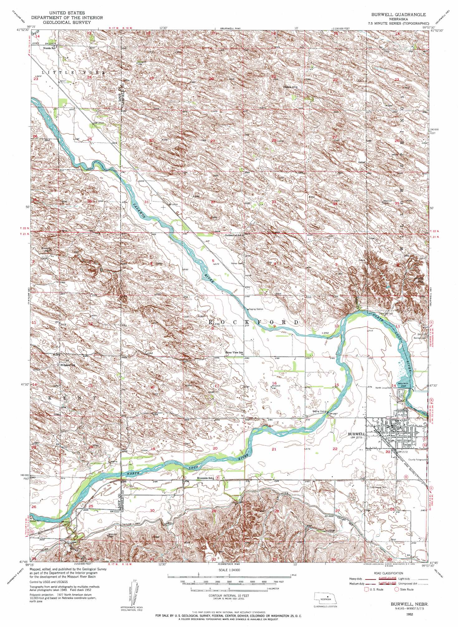
USGS Topo Quad 41099g2 - 1:24,000 scale
| Topo Map Name: | Burwell |
| USGS Topo Quad ID: | 41099g2 |
| Print Size: | ca. 21 1/4" wide x 27" high |
| Southeast Coordinates: | 41.75° N latitude / 99.125° W longitude |
| Map Center Coordinates: | 41.8125° N latitude / 99.1875° W longitude |
| U.S. State: | NE |
| Filename: | O41099G2.jpg |
| Download Map JPG Image: | Burwell topo map 1:24,000 scale |
| Map Type: | Topographic |
| Topo Series: | 7.5´ |
| Map Scale: | 1:24,000 |
| Source of Map Images: | United States Geological Survey (USGS) |
| Alternate Map Versions: |
Burwell NE 1952, updated 1954 Download PDF Buy paper map Burwell NE 2011 Download PDF Buy paper map Burwell NE 2014 Download PDF Buy paper map |
1:24,000 Topo Quads surrounding Burwell
Stonehouse Ranch Sw |
Stonehouse Ranch |
Carson Lake |
Abbott Ranch |
Chain Lake |
Taylor Nw |
Taylor Ne |
Burwell Nw |
Burwell Ne |
Gables Nw |
Taylor |
Taylor Se |
Burwell |
Burwell Se |
Gables Sw |
Sargent West |
Sargent East |
Comstock Nw |
Elyria |
Ord Nw |
Sargent Sw |
Sargent Se |
Comstock |
Comstock Se |
Ord |
> Back to 41099e1 at 1:100,000 scale
> Back to 41098a1 at 1:250,000 scale
> Back to U.S. Topo Maps home
Burwell topo map: Gazetteer
Burwell: Airports
Cram Field elevation 665m 2181′Burwell: Bays
Buckshot Bay elevation 688m 2257′Burwell: Canals
Taylor-Ord Canal elevation 678m 2224′Burwell: Dams
North Loup Dam elevation 653m 2142′North Loup Dam elevation 653m 2142′
Virginia Smith Dam elevation 663m 2175′
Burwell: Parks
Burwell City Park elevation 653m 2142′Calamus Valley Historical Marker elevation 698m 2290′
Garfield County Historical Marker elevation 664m 2178′
Mirdan Canal State Wildlife Management Area elevation 664m 2178′
North Loup Project Historical Marker elevation 698m 2290′
Riverside Park elevation 652m 2139′
Burwell: Populated Places
Burwell elevation 663m 2175′Rainbow Trailer Court elevation 663m 2175′
Burwell: Post Offices
Burwell Post Office elevation 664m 2178′Nunda Post Office (historical) elevation 679m 2227′
Burwell: Reservoirs
Burwell-Sumter Diversion Reservoir elevation 653m 2142′Calamus Reservoir elevation 663m 2175′
Burwell: Streams
Calamus River elevation 656m 2152′Sioux Creek elevation 669m 2194′
Burwell: Summits
Windy Hill elevation 725m 2378′Burwell digital topo map on disk
Buy this Burwell topo map showing relief, roads, GPS coordinates and other geographical features, as a high-resolution digital map file on DVD: