Taylor Ne Topo Map Nebraska
To zoom in, hover over the map of Taylor Ne
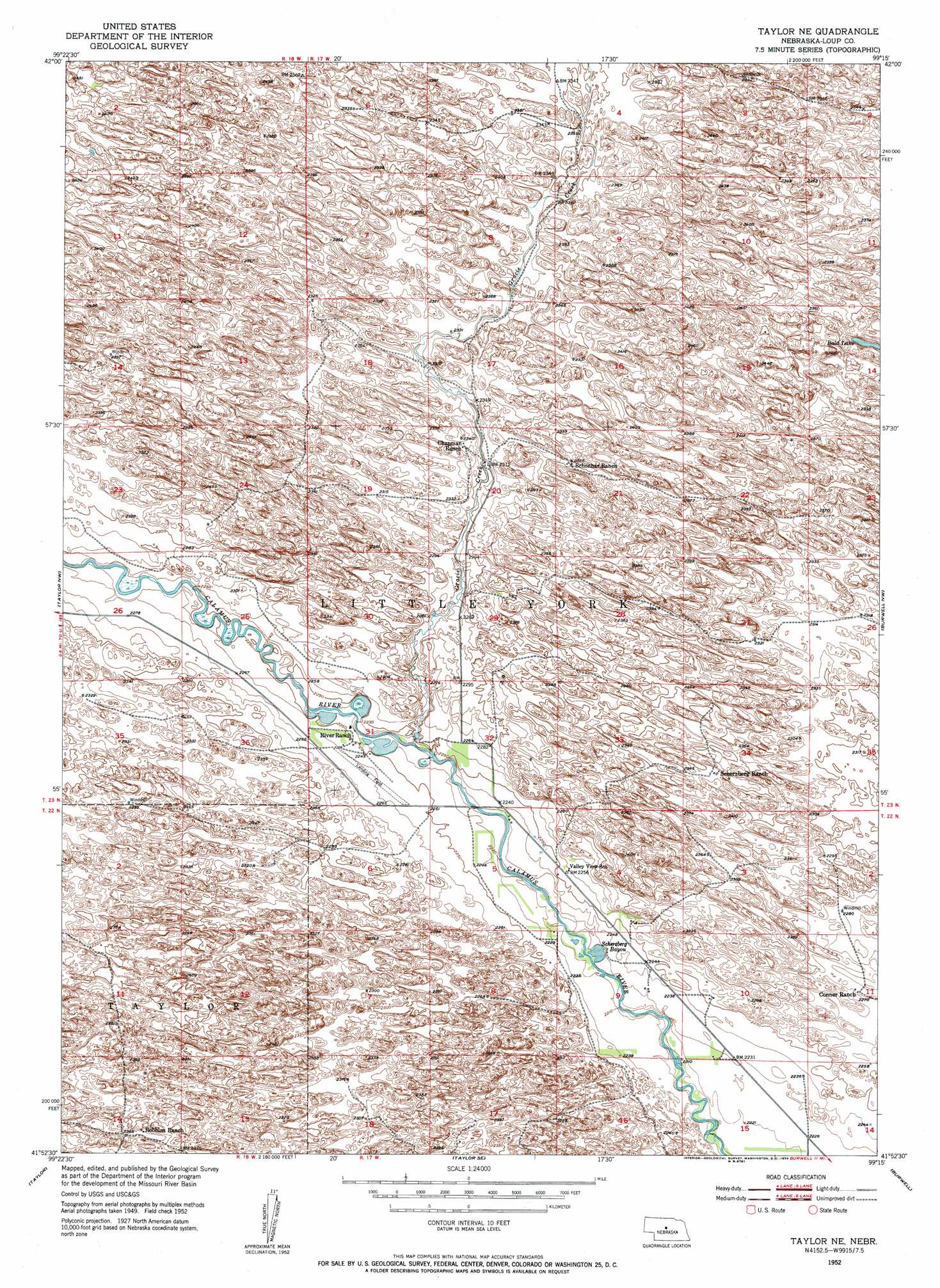
USGS Topo Quad 41099h3 - 1:24,000 scale
| Topo Map Name: | Taylor Ne |
| USGS Topo Quad ID: | 41099h3 |
| Print Size: | ca. 21 1/4" wide x 27" high |
| Southeast Coordinates: | 41.875° N latitude / 99.25° W longitude |
| Map Center Coordinates: | 41.9375° N latitude / 99.3125° W longitude |
| U.S. State: | NE |
| Filename: | O41099H3.jpg |
| Download Map JPG Image: | Taylor Ne topo map 1:24,000 scale |
| Map Type: | Topographic |
| Topo Series: | 7.5´ |
| Map Scale: | 1:24,000 |
| Source of Map Images: | United States Geological Survey (USGS) |
| Alternate Map Versions: |
Taylor NE NE 1952, updated 1954 Download PDF Buy paper map Taylor NE NE 2011 Download PDF Buy paper map Taylor NE NE 2014 Download PDF Buy paper map |
1:24,000 Topo Quads surrounding Taylor Ne
Rose |
Stonehouse Ranch Nw |
Stonehouse Ranch Ne |
Bruner Lake |
Swan Lake |
Shovel Dot Ranch |
Stonehouse Ranch Sw |
Stonehouse Ranch |
Carson Lake |
Abbott Ranch |
Almeria Ne |
Taylor Nw |
Taylor Ne |
Burwell Nw |
Burwell Ne |
Almeria |
Taylor |
Taylor Se |
Burwell |
Burwell Se |
Walworth |
Sargent West |
Sargent East |
Comstock Nw |
Elyria |
> Back to 41099e1 at 1:100,000 scale
> Back to 41098a1 at 1:250,000 scale
> Back to U.S. Topo Maps home
Taylor Ne topo map: Gazetteer
Taylor Ne: Dams
Morgan Dam elevation 706m 2316′Taylor Ne: Lakes
Scherzberg Bayou elevation 674m 2211′Taylor Ne: Parks
Calamus Reservoir State Recreation Area elevation 674m 2211′Valleyview Historical Marker elevation 683m 2240′
Taylor Ne: Post Offices
Valleyview Post Office (historical) elevation 680m 2230′Taylor Ne: Reservoirs
Morgan Reservoir Number 1 elevation 706m 2316′Taylor Ne: Streams
Gracie Creek elevation 681m 2234′Taylor Ne digital topo map on disk
Buy this Taylor Ne topo map showing relief, roads, GPS coordinates and other geographical features, as a high-resolution digital map file on DVD: