Brewster Topo Map Nebraska
To zoom in, hover over the map of Brewster
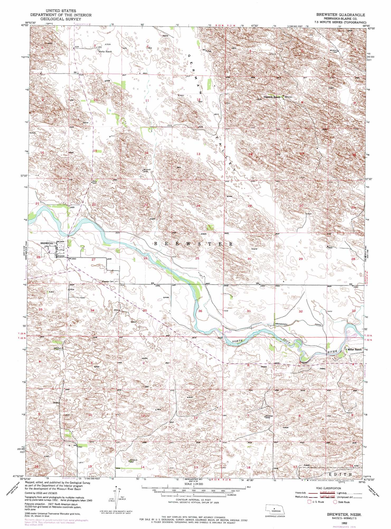
USGS Topo Quad 41099h7 - 1:24,000 scale
| Topo Map Name: | Brewster |
| USGS Topo Quad ID: | 41099h7 |
| Print Size: | ca. 21 1/4" wide x 27" high |
| Southeast Coordinates: | 41.875° N latitude / 99.75° W longitude |
| Map Center Coordinates: | 41.9375° N latitude / 99.8125° W longitude |
| U.S. State: | NE |
| Filename: | O41099H7.jpg |
| Download Map JPG Image: | Brewster topo map 1:24,000 scale |
| Map Type: | Topographic |
| Topo Series: | 7.5´ |
| Map Scale: | 1:24,000 |
| Source of Map Images: | United States Geological Survey (USGS) |
| Alternate Map Versions: |
Brewster NE 1952, updated 1954 Download PDF Buy paper map Brewster NE 1952, updated 1978 Download PDF Buy paper map Brewster NE 2011 Download PDF Buy paper map Brewster NE 2014 Download PDF Buy paper map |
1:24,000 Topo Quads surrounding Brewster
Koshopah Ne |
Goldman Lake Nw |
Goldman Lake Ne |
Paramount Valley |
Rose |
Koshopah |
Goldman Lake |
Goldman Lake Se |
Boiling Spring |
Shovel Dot Ranch |
Dunning Ne |
Brewster Nw |
Brewster |
Almeria Nw |
Almeria Ne |
Dunning |
Brewster Sw |
Brewster Se |
Almeria Sw |
Almeria |
Linscott |
Anselmo Nw |
Anselmo Ne |
Milburn |
Walworth |
> Back to 41099e1 at 1:100,000 scale
> Back to 41098a1 at 1:250,000 scale
> Back to U.S. Topo Maps home
Brewster topo map: Gazetteer
Brewster: Populated Places
Brewster elevation 760m 2493′Brewster: Post Offices
Brewster Post Office elevation 760m 2493′Brewster digital topo map on disk
Buy this Brewster topo map showing relief, roads, GPS coordinates and other geographical features, as a high-resolution digital map file on DVD: