Brady Topo Map Nebraska
To zoom in, hover over the map of Brady
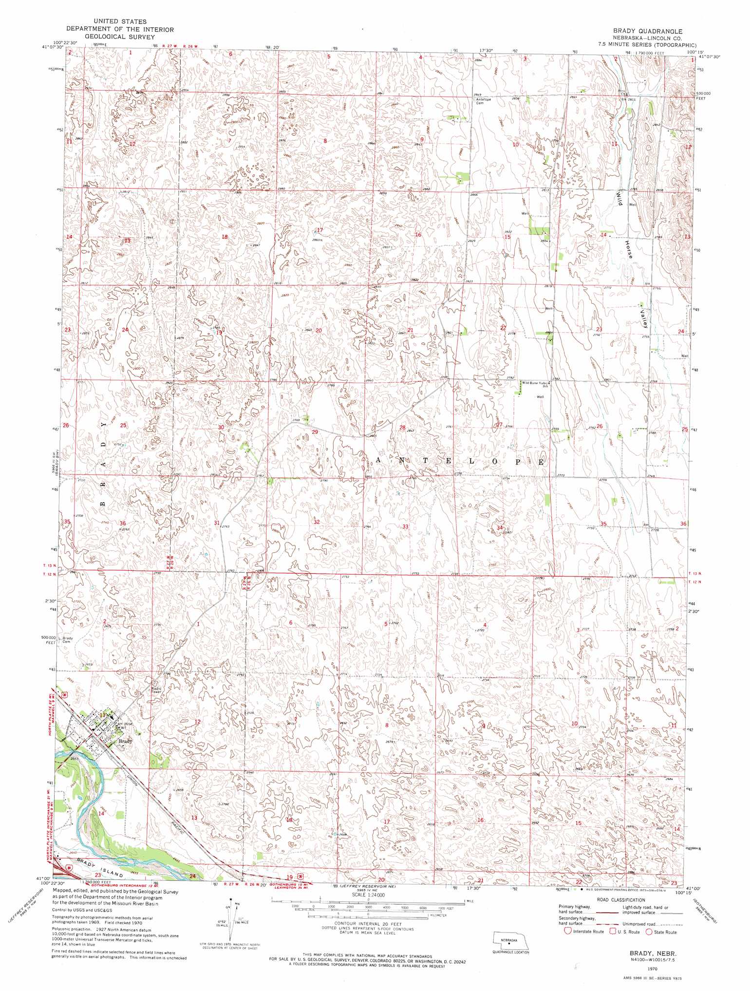
USGS Topo Quad 41100a3 - 1:24,000 scale
| Topo Map Name: | Brady |
| USGS Topo Quad ID: | 41100a3 |
| Print Size: | ca. 21 1/4" wide x 27" high |
| Southeast Coordinates: | 41° N latitude / 100.25° W longitude |
| Map Center Coordinates: | 41.0625° N latitude / 100.3125° W longitude |
| U.S. State: | NE |
| Filename: | O41100a3.jpg |
| Download Map JPG Image: | Brady topo map 1:24,000 scale |
| Map Type: | Topographic |
| Topo Series: | 7.5´ |
| Map Scale: | 1:24,000 |
| Source of Map Images: | United States Geological Survey (USGS) |
| Alternate Map Versions: |
Brady NE 1970, updated 1973 Download PDF Buy paper map Brady NE 2011 Download PDF Buy paper map Brady NE 2014 Download PDF Buy paper map |
1:24,000 Topo Quads surrounding Brady
Stapleton Se |
Gandy Sw |
Kilmer Valley |
Arnold Sw |
Murphy Table |
Maxwell Ne |
Brady Nw |
Brady Ne |
Odencranze Table North |
Roten Valley North |
Maxwell |
Brady Sw |
Brady |
Odencranze Table South |
Roten Valley South |
Wellfleet Ne |
Jeffrey Reservoir |
Jeffrey Reservoir Ne |
Gothenburg |
Willow Island |
Wellfleet Se |
Jeffrey Reservoir Sw |
Jeffrey Reservoir Se |
Gothenburg Sw |
Gothenburg Se |
> Back to 41100a1 at 1:100,000 scale
> Back to 41100a1 at 1:250,000 scale
> Back to U.S. Topo Maps home
Brady topo map: Gazetteer
Brady: Populated Places
Brady elevation 808m 2650′Brady: Post Offices
Brady Post Office elevation 808m 2650′Brady: Streams
Pawnee Creek elevation 808m 2650′Brady digital topo map on disk
Buy this Brady topo map showing relief, roads, GPS coordinates and other geographical features, as a high-resolution digital map file on DVD: