Brady Sw Topo Map Nebraska
To zoom in, hover over the map of Brady Sw
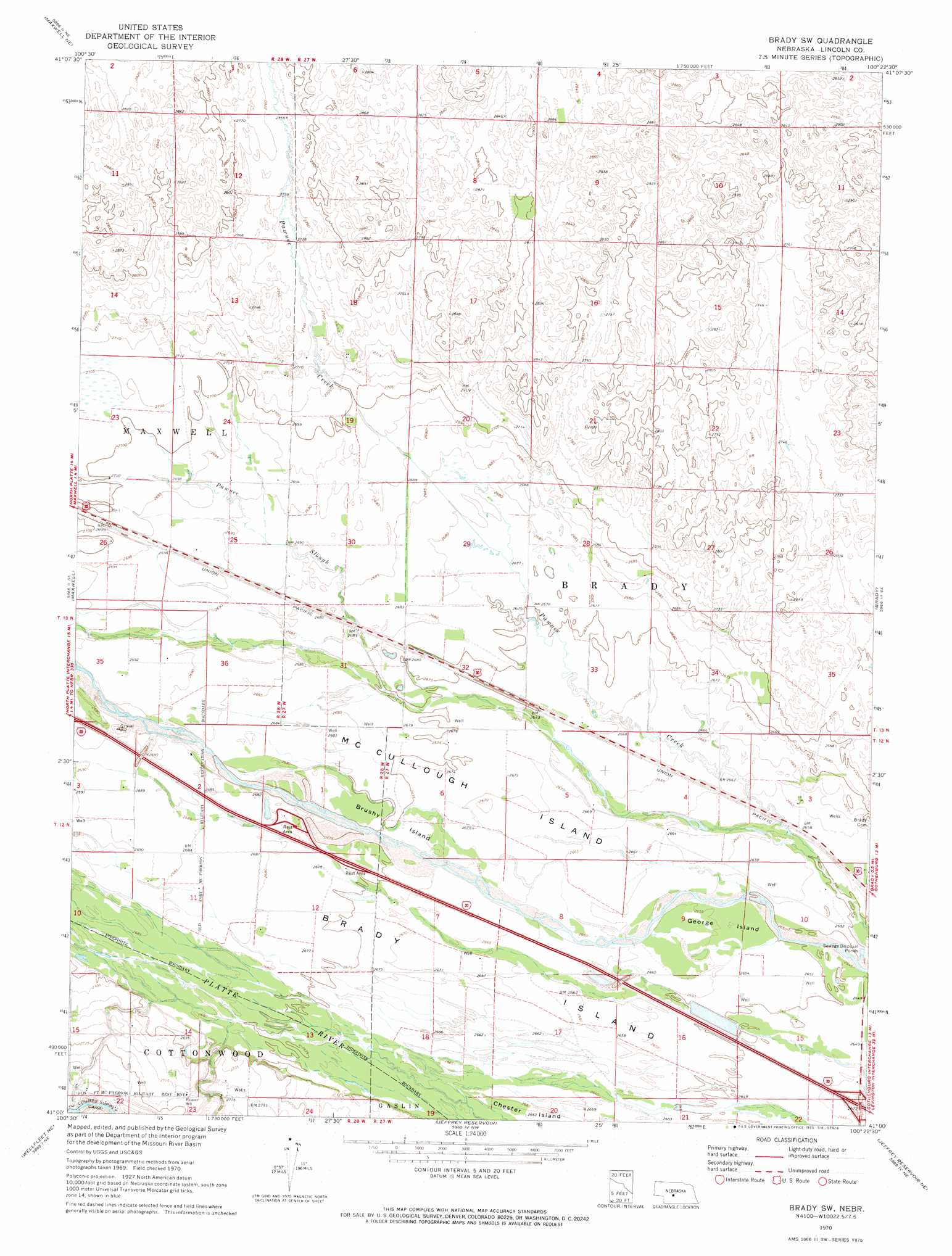
USGS Topo Quad 41100a4 - 1:24,000 scale
| Topo Map Name: | Brady Sw |
| USGS Topo Quad ID: | 41100a4 |
| Print Size: | ca. 21 1/4" wide x 27" high |
| Southeast Coordinates: | 41° N latitude / 100.375° W longitude |
| Map Center Coordinates: | 41.0625° N latitude / 100.4375° W longitude |
| U.S. State: | NE |
| Filename: | O41100a4.jpg |
| Download Map JPG Image: | Brady Sw topo map 1:24,000 scale |
| Map Type: | Topographic |
| Topo Series: | 7.5´ |
| Map Scale: | 1:24,000 |
| Source of Map Images: | United States Geological Survey (USGS) |
| Alternate Map Versions: |
Brady SW NE 1970, updated 1973 Download PDF Buy paper map Brady SW NE 2011 Download PDF Buy paper map Brady SW NE 2014 Download PDF Buy paper map |
1:24,000 Topo Quads surrounding Brady Sw
Stapleton Sw |
Stapleton Se |
Gandy Sw |
Kilmer Valley |
Arnold Sw |
North Platte East |
Maxwell Ne |
Brady Nw |
Brady Ne |
Odencranze Table North |
Maxwell Sw |
Maxwell |
Brady Sw |
Brady |
Odencranze Table South |
Wellfleet Nw |
Wellfleet Ne |
Jeffrey Reservoir |
Jeffrey Reservoir Ne |
Gothenburg |
Wellfleet |
Wellfleet Se |
Jeffrey Reservoir Sw |
Jeffrey Reservoir Se |
Gothenburg Sw |
> Back to 41100a1 at 1:100,000 scale
> Back to 41100a1 at 1:250,000 scale
> Back to U.S. Topo Maps home
Brady Sw topo map: Gazetteer
Brady Sw: Crossings
Interchange 199 elevation 811m 2660′Brady Sw: Dams
Earth Dam-Canal Mile 148 Dam elevation 836m 2742′Brady Sw: Islands
Brady Island elevation 817m 2680′Brushy Island elevation 814m 2670′
George Island elevation 810m 2657′
McCullough Island elevation 815m 2673′
Brady Sw: Parks
Fort McPherson and North Platte Historical Marker elevation 819m 2687′Nebraska Gateway Sculpture elevation 819m 2687′
Road Ranches along the Platte Historical Marker elevation 817m 2680′
West Brady State Wildlife Management Area elevation 811m 2660′
Brady Sw: Streams
Pawnee Slough elevation 808m 2650′Brady Sw digital topo map on disk
Buy this Brady Sw topo map showing relief, roads, GPS coordinates and other geographical features, as a high-resolution digital map file on DVD: