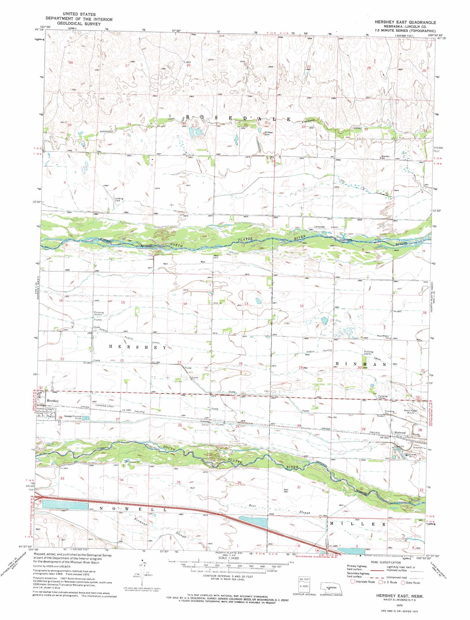
Hershey East Topo Map Nebraska
To zoom in, hover over the map of Hershey East
USGS Topo Quad 41100b8 - 1:24,000 scale
| Topo Map Name: | Hershey East |
| USGS Topo Quad ID: | 41100b8 |
| Print Size: | ca. 21 1/4" wide x 27" high |
| Southeast Coordinates: | 41.125° N latitude / 100.875° W longitude |
| Map Center Coordinates: | 41.1875° N latitude / 100.9375° W longitude |
| U.S. State: | NE |
| Filename: | O41100b8.jpg |
| Download Map JPG Image: | Hershey East topo map 1:24,000 scale |
| Map Type: | Topographic |
| Topo Series: | 7.5´ |
| Map Scale: | 1:24,000 |
| Source of Map Images: | United States Geological Survey (USGS) |
| Alternate Map Versions: |
Hershey East NE 1970, updated 1973 Download PDF Buy paper map Hershey East NE 2011 Download PDF Buy paper map Hershey East NE 2014 Download PDF Buy paper map |
1:24,000 Topo Quads surrounding Hershey East
Tin Camp Ranch |
Pierson Ranch |
North Platte 2 Nw |
North Platte 2 Ne |
Stapleton Nw |
Applegate Ranch |
Green Ranch |
North Platte 2 Sw |
North Platte 2 Se |
Stapleton Sw |
Sutherland Reservoir Nw |
Hershey West |
Hershey East |
North Platte West |
North Platte East |
Sutherland Reservoir West |
Sutherland Reservoir East |
North Platte Sw |
Lake Maloney |
Maxwell Sw |
Wallace Nw |
Wallace Ne |
Dickens Nw |
Dickens Ne |
Wellfleet Nw |
> Back to 41100a1 at 1:100,000 scale
> Back to 41100a1 at 1:250,000 scale
> Back to U.S. Topo Maps home
Hershey East topo map: Gazetteer
Hershey East: Airports
Evans Ranch Airport elevation 878m 2880′Hershey East: Canals
Birdwood Canal elevation 884m 2900′North Platte Canal elevation 881m 2890′
Hershey East: Parks
Birdwood Lake State Wildlife Management Area elevation 871m 2857′East Hershey State Wildlife Management Area elevation 874m 2867′
Hershey State Wildlife Management Area elevation 883m 2896′
Muskrat Run State Wildlife Management Area elevation 870m 2854′
Hershey East: Populated Places
Birdwood elevation 870m 2854′Hershey East: Post Offices
Birdwood Post Office (historical) elevation 870m 2854′Hershey East: Reservoirs
Birdwood Lake elevation 871m 2857′East Hershey Lake elevation 874m 2867′
Hershey Lake elevation 883m 2896′
Hershey East digital topo map on disk
Buy this Hershey East topo map showing relief, roads, GPS coordinates and other geographical features, as a high-resolution digital map file on DVD: