Davenport Table Topo Map Nebraska
To zoom in, hover over the map of Davenport Table
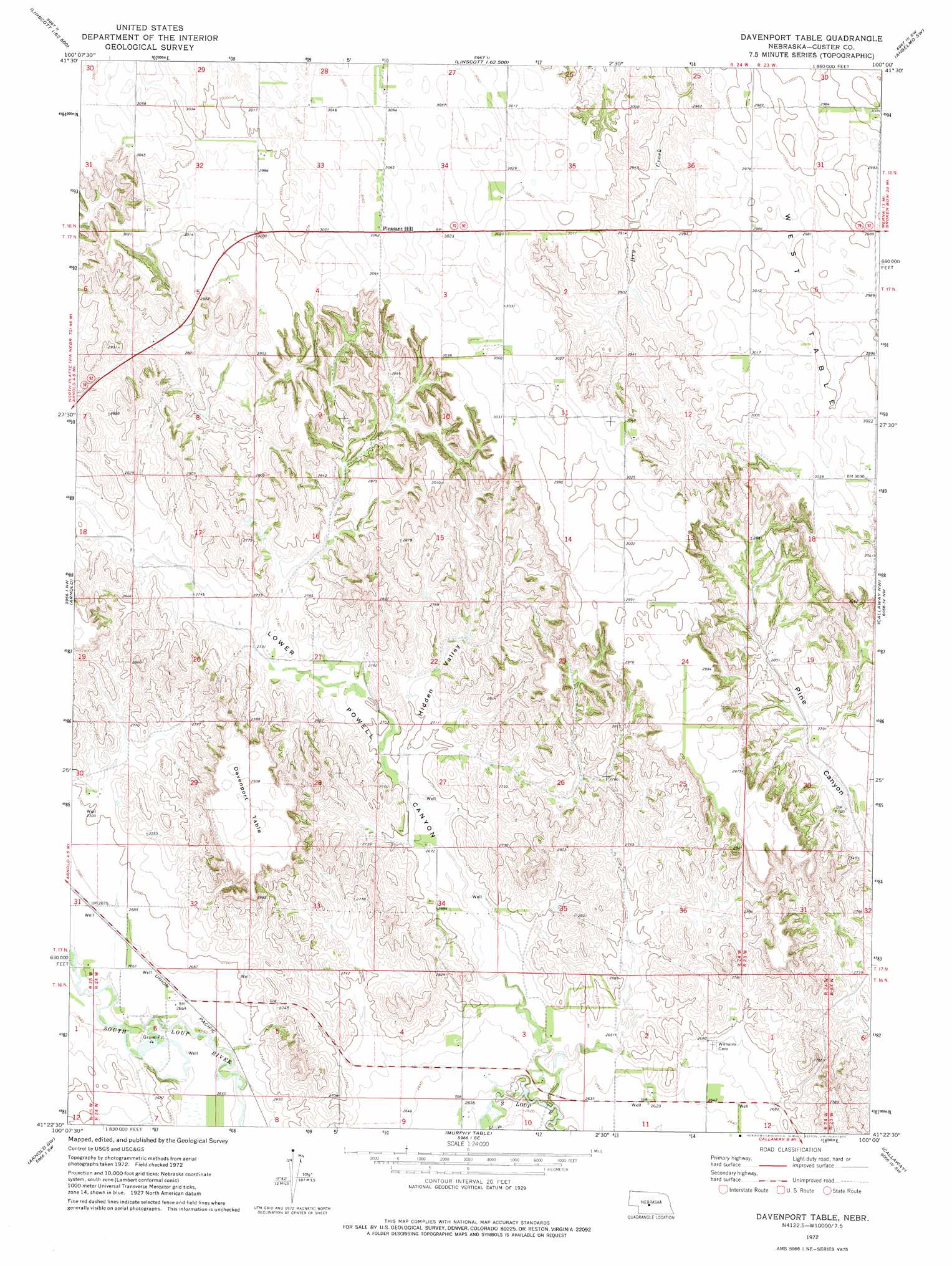
USGS Topo Quad 41100d1 - 1:24,000 scale
| Topo Map Name: | Davenport Table |
| USGS Topo Quad ID: | 41100d1 |
| Print Size: | ca. 21 1/4" wide x 27" high |
| Southeast Coordinates: | 41.375° N latitude / 100° W longitude |
| Map Center Coordinates: | 41.4375° N latitude / 100.0625° W longitude |
| U.S. State: | NE |
| Filename: | O41100d1.jpg |
| Download Map JPG Image: | Davenport Table topo map 1:24,000 scale |
| Map Type: | Topographic |
| Topo Series: | 7.5´ |
| Map Scale: | 1:24,000 |
| Source of Map Images: | United States Geological Survey (USGS) |
| Alternate Map Versions: |
Davenport Table NE 1972, updated 1975 Download PDF Buy paper map Davenport Table NE 2011 Download PDF Buy paper map Davenport Table NE 2014 Download PDF Buy paper map |
1:24,000 Topo Quads surrounding Davenport Table
Hoagland Ne |
Linscott Nw |
Linscott |
Anselmo Nw |
Anselmo Ne |
Hoagland |
Linscott Sw |
Linscott Se |
Anselmo Sw |
Anselmo |
Logan |
Arnold |
Davenport Table |
Callaway Nw |
Merna |
Kilmer Valley |
Arnold Sw |
Murphy Table |
Callaway |
Callaway Se |
Brady Ne |
Odencranze Table North |
Roten Valley North |
Oconto Nw |
Oconto |
> Back to 41100a1 at 1:100,000 scale
> Back to 41100a1 at 1:250,000 scale
> Back to U.S. Topo Maps home
Davenport Table topo map: Gazetteer
Davenport Table: Populated Places
Pleasant Hill elevation 933m 3061′Davenport Table: Summits
Davenport Table elevation 896m 2939′Davenport Table: Valleys
Hidden Valley elevation 822m 2696′Lower Powell Canyon elevation 805m 2641′
Pine Canyon elevation 835m 2739′
Upper Powell Canyon elevation 839m 2752′
Davenport Table digital topo map on disk
Buy this Davenport Table topo map showing relief, roads, GPS coordinates and other geographical features, as a high-resolution digital map file on DVD: