Paxton Sw Topo Map Nebraska
To zoom in, hover over the map of Paxton Sw
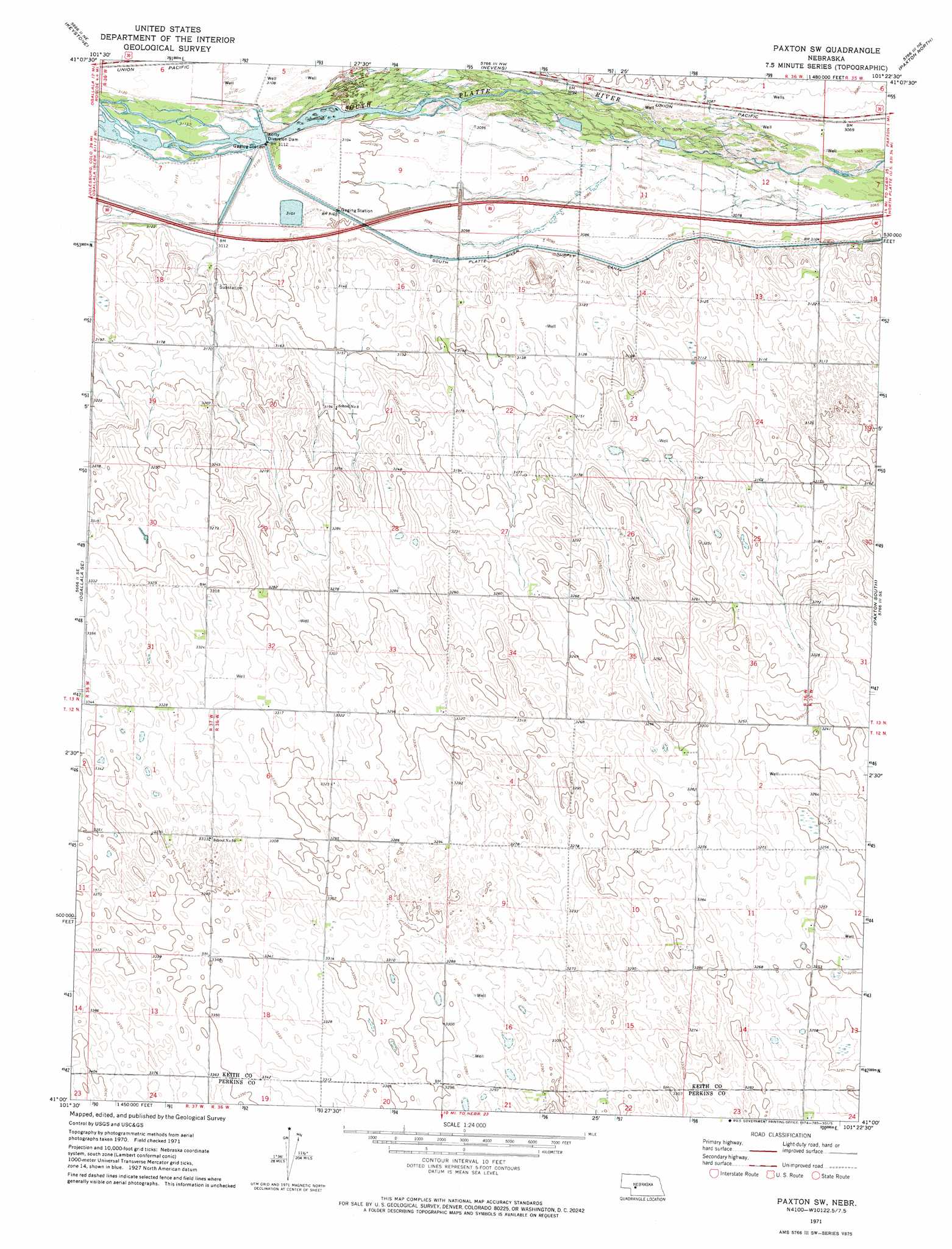
USGS Topo Quad 41101a4 - 1:24,000 scale
| Topo Map Name: | Paxton Sw |
| USGS Topo Quad ID: | 41101a4 |
| Print Size: | ca. 21 1/4" wide x 27" high |
| Southeast Coordinates: | 41° N latitude / 101.375° W longitude |
| Map Center Coordinates: | 41.0625° N latitude / 101.4375° W longitude |
| U.S. State: | NE |
| Filename: | O41101a4.jpg |
| Download Map JPG Image: | Paxton Sw topo map 1:24,000 scale |
| Map Type: | Topographic |
| Topo Series: | 7.5´ |
| Map Scale: | 1:24,000 |
| Source of Map Images: | United States Geological Survey (USGS) |
| Alternate Map Versions: |
Paxton SW NE 1971, updated 1974 Download PDF Buy paper map Paxton SW NE 2011 Download PDF Buy paper map Paxton SW NE 2014 Download PDF Buy paper map |
1:24,000 Topo Quads surrounding Paxton Sw
Martin |
Glinn Ranch |
Big Bald Hill |
Big Bald Hill Se |
Applegate Ranch |
Ogallala |
Keystone |
Nevens |
Paxton North |
Sutherland Reservoir Nw |
Ogallala Sw |
Ogallala Se |
Paxton Sw |
Paxton South |
Sutherland Reservoir West |
Wild Horse Spring |
Grant Ne |
Elsie Nw |
Elsie Ne |
Wallace Nw |
Grant |
Madrid |
Elsie |
Grainton |
Wallace |
> Back to 41101a1 at 1:100,000 scale
> Back to 41100a1 at 1:250,000 scale
> Back to U.S. Topo Maps home
Paxton Sw topo map: Gazetteer
Paxton Sw: Canals
South Platte River Supply Canal elevation 945m 3100′Paxton Sw: Dams
Platte Valley Diversion Dam elevation 948m 3110′Paxton Sw digital topo map on disk
Buy this Paxton Sw topo map showing relief, roads, GPS coordinates and other geographical features, as a high-resolution digital map file on DVD: