Brule Se Topo Map Nebraska
To zoom in, hover over the map of Brule Se
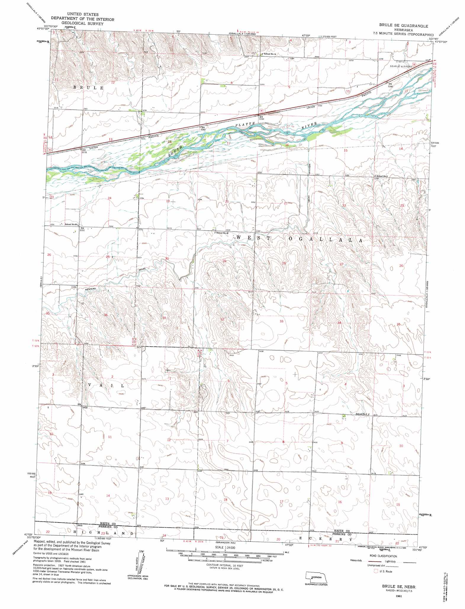
USGS Topo Quad 41101a7 - 1:24,000 scale
| Topo Map Name: | Brule Se |
| USGS Topo Quad ID: | 41101a7 |
| Print Size: | ca. 21 1/4" wide x 27" high |
| Southeast Coordinates: | 41° N latitude / 101.75° W longitude |
| Map Center Coordinates: | 41.0625° N latitude / 101.8125° W longitude |
| U.S. State: | NE |
| Filename: | O41101a7.jpg |
| Download Map JPG Image: | Brule Se topo map 1:24,000 scale |
| Map Type: | Topographic |
| Topo Series: | 7.5´ |
| Map Scale: | 1:24,000 |
| Source of Map Images: | United States Geological Survey (USGS) |
| Alternate Map Versions: |
Brule SE NE 1961, updated 1963 Download PDF Buy paper map Brule SE NE 1961, updated 1963 Download PDF Buy paper map Brule SE NE 2011 Download PDF Buy paper map Brule SE NE 2014 Download PDF Buy paper map |
1:24,000 Topo Quads surrounding Brule Se
Ruthton |
Belmar |
Lemoyne |
Martin |
Glinn Ranch |
Big Springs Ne |
Brule Nw |
Brule Ne |
Ogallala |
Keystone |
Big Springs |
Brule |
Brule Se |
Ogallala Sw |
Ogallala Se |
Venango Ne |
Brandon Nw |
Brandon Ne |
Wild Horse Spring |
Grant Ne |
Venango |
Brandon |
Brandon Se |
Grant |
Madrid |
> Back to 41101a1 at 1:100,000 scale
> Back to 41100a1 at 1:250,000 scale
> Back to U.S. Topo Maps home
Brule Se topo map: Gazetteer
Brule Se: Airports
Searle Airport elevation 993m 3257′Shelburnes Airport elevation 1058m 3471′
Brule Se: Dams
Detention Dam 1 elevation 1013m 3323′Maloney Dam elevation 1051m 3448′
Brule Se: Reservoirs
Western Irrigation District Reservoir elevation 1013m 3323′Brule Se: Valleys
Chase Canyon elevation 1013m 3323′Brule Se digital topo map on disk
Buy this Brule Se topo map showing relief, roads, GPS coordinates and other geographical features, as a high-resolution digital map file on DVD: