Nevens Topo Map Nebraska
To zoom in, hover over the map of Nevens
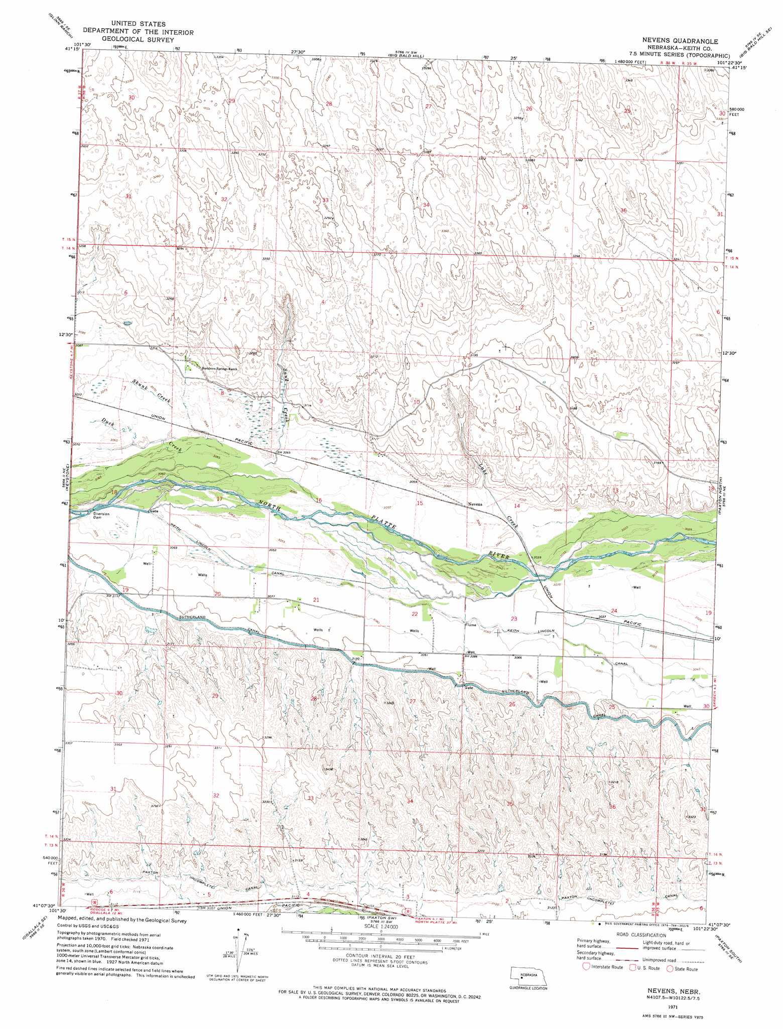
USGS Topo Quad 41101b4 - 1:24,000 scale
| Topo Map Name: | Nevens |
| USGS Topo Quad ID: | 41101b4 |
| Print Size: | ca. 21 1/4" wide x 27" high |
| Southeast Coordinates: | 41.125° N latitude / 101.375° W longitude |
| Map Center Coordinates: | 41.1875° N latitude / 101.4375° W longitude |
| U.S. State: | NE |
| Filename: | O41101b4.jpg |
| Download Map JPG Image: | Nevens topo map 1:24,000 scale |
| Map Type: | Topographic |
| Topo Series: | 7.5´ |
| Map Scale: | 1:24,000 |
| Source of Map Images: | United States Geological Survey (USGS) |
| Alternate Map Versions: |
Nevens NE 1971, updated 1974 Download PDF Buy paper map Nevens NE 2011 Download PDF Buy paper map Nevens NE 2014 Download PDF Buy paper map |
1:24,000 Topo Quads surrounding Nevens
Packard Ranch |
Spotted Horse Valley |
Bucktail Lake |
Big Bald Hill Ne |
Tin Camp Ranch |
Martin |
Glinn Ranch |
Big Bald Hill |
Big Bald Hill Se |
Applegate Ranch |
Ogallala |
Keystone |
Nevens |
Paxton North |
Sutherland Reservoir Nw |
Ogallala Sw |
Ogallala Se |
Paxton Sw |
Paxton South |
Sutherland Reservoir West |
Wild Horse Spring |
Grant Ne |
Elsie Nw |
Elsie Ne |
Wallace Nw |
> Back to 41101a1 at 1:100,000 scale
> Back to 41100a1 at 1:250,000 scale
> Back to U.S. Topo Maps home
Nevens topo map: Gazetteer
Nevens: Canals
Paxton Canal elevation 956m 3136′Sutherland Canal elevation 949m 3113′
Nevens: Populated Places
Nevens elevation 931m 3054′Nevens: Streams
Duck Creek elevation 934m 3064′Lake Creek elevation 927m 3041′
Sand Creek elevation 934m 3064′
Skunk Creek elevation 933m 3061′
Nevens digital topo map on disk
Buy this Nevens topo map showing relief, roads, GPS coordinates and other geographical features, as a high-resolution digital map file on DVD: