Rothwell Lake Topo Map Nebraska
To zoom in, hover over the map of Rothwell Lake
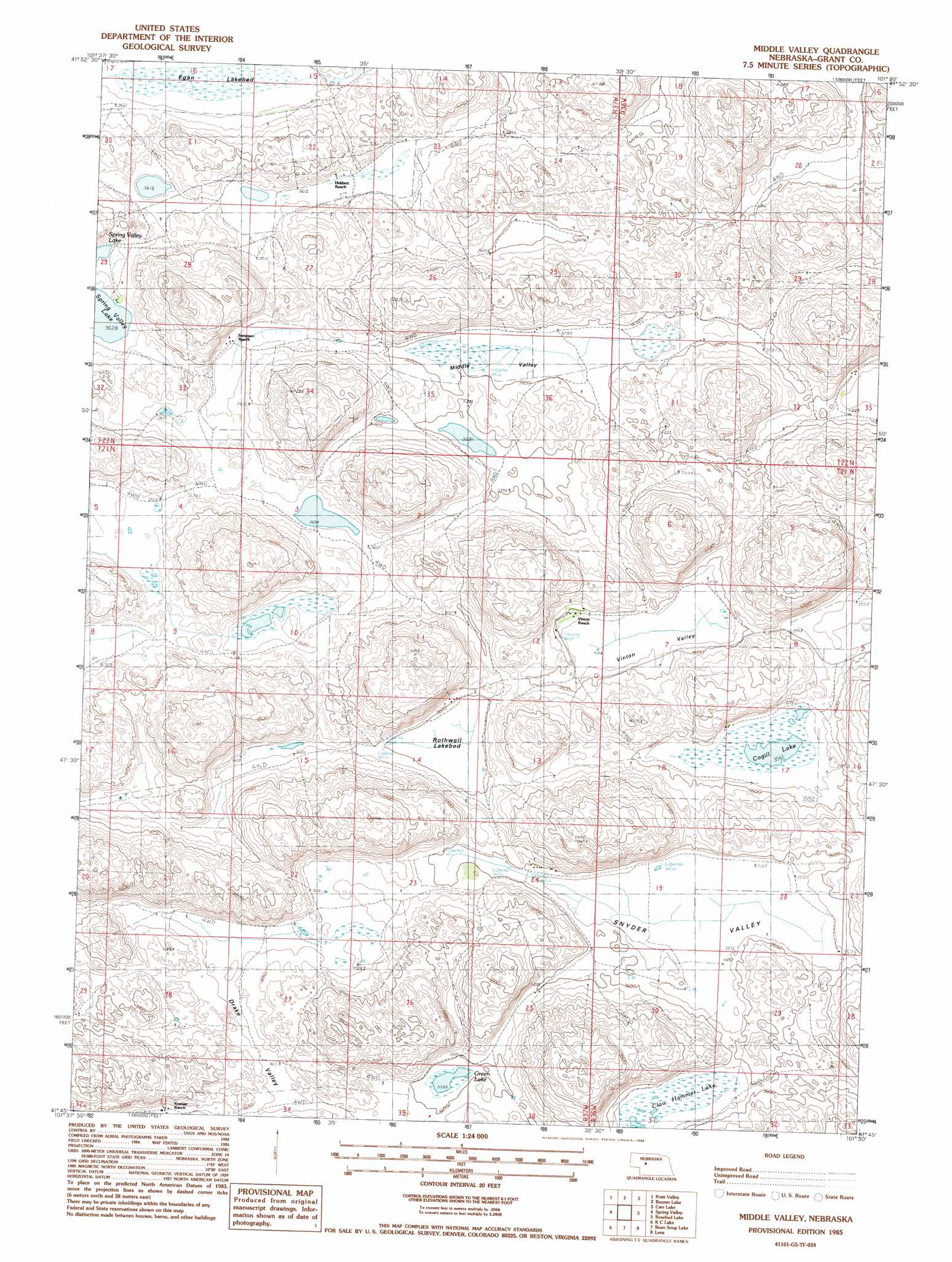
USGS Topo Quad 41101g5 - 1:24,000 scale
| Topo Map Name: | Rothwell Lake |
| USGS Topo Quad ID: | 41101g5 |
| Print Size: | ca. 21 1/4" wide x 27" high |
| Southeast Coordinates: | 41.75° N latitude / 101.5° W longitude |
| Map Center Coordinates: | 41.8125° N latitude / 101.5625° W longitude |
| U.S. State: | NE |
| Filename: | O41101g5.jpg |
| Download Map JPG Image: | Rothwell Lake topo map 1:24,000 scale |
| Map Type: | Topographic |
| Topo Series: | 7.5´ |
| Map Scale: | 1:24,000 |
| Source of Map Images: | United States Geological Survey (USGS) |
| Alternate Map Versions: |
Middle Valley NE 1985, updated 1986 Download PDF Buy paper map Middle Valley NE 2011 Download PDF Buy paper map Middle Valley NE 2014 Download PDF Buy paper map |
1:24,000 Topo Quads surrounding Rothwell Lake
Hyannis North |
Frye Lake |
Whitman |
Hire Sw |
Hire Se |
Hyannis South |
Moran Lake |
Bunner Lake |
Carr Lake |
Carr Lake Ne |
George Lake Se |
Spring Valley |
Rothwell Lake |
Haney Lake |
Jefford Lake |
Jensen Lake |
K C Lake |
Cheyenne Lake |
Lena |
Whitewater Lake |
Hulbert Lake |
Arthur |
Lightning Valley |
Bucktail |
Flats |
> Back to 41101e1 at 1:100,000 scale
> Back to 41100a1 at 1:250,000 scale
> Back to U.S. Topo Maps home
Rothwell Lake topo map: Gazetteer
Rothwell Lake: Basins
Drake Valley elevation 1102m 3615′Middle Valley elevation 1096m 3595′
Snyder Valley elevation 1090m 3576′
Vinton Valley elevation 1092m 3582′
Rothwell Lake: Lakes
Claw Hammer Lake elevation 1090m 3576′Cogill Lake elevation 1089m 3572′
Egan Lake elevation 1102m 3615′
Green Lake elevation 1095m 3592′
Rothwell Lake elevation 1096m 3595′
Spring Valley Lake elevation 1108m 3635′
Rothwell Lake digital topo map on disk
Buy this Rothwell Lake topo map showing relief, roads, GPS coordinates and other geographical features, as a high-resolution digital map file on DVD: