Big Springs Topo Map Nebraska
To zoom in, hover over the map of Big Springs
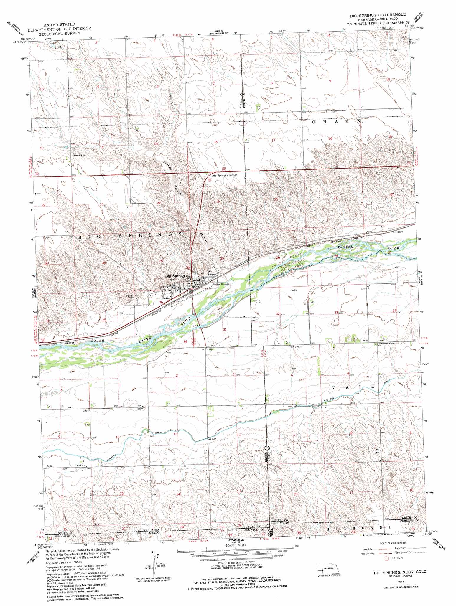
USGS Topo Quad 41102a1 - 1:24,000 scale
| Topo Map Name: | Big Springs |
| USGS Topo Quad ID: | 41102a1 |
| Print Size: | ca. 21 1/4" wide x 27" high |
| Southeast Coordinates: | 41° N latitude / 102° W longitude |
| Map Center Coordinates: | 41.0625° N latitude / 102.0625° W longitude |
| U.S. States: | NE, CO |
| Filename: | O41102A1.jpg |
| Download Map JPG Image: | Big Springs topo map 1:24,000 scale |
| Map Type: | Topographic |
| Topo Series: | 7.5´ |
| Map Scale: | 1:24,000 |
| Source of Map Images: | United States Geological Survey (USGS) |
| Alternate Map Versions: |
Big Springs NE 1961, updated 1963 Download PDF Buy paper map Big Springs NE 1961, updated 1983 Download PDF Buy paper map Big Springs NE 2010 Download PDF Buy paper map Big Springs NE 2011 Download PDF Buy paper map Big Springs NE 2014 Download PDF Buy paper map |
1:24,000 Topo Quads surrounding Big Springs
Barn Butte |
Lewellen |
Ruthton |
Belmar |
Lemoyne |
Chappell Ne |
Big Springs Nw |
Big Springs Ne |
Brule Nw |
Brule Ne |
Chappell Se |
Barton |
Big Springs |
Brule |
Brule Se |
Julesburg |
Venango Nw |
Venango Ne |
Brandon Nw |
Brandon Ne |
Julesburg Se |
Venango Sw |
Venango |
Brandon |
Brandon Se |
> Back to 41102a1 at 1:100,000 scale
> Back to 41102a1 at 1:250,000 scale
> Back to U.S. Topo Maps home
Big Springs topo map: Gazetteer
Big Springs: Airports
Newman Airport elevation 1080m 3543′Big Springs: Canals
Western Canal elevation 1037m 3402′Big Springs: Crossings
Interchange 107 elevation 1028m 3372′Big Springs: Parks
Eiker Park elevation 1028m 3372′McGreer Camper Park elevation 1028m 3372′
Phelps Hotel Historical Marker elevation 1028m 3372′
Sam Bass and the Big Springs Robbery Historical Marker elevation 1028m 3372′
Waterman Sod House Historical Marker elevation 1028m 3372′
Big Springs: Populated Places
Big Springs elevation 1028m 3372′Big Springs: Post Offices
Big Springs Post Office elevation 1028m 3372′Big Springs: Valleys
Trailer House Gulch elevation 1025m 3362′Big Springs digital topo map on disk
Buy this Big Springs topo map showing relief, roads, GPS coordinates and other geographical features, as a high-resolution digital map file on DVD:
Eastern Wyoming & Western South Dakota
Buy digital topo maps: Eastern Wyoming & Western South Dakota