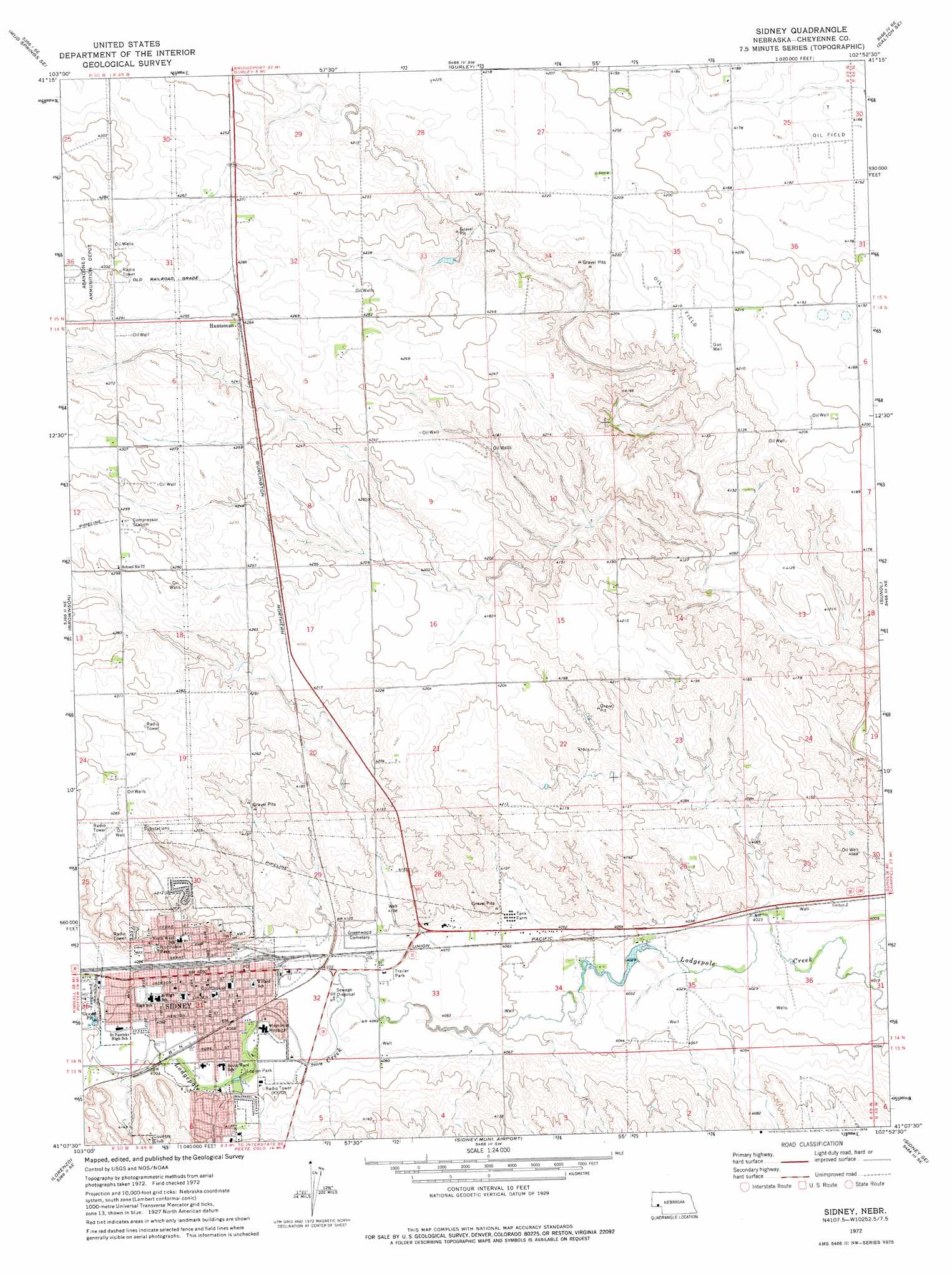
Sidney Topo Map Nebraska
To zoom in, hover over the map of Sidney
USGS Topo Quad 41102b8 - 1:24,000 scale
| Topo Map Name: | Sidney |
| USGS Topo Quad ID: | 41102b8 |
| Print Size: | ca. 21 1/4" wide x 27" high |
| Southeast Coordinates: | 41.125° N latitude / 102.875° W longitude |
| Map Center Coordinates: | 41.1875° N latitude / 102.9375° W longitude |
| U.S. State: | NE |
| Filename: | O41102B8.jpg |
| Download Map JPG Image: | Sidney topo map 1:24,000 scale |
| Map Type: | Topographic |
| Topo Series: | 7.5´ |
| Map Scale: | 1:24,000 |
| Source of Map Images: | United States Geological Survey (USGS) |
| Alternate Map Versions: |
Sidney NE 1972, updated 1976 Download PDF Buy paper map Sidney NE 2011 Download PDF Buy paper map Sidney NE 2014 Download PDF Buy paper map |
1:24,000 Topo Quads surrounding Sidney
Horsehead Ranch |
Mud Springs |
Dalton |
Fairchild Ranch |
Lisco Nw |
Mud Springs Sw |
Mud Springs Se |
Gurley |
Dalton Se |
Lisco Sw |
Point Of Rocks |
Brownson |
Sidney |
Sunol |
Lodgepole |
Easterly Airport |
Lorenzo |
Sidney Municipal Airport |
Sidney Se |
Lodgepole Sw |
Padroni Nw |
Peetz |
Haystack Butte |
Twin Buttes |
Julesburg Reservoir |
> Back to 41102a1 at 1:100,000 scale
> Back to 41102a1 at 1:250,000 scale
> Back to U.S. Topo Maps home
Sidney topo map: Gazetteer
Sidney: Dams
Blanke Dam elevation 1296m 4251′Peetz Dam elevation 1250m 4101′
Sidney East Dam elevation 1263m 4143′
Sidney West Dam elevation 1270m 4166′
Sidney: Parks
Fort Sidney Historical Marker elevation 1246m 4087′Legion Park elevation 1246m 4087′
Living Memorial Gardens elevation 1248m 4094′
Northside Park elevation 1250m 4101′
Sidney - Black Hills Trail Historical Marker elevation 1256m 4120′
Sidney: Populated Places
Conestoga Mobile Home Park elevation 1245m 4084′Gordons Mobile Plaza elevation 1248m 4094′
Huntsman elevation 1306m 4284′
Sidney elevation 1246m 4087′
Sidney: Post Offices
Huntsman Post Office (historical) elevation 1306m 4284′Sidney Post Office elevation 1246m 4087′
Sidney: Reservoirs
Blanke Reservoir elevation 1296m 4251′Peetz Reservoir elevation 1250m 4101′
Sidney East Reservoir elevation 1263m 4143′
Sidney West Reservoir elevation 1270m 4166′
Sidney: Trails
Sidney Deadwood Trail elevation 1246m 4087′Sidney digital topo map on disk
Buy this Sidney topo map showing relief, roads, GPS coordinates and other geographical features, as a high-resolution digital map file on DVD:
Eastern Wyoming & Western South Dakota
Buy digital topo maps: Eastern Wyoming & Western South Dakota