Coumbe Bluff Topo Map Nebraska
To zoom in, hover over the map of Coumbe Bluff
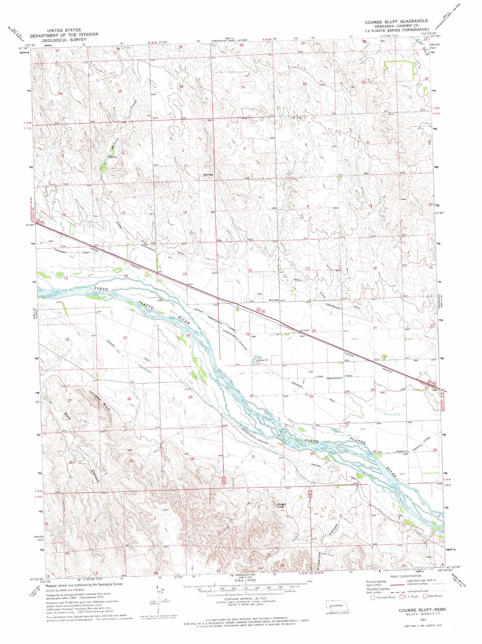
USGS Topo Quad 41102d4 - 1:24,000 scale
| Topo Map Name: | Coumbe Bluff |
| USGS Topo Quad ID: | 41102d4 |
| Print Size: | ca. 21 1/4" wide x 27" high |
| Southeast Coordinates: | 41.375° N latitude / 102.375° W longitude |
| Map Center Coordinates: | 41.4375° N latitude / 102.4375° W longitude |
| U.S. State: | NE |
| Filename: | O41102D4.jpg |
| Download Map JPG Image: | Coumbe Bluff topo map 1:24,000 scale |
| Map Type: | Topographic |
| Topo Series: | 7.5´ |
| Map Scale: | 1:24,000 |
| Source of Map Images: | United States Geological Survey (USGS) |
| Alternate Map Versions: |
Coumbe Bluff NE 1971, updated 1974 Download PDF Buy paper map Coumbe Bluff NE 2011 Download PDF Buy paper map Coumbe Bluff NE 2014 Download PDF Buy paper map |
1:24,000 Topo Quads surrounding Coumbe Bluff
Tar Valley |
Richardson Lake |
Crescent Lake |
Deer Lake |
Rackett |
Tar Valley Sw |
Buske Ranch |
Sugar Loaf Hill |
Crescent Lake Se |
Gusher Spring |
Lisco Nw |
Lisco |
Coumbe Bluff |
Oshkosh |
Twin Buttes |
Lisco Sw |
Lisco Se |
Oskosh Sw |
Barn Butte |
Lewellen |
Lodgepole |
Mount Vernon |
Chappell Nw |
Chappell Ne |
Big Springs Nw |
> Back to 41102a1 at 1:100,000 scale
> Back to 41102a1 at 1:250,000 scale
> Back to U.S. Topo Maps home
Coumbe Bluff topo map: Gazetteer
Coumbe Bluff: Canals
Lyons Canal elevation 1038m 3405′North River Canal elevation 1060m 3477′
Oshkosh Canal elevation 1036m 3398′
Spohn Canal elevation 1043m 3421′
Coumbe Bluff: Cliffs
Coumbe Bluff elevation 1091m 3579′Coumbe Bluff: Streams
Mutton Creek elevation 1049m 3441′Coumbe Bluff: Summits
Sugar Loaf elevation 1113m 3651′Coumbe Bluff: Valleys
Grapevine Canyon elevation 1042m 3418′Wolf Canyon elevation 1067m 3500′
Coumbe Bluff digital topo map on disk
Buy this Coumbe Bluff topo map showing relief, roads, GPS coordinates and other geographical features, as a high-resolution digital map file on DVD:
Eastern Wyoming & Western South Dakota
Buy digital topo maps: Eastern Wyoming & Western South Dakota