Potter Topo Map Nebraska
To zoom in, hover over the map of Potter
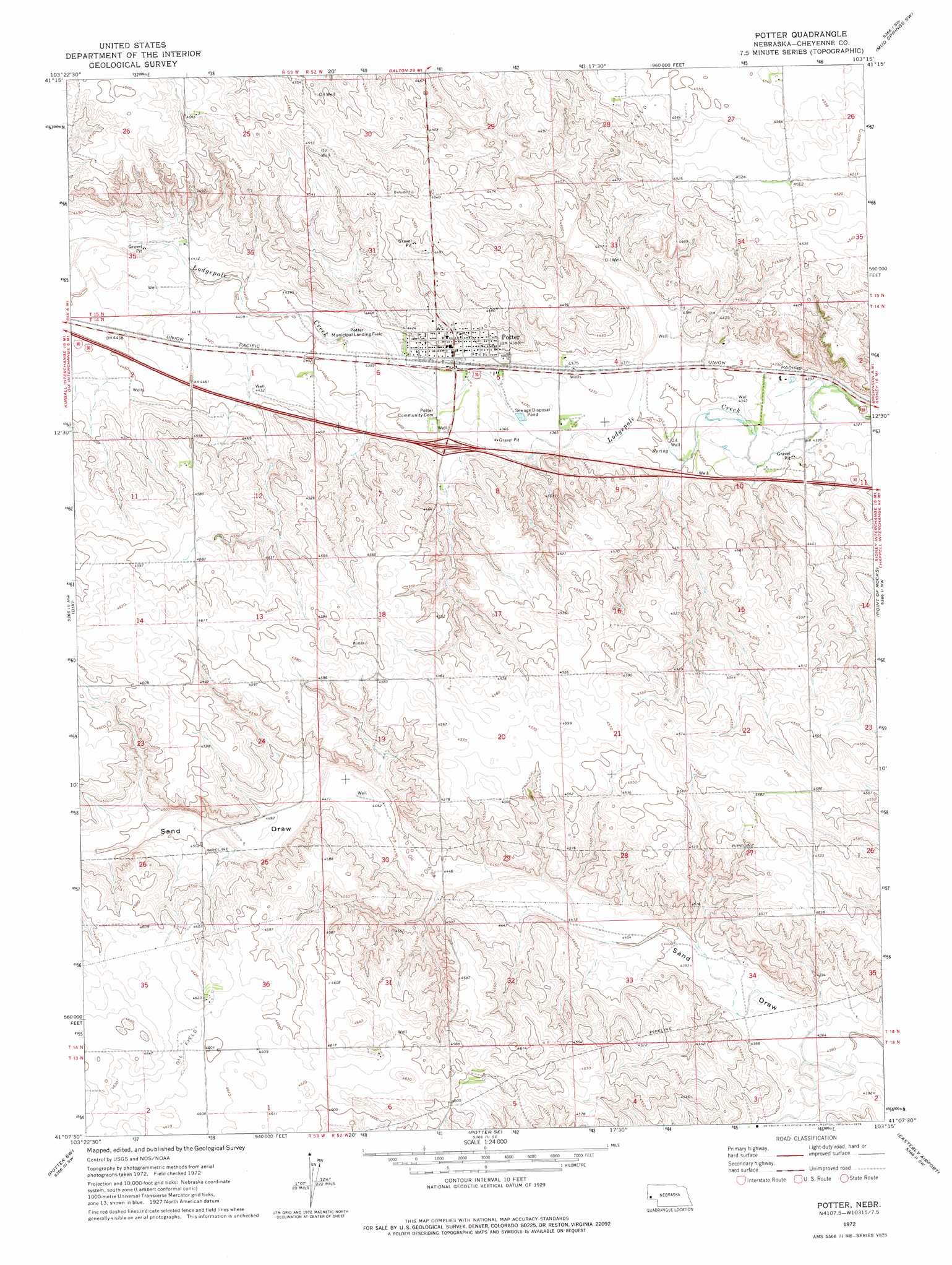
USGS Topo Quad 41103b3 - 1:24,000 scale
| Topo Map Name: | Potter |
| USGS Topo Quad ID: | 41103b3 |
| Print Size: | ca. 21 1/4" wide x 27" high |
| Southeast Coordinates: | 41.125° N latitude / 103.25° W longitude |
| Map Center Coordinates: | 41.1875° N latitude / 103.3125° W longitude |
| U.S. State: | NE |
| Filename: | O41103B3.jpg |
| Download Map JPG Image: | Potter topo map 1:24,000 scale |
| Map Type: | Topographic |
| Topo Series: | 7.5´ |
| Map Scale: | 1:24,000 |
| Source of Map Images: | United States Geological Survey (USGS) |
| Alternate Map Versions: |
Potter NE 1972, updated 1976 Download PDF Buy paper map Potter NE 2011 Download PDF Buy paper map Potter NE 2014 Download PDF Buy paper map |
1:24,000 Topo Quads surrounding Potter
Lone Pine Butte |
Singleton Ranch |
Potter 2 Ne |
Horsehead Ranch |
Mud Springs |
Bennett Reservoir East |
Potter 2 Sw |
Potter 2 Se |
Mud Springs Sw |
Mud Springs Se |
Owasco |
Dix |
Potter |
Point Of Rocks |
Brownson |
Kimball Se |
Potter Sw |
Potter Se |
Easterly Airport |
Lorenzo |
Dipper Spring |
Chimney Canyons |
Kirchnavy Butte |
Padroni Nw |
Peetz |
> Back to 41103a1 at 1:100,000 scale
> Back to 41102a1 at 1:250,000 scale
> Back to U.S. Topo Maps home
Potter topo map: Gazetteer
Potter: Crossings
Interchange 38 elevation 1343m 4406′Potter: Dams
Heimer Dam elevation 1360m 4461′Jung Dam elevation 1366m 4481′
Willoughby Dam elevation 1349m 4425′
Potter: Populated Places
Potter elevation 1341m 4399′Potter: Post Offices
Potter Post Office elevation 1341m 4399′Potter: Reservoirs
Heimer Reservoir elevation 1360m 4461′Jung Reservoir elevation 1366m 4481′
Willoughby Reservoir elevation 1349m 4425′
Potter digital topo map on disk
Buy this Potter topo map showing relief, roads, GPS coordinates and other geographical features, as a high-resolution digital map file on DVD:
Eastern Wyoming & Western South Dakota
Buy digital topo maps: Eastern Wyoming & Western South Dakota