Mud Springs Sw Topo Map Nebraska
To zoom in, hover over the map of Mud Springs Sw
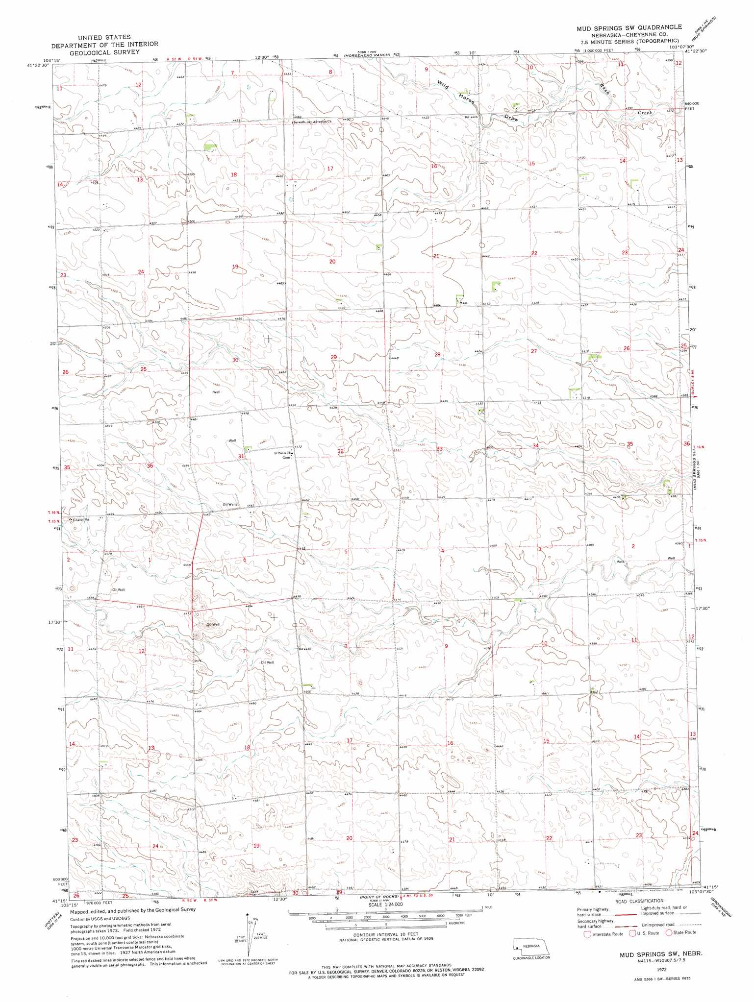
USGS Topo Quad 41103c2 - 1:24,000 scale
| Topo Map Name: | Mud Springs Sw |
| USGS Topo Quad ID: | 41103c2 |
| Print Size: | ca. 21 1/4" wide x 27" high |
| Southeast Coordinates: | 41.25° N latitude / 103.125° W longitude |
| Map Center Coordinates: | 41.3125° N latitude / 103.1875° W longitude |
| U.S. State: | NE |
| Filename: | O41103C2.jpg |
| Download Map JPG Image: | Mud Springs Sw topo map 1:24,000 scale |
| Map Type: | Topographic |
| Topo Series: | 7.5´ |
| Map Scale: | 1:24,000 |
| Source of Map Images: | United States Geological Survey (USGS) |
| Alternate Map Versions: |
Mud Springs SW NE 1972, updated 1975 Download PDF Buy paper map Mud Springs SW NE 2011 Download PDF Buy paper map Mud Springs SW NE 2014 Download PDF Buy paper map |
1:24,000 Topo Quads surrounding Mud Springs Sw
Hackberry Creek |
Redington |
Roundhouse Rock |
Courthouse Rock |
Broadwater Sw |
Singleton Ranch |
Potter 2 Ne |
Horsehead Ranch |
Mud Springs |
Dalton |
Potter 2 Sw |
Potter 2 Se |
Mud Springs Sw |
Mud Springs Se |
Gurley |
Dix |
Potter |
Point Of Rocks |
Brownson |
Sidney |
Potter Sw |
Potter Se |
Easterly Airport |
Lorenzo |
Sidney Municipal Airport |
> Back to 41103a1 at 1:100,000 scale
> Back to 41102a1 at 1:250,000 scale
> Back to U.S. Topo Maps home
Mud Springs Sw digital topo map on disk
Buy this Mud Springs Sw topo map showing relief, roads, GPS coordinates and other geographical features, as a high-resolution digital map file on DVD:
Eastern Wyoming & Western South Dakota
Buy digital topo maps: Eastern Wyoming & Western South Dakota