Murray Lake Topo Map Nebraska
To zoom in, hover over the map of Murray Lake
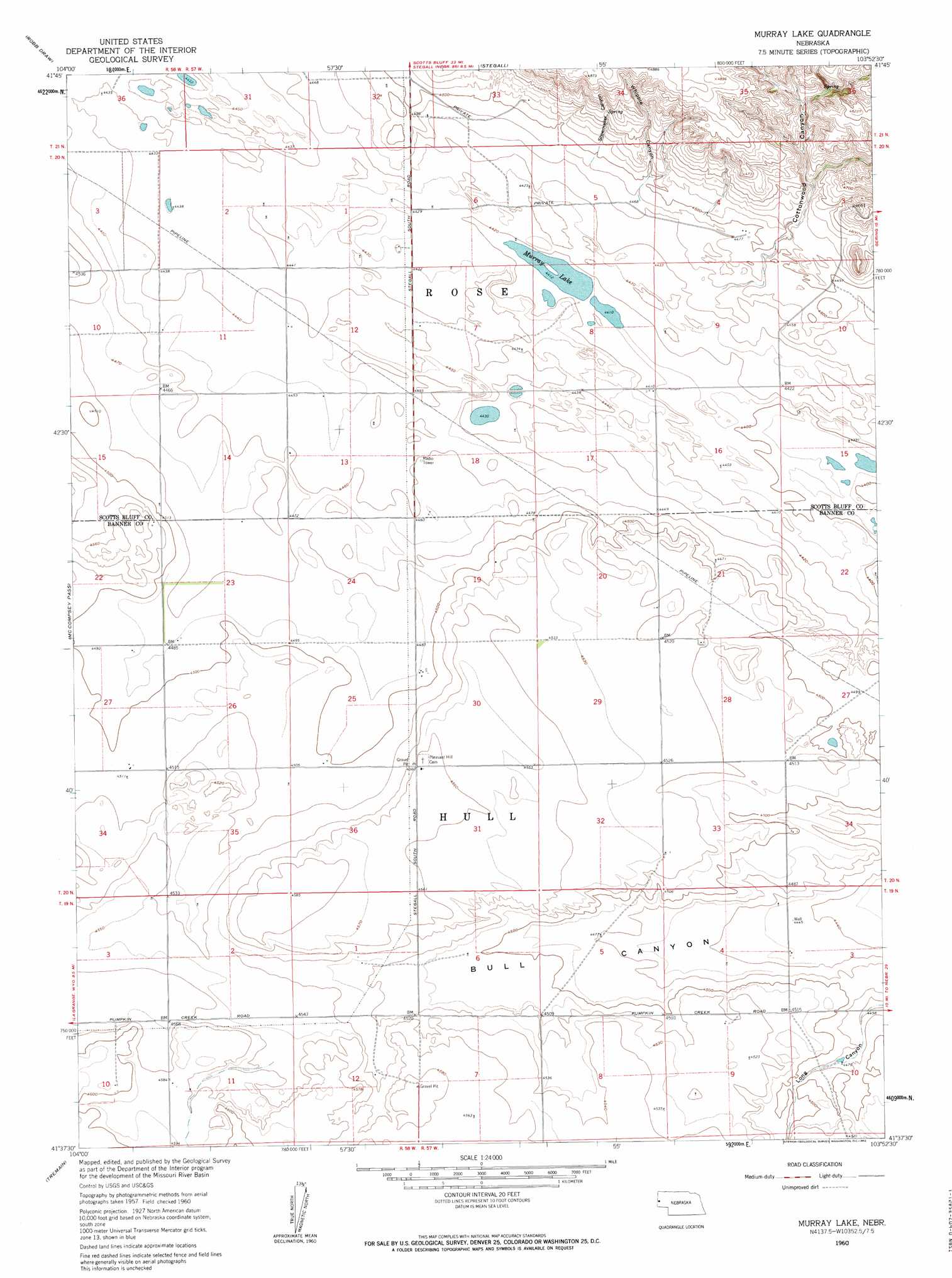
USGS Topo Quad 41103f8 - 1:24,000 scale
| Topo Map Name: | Murray Lake |
| USGS Topo Quad ID: | 41103f8 |
| Print Size: | ca. 21 1/4" wide x 27" high |
| Southeast Coordinates: | 41.625° N latitude / 103.875° W longitude |
| Map Center Coordinates: | 41.6875° N latitude / 103.9375° W longitude |
| U.S. State: | NE |
| Filename: | O41103F8.jpg |
| Download Map JPG Image: | Murray Lake topo map 1:24,000 scale |
| Map Type: | Topographic |
| Topo Series: | 7.5´ |
| Map Scale: | 1:24,000 |
| Source of Map Images: | United States Geological Survey (USGS) |
| Alternate Map Versions: |
Murray Lake NE 1960, updated 1962 Download PDF Buy paper map Murray Lake NE 1960, updated 1962 Download PDF Buy paper map Murray Lake NE 2011 Download PDF Buy paper map Murray Lake NE 2014 Download PDF Buy paper map |
1:24,000 Topo Quads surrounding Murray Lake
Huntley |
Lyman |
Morrill |
Mitchell |
Scottsbluff North |
Duroc |
Robb Draw |
Stegall |
Roubadeau Pass |
Scottsbluff South |
La Grange |
Mccompsey Pass |
Murray Lake |
Murray Lake Ne |
Wildcat Mountain |
Petsch Reservoir |
Tremain |
Murray Lake Sw |
Gabe Rock |
Harrisburg |
Gurney Peak |
Albin |
Kimball 2 Nw |
Kimball 2 Ne |
Bennett Reservoir Nw |
> Back to 41103e1 at 1:100,000 scale
> Back to 41102a1 at 1:250,000 scale
> Back to U.S. Topo Maps home
Murray Lake topo map: Gazetteer
Murray Lake: Lakes
Murray Lake elevation 1346m 4416′Murray Lake: Valleys
Bull Canyon elevation 1354m 4442′Cottonwood Canyon elevation 1373m 4504′
Shoemaker Canyon elevation 1369m 4491′
Whipple Canyon elevation 1374m 4507′
Murray Lake digital topo map on disk
Buy this Murray Lake topo map showing relief, roads, GPS coordinates and other geographical features, as a high-resolution digital map file on DVD:
Eastern Wyoming & Western South Dakota
Buy digital topo maps: Eastern Wyoming & Western South Dakota