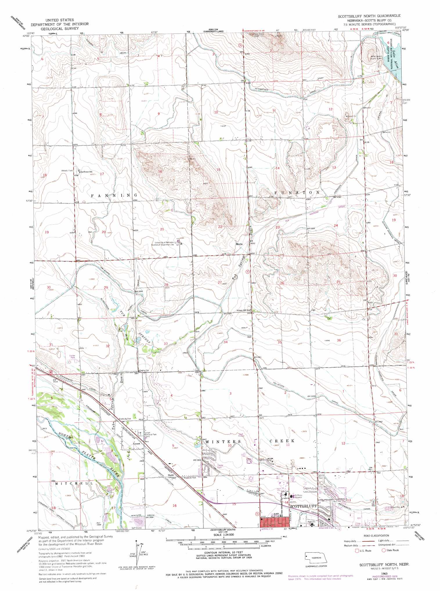
Scottsbluff North Topo Map Nebraska
To zoom in, hover over the map of Scottsbluff North
USGS Topo Quad 41103h6 - 1:24,000 scale
| Topo Map Name: | Scottsbluff North |
| USGS Topo Quad ID: | 41103h6 |
| Print Size: | ca. 21 1/4" wide x 27" high |
| Southeast Coordinates: | 41.875° N latitude / 103.625° W longitude |
| Map Center Coordinates: | 41.9375° N latitude / 103.6875° W longitude |
| U.S. State: | NE |
| Filename: | O41103H6.jpg |
| Download Map JPG Image: | Scottsbluff North topo map 1:24,000 scale |
| Map Type: | Topographic |
| Topo Series: | 7.5´ |
| Map Scale: | 1:24,000 |
| Source of Map Images: | United States Geological Survey (USGS) |
| Alternate Map Versions: |
Scottsbluff North NE 1963, updated 1965 Download PDF Buy paper map Scottsbluff North NE 1963, updated 1977 Download PDF Buy paper map Scottsbluff North NE 2011 Download PDF Buy paper map Scottsbluff North NE 2014 Download PDF Buy paper map |
1:24,000 Topo Quads surrounding Scottsbluff North
Chalk Buttes |
Chalk Buttes Ne |
University Lake Nw |
University Lake Ne |
Kilpatrick Lake Nw |
Dry Sheep Creek |
Erdman Ranch |
University Lake |
University Lake Se |
Kilpatrick Lake Sw |
Morrill |
Mitchell |
Scottsbluff North |
Lake Alice |
Lake Minatare |
Stegall |
Roubadeau Pass |
Scottsbluff South |
Minatare |
Bayard Sw |
Murray Lake |
Murray Lake Ne |
Wildcat Mountain |
Wright Gap |
Mcgrew |
> Back to 41103e1 at 1:100,000 scale
> Back to 41102a1 at 1:250,000 scale
> Back to U.S. Topo Maps home
Scottsbluff North topo map: Gazetteer
Scottsbluff North: Airports
Reisig Brothers Airport elevation 1210m 3969′Scottsbluff North: Canals
Enterprise Canal elevation 1198m 3930′Hiersche Drain elevation 1250m 4101′
Lateral 24 elevation 1275m 4183′
Perry Drain elevation 1219m 3999′
Scottsbluff Drain elevation 1188m 3897′
Sunflower Drain elevation 1208m 3963′
Tub Springs Drain elevation 1219m 3999′
Scottsbluff North: Dams
Lake Alice Upper Dam elevation 1270m 4166′Scottsbluff North: Parks
Babe Ruth Baseball Field elevation 1185m 3887′Frank Park elevation 1186m 3891′
Northwood Park elevation 1187m 3894′
Splash Arena elevation 1185m 3887′
Terry Carpenter Park and Recreation Area elevation 1185m 3887′
Twenty-three Club Baseball Fields elevation 1186m 3891′
Scottsbluff North: Populated Places
Covert elevation 1193m 3914′Heldt elevation 1190m 3904′
Mintle elevation 1231m 4038′
Northside Mobile Home Ranch elevation 1199m 3933′
Scottsbluff North: Reservoirs
Lake Alice elevation 1270m 4166′Scottsbluff North: Springs
Tub Springs elevation 1208m 3963′Scottsbluff North digital topo map on disk
Buy this Scottsbluff North topo map showing relief, roads, GPS coordinates and other geographical features, as a high-resolution digital map file on DVD:
Eastern Wyoming & Western South Dakota
Buy digital topo maps: Eastern Wyoming & Western South Dakota