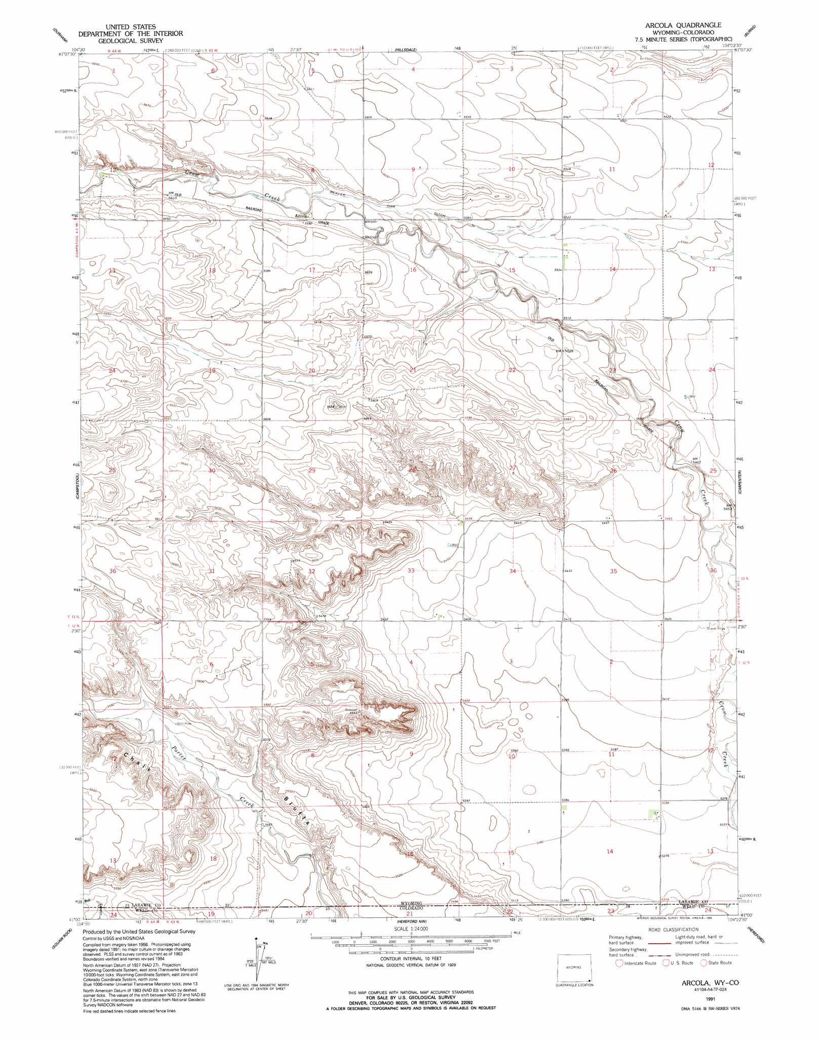
Arcola Topo Map Wyoming
To zoom in, hover over the map of Arcola
USGS Topo Quad 41104a4 - 1:24,000 scale
| Topo Map Name: | Arcola |
| USGS Topo Quad ID: | 41104a4 |
| Print Size: | ca. 21 1/4" wide x 27" high |
| Southeast Coordinates: | 41° N latitude / 104.375° W longitude |
| Map Center Coordinates: | 41.0625° N latitude / 104.4375° W longitude |
| U.S. States: | WY, CO |
| Filename: | o41104a4.jpg |
| Download Map JPG Image: | Arcola topo map 1:24,000 scale |
| Map Type: | Topographic |
| Topo Series: | 7.5´ |
| Map Scale: | 1:24,000 |
| Source of Map Images: | United States Geological Survey (USGS) |
| Alternate Map Versions: |
Arcola WY 1963, updated 1967 Download PDF Buy paper map Arcola WY 1991, updated 1995 Download PDF Buy paper map Arcola WY 2010 Download PDF Buy paper map Arcola WY 2012 Download PDF Buy paper map Arcola WY 2015 Download PDF Buy paper map |
1:24,000 Topo Quads surrounding Arcola
Pole Creek Ranch |
Pole Creek Ranch Se |
Midway Sw |
Midway Se |
Albin Sw |
Archer |
Durham |
Hillsdale |
Burns |
Tracy |
Altvan |
Campstool |
Arcola |
Carpenter |
Pine Bluffs Sw |
Eastman Creek North |
Squaw Rock |
Hereford Nw |
Hereford |
Grover North |
Eastman Creek South |
Eastman Creek Se |
Reno Reservoir |
Hereford Se |
Grover South |
> Back to 41104a1 at 1:100,000 scale
> Back to 41104a1 at 1:250,000 scale
> Back to U.S. Topo Maps home
Arcola topo map: Gazetteer
Arcola: Canals
Beaver Dam Ditch elevation 1698m 5570′Arcola: Dams
Beaver Dam elevation 1680m 5511′Arcola: Populated Places
Arcola elevation 1702m 5583′Arcola: Reservoirs
Beaver Dam Reservoir elevation 1680m 5511′Arcola: Streams
Geary Creek elevation 1681m 5515′Arcola digital topo map on disk
Buy this Arcola topo map showing relief, roads, GPS coordinates and other geographical features, as a high-resolution digital map file on DVD:
Eastern Wyoming & Western South Dakota
Buy digital topo maps: Eastern Wyoming & Western South Dakota