La Grange Topo Map Wyoming
To zoom in, hover over the map of La Grange
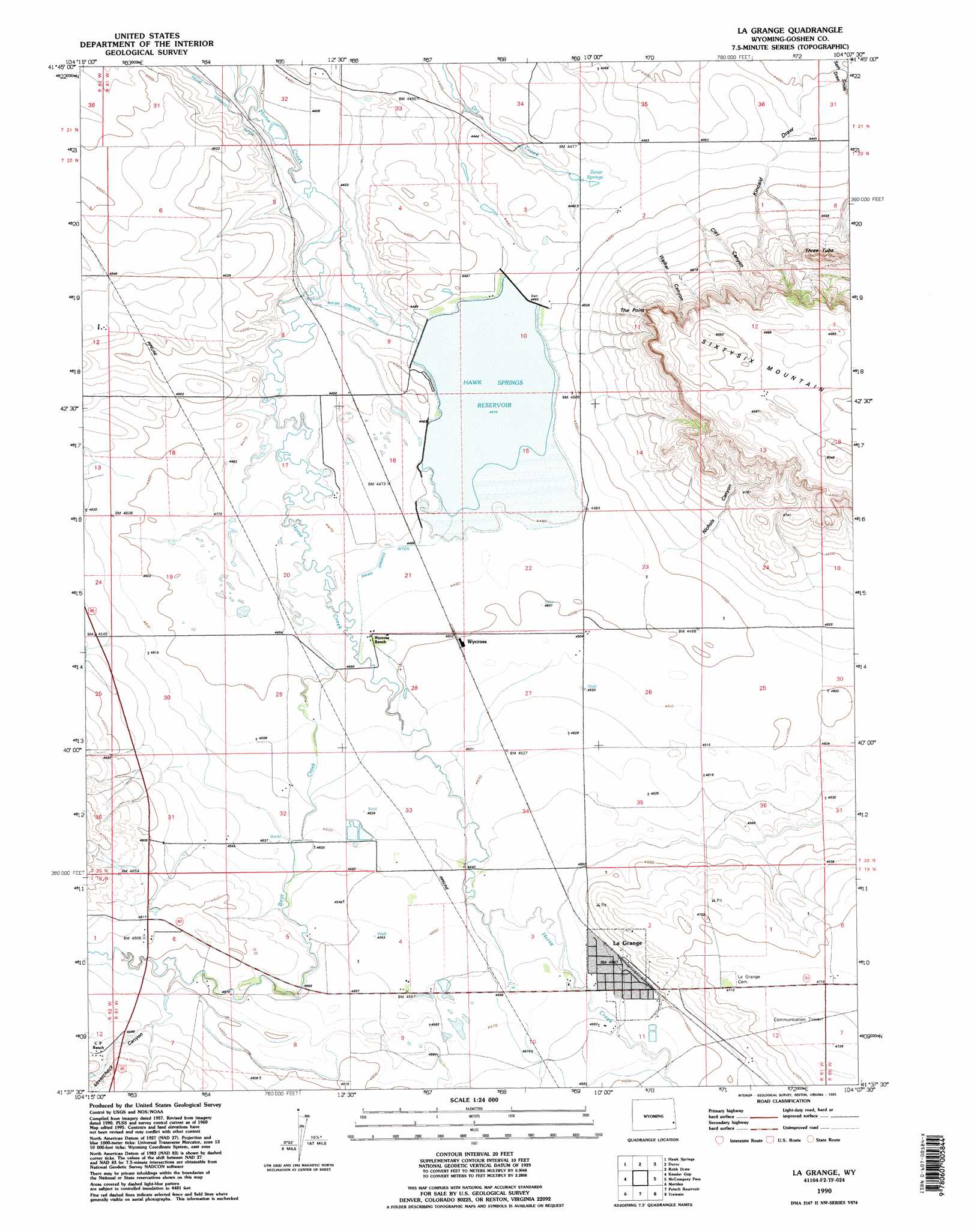
USGS Topo Quad 41104f2 - 1:24,000 scale
| Topo Map Name: | La Grange |
| USGS Topo Quad ID: | 41104f2 |
| Print Size: | ca. 21 1/4" wide x 27" high |
| Southeast Coordinates: | 41.625° N latitude / 104.125° W longitude |
| Map Center Coordinates: | 41.6875° N latitude / 104.1875° W longitude |
| U.S. State: | WY |
| Filename: | o41104f2.jpg |
| Download Map JPG Image: | La Grange topo map 1:24,000 scale |
| Map Type: | Topographic |
| Topo Series: | 7.5´ |
| Map Scale: | 1:24,000 |
| Source of Map Images: | United States Geological Survey (USGS) |
| Alternate Map Versions: |
La Grange WY 1960, updated 1962 Download PDF Buy paper map La Grange WY 1960, updated 1993 Download PDF Buy paper map La Grange WY 1990, updated 1995 Download PDF Buy paper map La Grange WY 2012 Download PDF Buy paper map La Grange WY 2015 Download PDF Buy paper map |
1:24,000 Topo Quads surrounding La Grange
Veteran |
Yoder |
Huntley |
Lyman |
Morrill |
Needle Rock |
Hawk Springs |
Duroc |
Robb Draw |
Stegall |
Diamond Flat |
Kessler Gap |
La Grange |
Mccompsey Pass |
Murray Lake |
Rocky Hollow |
Meriden |
Petsch Reservoir |
Tremain |
Murray Lake Sw |
Midway |
Round Top |
Gurney Peak |
Albin |
Kimball 2 Nw |
> Back to 41104e1 at 1:100,000 scale
> Back to 41104a1 at 1:250,000 scale
> Back to U.S. Topo Maps home
La Grange topo map: Gazetteer
La Grange: Canals
Wycross Ditch elevation 1375m 4511′La Grange: Cliffs
The Point elevation 1515m 4970′La Grange: Dams
Hawk Springs Dam Number 1 elevation 1365m 4478′La Grange: Populated Places
La Grange elevation 1399m 4589′Wycross elevation 1372m 4501′
La Grange: Reservoirs
Hawk Springs Reservoir elevation 1365m 4478′Hawk Springs Reservoir elevation 1365m 4478′
La Grange: Springs
Zenar Springs elevation 1357m 4452′La Grange: Streams
Bear Creek elevation 1363m 4471′La Grange: Summits
Three Tubs elevation 1503m 4931′La Grange: Valleys
Boxelder Spring Draw elevation 1389m 4557′Clay Canyon elevation 1372m 4501′
Kincaid Draw elevation 1341m 4399′
Nichols Canyon elevation 1377m 4517′
Walker Canyon elevation 1379m 4524′
La Grange digital topo map on disk
Buy this La Grange topo map showing relief, roads, GPS coordinates and other geographical features, as a high-resolution digital map file on DVD:
Eastern Wyoming & Western South Dakota
Buy digital topo maps: Eastern Wyoming & Western South Dakota