Johnson Ranch Topo Map Wyoming
To zoom in, hover over the map of Johnson Ranch
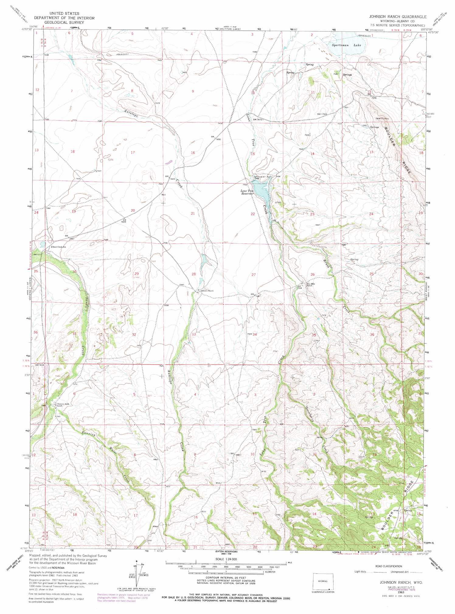
USGS Topo Quad 41105a6 - 1:24,000 scale
| Topo Map Name: | Johnson Ranch |
| USGS Topo Quad ID: | 41105a6 |
| Print Size: | ca. 21 1/4" wide x 27" high |
| Southeast Coordinates: | 41° N latitude / 105.625° W longitude |
| Map Center Coordinates: | 41.0625° N latitude / 105.6875° W longitude |
| U.S. State: | WY |
| Filename: | o41105a6.jpg |
| Download Map JPG Image: | Johnson Ranch topo map 1:24,000 scale |
| Map Type: | Topographic |
| Topo Series: | 7.5´ |
| Map Scale: | 1:24,000 |
| Source of Map Images: | United States Geological Survey (USGS) |
| Alternate Map Versions: |
Johnson Ranch WY 1963, updated 1965 Download PDF Buy paper map Johnson Ranch WY 1963, updated 1975 Download PDF Buy paper map Johnson Ranch WY 1963, updated 1978 Download PDF Buy paper map Johnson Ranch WY 2012 Download PDF Buy paper map Johnson Ranch WY 2015 Download PDF Buy paper map |
1:24,000 Topo Quads surrounding Johnson Ranch
Millbrook |
La Marsh Creek West |
Laramie Sw |
Laramie |
Pilot Hill |
Sodergreen Lake |
Caldwell Lake |
Hutton Lake |
Red Buttes |
Sherman Mountains West |
Jelm Mountain |
Downey Lakes |
Johnson Ranch |
Best Ranch |
Dale Creek |
Crazy Mountain |
Sand Creek Pass |
Eaton Reservoir |
Diamond Peak |
Cherokee Park |
Glendevey |
Deadman |
South Bald Mountain |
Red Feather Lakes |
Haystack Gulch |
> Back to 41105a1 at 1:100,000 scale
> Back to 41104a1 at 1:250,000 scale
> Back to U.S. Topo Maps home
Johnson Ranch topo map: Gazetteer
Johnson Ranch: Dams
Lone Tree Dam elevation 2282m 7486′Johnson Ranch: Lakes
Sportsman Lake elevation 2243m 7358′Johnson Ranch: Reservoirs
Lone Tree Reservoir elevation 2283m 7490′Johnson Ranch: Streams
Antelope Creek elevation 2312m 7585′Brush Creek elevation 2284m 7493′
Gooseberry Creek elevation 2364m 7755′
Lone Tree Creek elevation 2339m 7673′
Running Water Creek elevation 2271m 7450′
Running Water Creek elevation 2271m 7450′
Johnson Ranch digital topo map on disk
Buy this Johnson Ranch topo map showing relief, roads, GPS coordinates and other geographical features, as a high-resolution digital map file on DVD:
Eastern Wyoming & Western South Dakota
Buy digital topo maps: Eastern Wyoming & Western South Dakota