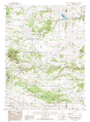
Sherman Mountains East Topo Map Wyoming
To zoom in, hover over the map of Sherman Mountains East
USGS Topo Quad 41105b3 - 1:24,000 scale
| Topo Map Name: | Sherman Mountains East |
| USGS Topo Quad ID: | 41105b3 |
| Print Size: | ca. 21 1/4" wide x 27" high |
| Southeast Coordinates: | 41.125° N latitude / 105.25° W longitude |
| Map Center Coordinates: | 41.1875° N latitude / 105.3125° W longitude |
| U.S. State: | WY |
| Filename: | o41105b3.jpg |
| Download Map JPG Image: | Sherman Mountains East topo map 1:24,000 scale |
| Map Type: | Topographic |
| Topo Series: | 7.5´ |
| Map Scale: | 1:24,000 |
| Source of Map Images: | United States Geological Survey (USGS) |
| Alternate Map Versions: |
Sherman Mountains East WY 1987, updated 1987 Download PDF Buy paper map Sherman Mountains East WY 1987, updated 1995 Download PDF Buy paper map Sherman Mountains East WY 1992, updated 1996 Download PDF Buy paper map Sherman Mountains East WY 1992, updated 1996 Download PDF Buy paper map Sherman Mountains East WY 2012 Download PDF Buy paper map Sherman Mountains East WY 2015 Download PDF Buy paper map |
| FStopo: | US Forest Service topo Sherman Mountains East is available: Download FStopo PDF Download FStopo TIF |
1:24,000 Topo Quads surrounding Sherman Mountains East
> Back to 41105a1 at 1:100,000 scale
> Back to 41104a1 at 1:250,000 scale
> Back to U.S. Topo Maps home
Sherman Mountains East topo map: Gazetteer
Sherman Mountains East: Dams
Upper Van Tassell Dam elevation 2294m 7526′Sherman Mountains East: Mines
Monte Cristo Mine elevation 2300m 7545′Sherman Mountains East: Parks
Devils Playground elevation 2406m 7893′Sherman Mountains East: Populated Places
Hirsig elevation 2369m 7772′Sherman Mountains East: Reservoirs
Upper North Crow Reservoir elevation 2287m 7503′Upper Van Tassell Reservoir elevation 2294m 7526′
Sherman Mountains East: Ridges
Van Horn Ridge elevation 2392m 7847′Sherman Mountains East: Streams
North Branch Crow Creek elevation 2288m 7506′South Branch Crow Creek elevation 2297m 7536′
Sherman Mountains East: Summits
Egbert Hill elevation 2584m 8477′Green Mountain elevation 2577m 8454′
Reynolds Hill elevation 2461m 8074′
Twin Mountain elevation 2632m 8635′
Sherman Mountains East: Trails
Brady Rock Trail elevation 2487m 8159′Buford Trail elevation 2440m 8005′
Lattas Ranch Trail elevation 2389m 7837′
Sherman Mountains East digital topo map on disk
Buy this Sherman Mountains East topo map showing relief, roads, GPS coordinates and other geographical features, as a high-resolution digital map file on DVD:
Eastern Wyoming & Western South Dakota
Buy digital topo maps: Eastern Wyoming & Western South Dakota


