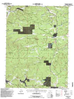
Foxpark Topo Map Wyoming
To zoom in, hover over the map of Foxpark
USGS Topo Quad 41106a2 - 1:24,000 scale
| Topo Map Name: | Foxpark |
| USGS Topo Quad ID: | 41106a2 |
| Print Size: | ca. 21 1/4" wide x 27" high |
| Southeast Coordinates: | 41° N latitude / 106.125° W longitude |
| Map Center Coordinates: | 41.0625° N latitude / 106.1875° W longitude |
| U.S. State: | WY |
| Filename: | o41106a2.jpg |
| Download Map JPG Image: | Foxpark topo map 1:24,000 scale |
| Map Type: | Topographic |
| Topo Series: | 7.5´ |
| Map Scale: | 1:24,000 |
| Source of Map Images: | United States Geological Survey (USGS) |
| Alternate Map Versions: |
Foxpark WY 1961, updated 1963 Download PDF Buy paper map Foxpark WY 1961, updated 1967 Download PDF Buy paper map Foxpark WY 1961, updated 1984 Download PDF Buy paper map Foxpark WY 1992, updated 1996 Download PDF Buy paper map Foxpark WY 1992, updated 1996 Download PDF Buy paper map Foxpark WY 2012 Download PDF Buy paper map Foxpark WY 2015 Download PDF Buy paper map |
| FStopo: | US Forest Service topo Foxpark is available: Download FStopo PDF Download FStopo TIF |
1:24,000 Topo Quads surrounding Foxpark
> Back to 41106a1 at 1:100,000 scale
> Back to 41106a1 at 1:250,000 scale
> Back to U.S. Topo Maps home
Foxpark topo map: Gazetteer
Foxpark: Flats
Grindstone Park elevation 2757m 9045′Hay Park elevation 2773m 9097′
Foxpark: Lakes
Miller Lake elevation 2761m 9058′Foxpark: Mines
American Mine elevation 2679m 8789′Dell Mine elevation 2591m 8500′
Desert Rose Mine elevation 2726m 8943′
Ione Prospect elevation 2787m 9143′
Kansas Group - Keystone Holmes Area Mine elevation 2736m 8976′
Keystone Mine elevation 2622m 8602′
Lake Creek Mines elevation 2665m 8743′
Maudem Group Mine elevation 2630m 8628′
Muscovite Claim Mine elevation 2793m 9163′
Foxpark: Populated Places
Collins (historical) elevation 2727m 8946′Foxpark elevation 2762m 9061′
Gramm elevation 2723m 8933′
Mountain Home elevation 2673m 8769′
Wyocolo elevation 2674m 8772′
Foxpark: Post Offices
Gramm Post Office (historical) elevation 2723m 8933′Foxpark: Streams
Badger Creek elevation 2598m 8523′Collins Creek elevation 2671m 8763′
Evans Creek elevation 2744m 9002′
Heidrich Creek elevation 2639m 8658′
Lake Creek elevation 2589m 8494′
Muddy Creek elevation 2594m 8510′
North Fork elevation 2630m 8628′
North Fork Pelton Creek elevation 2630m 8628′
Park Run elevation 2653m 8704′
Smith North Creek elevation 2591m 8500′
Foxpark: Summits
Douglas Point elevation 2820m 9251′Somber Hill elevation 2861m 9386′
Foxpark: Valleys
Lincoln Gulch elevation 2671m 8763′Foxpark digital topo map on disk
Buy this Foxpark topo map showing relief, roads, GPS coordinates and other geographical features, as a high-resolution digital map file on DVD:
Eastern Wyoming & Western South Dakota
Buy digital topo maps: Eastern Wyoming & Western South Dakota


