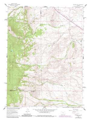
Strouss Hill Topo Map Wyoming
To zoom in, hover over the map of Strouss Hill
USGS Topo Quad 41106d1 - 1:24,000 scale
| Topo Map Name: | Strouss Hill |
| USGS Topo Quad ID: | 41106d1 |
| Print Size: | ca. 21 1/4" wide x 27" high |
| Southeast Coordinates: | 41.375° N latitude / 106° W longitude |
| Map Center Coordinates: | 41.4375° N latitude / 106.0625° W longitude |
| U.S. State: | WY |
| Filename: | o41106d1.jpg |
| Download Map JPG Image: | Strouss Hill topo map 1:24,000 scale |
| Map Type: | Topographic |
| Topo Series: | 7.5´ |
| Map Scale: | 1:24,000 |
| Source of Map Images: | United States Geological Survey (USGS) |
| Alternate Map Versions: |
Strouss Hill WY 1961, updated 1963 Download PDF Buy paper map Strouss Hill WY 1961, updated 1972 Download PDF Buy paper map Strouss Hill WY 1961, updated 1984 Download PDF Buy paper map Strouss Hill WY 1992, updated 1996 Download PDF Buy paper map Strouss Hill WY 2012 Download PDF Buy paper map Strouss Hill WY 2015 Download PDF Buy paper map |
| FStopo: | US Forest Service topo Strouss Hill is available: Download FStopo PDF Download FStopo TIF |
1:24,000 Topo Quads surrounding Strouss Hill
> Back to 41106a1 at 1:100,000 scale
> Back to 41106a1 at 1:250,000 scale
> Back to U.S. Topo Maps home
Strouss Hill topo map: Gazetteer
Strouss Hill: Canals
Straus Ditch Number 2 elevation 2315m 7595′Strouss Hill: Lakes
Lost Lake elevation 2815m 9235′Strouss Hill: Mines
Monolith Portland Midwest Company Mine elevation 2307m 7568′Strouss Hill: Streams
Middle Fork Mill Creek elevation 2308m 7572′Nellis Creek elevation 2304m 7559′
North Fork Mill Creek elevation 2274m 7460′
Onemile Creek elevation 2323m 7621′
South Fork Mill Creek elevation 2308m 7572′
Strouss Hill: Summits
Bunker Hill elevation 2672m 8766′Coyote Hill elevation 2796m 9173′
Strouss Hill elevation 2453m 8047′
Strouss Hill: Trails
Overland Trail elevation 2335m 7660′Strouss Hill digital topo map on disk
Buy this Strouss Hill topo map showing relief, roads, GPS coordinates and other geographical features, as a high-resolution digital map file on DVD:
Eastern Wyoming & Western South Dakota
Buy digital topo maps: Eastern Wyoming & Western South Dakota


