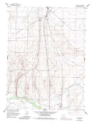
Overland Topo Map Wyoming
To zoom in, hover over the map of Overland
USGS Topo Quad 41106e7 - 1:24,000 scale
| Topo Map Name: | Overland |
| USGS Topo Quad ID: | 41106e7 |
| Print Size: | ca. 21 1/4" wide x 27" high |
| Southeast Coordinates: | 41.5° N latitude / 106.75° W longitude |
| Map Center Coordinates: | 41.5625° N latitude / 106.8125° W longitude |
| U.S. State: | WY |
| Filename: | o41106e7.jpg |
| Download Map JPG Image: | Overland topo map 1:24,000 scale |
| Map Type: | Topographic |
| Topo Series: | 7.5´ |
| Map Scale: | 1:24,000 |
| Source of Map Images: | United States Geological Survey (USGS) |
| Alternate Map Versions: |
Overland WY 1955, updated 1957 Download PDF Buy paper map Overland WY 1955, updated 1957 Download PDF Buy paper map Overland WY 1955, updated 1983 Download PDF Buy paper map Overland WY 2012 Download PDF Buy paper map Overland WY 2015 Download PDF Buy paper map |
1:24,000 Topo Quads surrounding Overland
> Back to 41106e1 at 1:100,000 scale
> Back to 41106a1 at 1:250,000 scale
> Back to U.S. Topo Maps home
Overland topo map: Gazetteer
Overland: Canals
Pick Ditch elevation 2061m 6761′Overland: Flats
Hay Meadows elevation 2054m 6738′Overland: Lakes
Lake Creek Lake elevation 2073m 6801′Overland: Mines
Brook Deposit elevation 2082m 6830′Six Mile Hill Mine elevation 2113m 6932′
Overland: Streams
Jack Creek elevation 2049m 6722′Overland: Summits
Sheep Rock elevation 2188m 7178′Sixmile Hill elevation 2146m 7040′
Overland: Valleys
McPhail Draw elevation 2049m 6722′McPhail Draw elevation 2049m 6722′
Overland digital topo map on disk
Buy this Overland topo map showing relief, roads, GPS coordinates and other geographical features, as a high-resolution digital map file on DVD:
Eastern Wyoming & Western South Dakota
Buy digital topo maps: Eastern Wyoming & Western South Dakota


