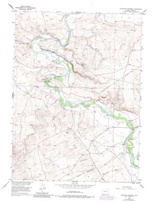
Overland Crossing Topo Map Wyoming
To zoom in, hover over the map of Overland Crossing
USGS Topo Quad 41106e8 - 1:24,000 scale
| Topo Map Name: | Overland Crossing |
| USGS Topo Quad ID: | 41106e8 |
| Print Size: | ca. 21 1/4" wide x 27" high |
| Southeast Coordinates: | 41.5° N latitude / 106.875° W longitude |
| Map Center Coordinates: | 41.5625° N latitude / 106.9375° W longitude |
| U.S. State: | WY |
| Filename: | o41106e8.jpg |
| Download Map JPG Image: | Overland Crossing topo map 1:24,000 scale |
| Map Type: | Topographic |
| Topo Series: | 7.5´ |
| Map Scale: | 1:24,000 |
| Source of Map Images: | United States Geological Survey (USGS) |
| Alternate Map Versions: |
Overland Crossing WY 1955, updated 1957 Download PDF Buy paper map Overland Crossing WY 1955, updated 1973 Download PDF Buy paper map Overland Crossing WY 1955, updated 1983 Download PDF Buy paper map Overland Crossing WY 2012 Download PDF Buy paper map Overland Crossing WY 2015 Download PDF Buy paper map |
1:24,000 Topo Quads surrounding Overland Crossing
> Back to 41106e1 at 1:100,000 scale
> Back to 41106a1 at 1:250,000 scale
> Back to U.S. Topo Maps home
Overland Crossing topo map: Gazetteer
Overland Crossing: Bridges
Pick Bridge elevation 2038m 6686′Overland Crossing: Flats
Kent Meadows elevation 2023m 6637′McKeal Meadows elevation 2021m 6630′
Overland Crossing: Islands
Johnson Island elevation 2024m 6640′Overland Crossing: Levees
Coal Banks elevation 2052m 6732′Overland Crossing: Mines
Everist Mine elevation 2038m 6686′Larsen Mine elevation 2058m 6751′
McKeal Mine elevation 2038m 6686′
Moomaw Everist Mine elevation 2049m 6722′
Peck Mine elevation 2069m 6788′
Petty Mine elevation 2107m 6912′
Phillips Mine elevation 2195m 7201′
Ream and Ramsey Mine elevation 2137m 7011′
Seahorn Mine elevation 2143m 7030′
Overland Crossing: Populated Places
Old Haymaker Place elevation 2044m 6706′Old McKeal Place elevation 2018m 6620′
Overland Crossing: Streams
Sage Creek elevation 2016m 6614′Overland Crossing: Valleys
Blydenburg Draw elevation 2051m 6729′Coal Mine Draw elevation 2015m 6610′
Coal Mine Draw elevation 2053m 6735′
First Cottonwood Draw elevation 2052m 6732′
Overland Crossing digital topo map on disk
Buy this Overland Crossing topo map showing relief, roads, GPS coordinates and other geographical features, as a high-resolution digital map file on DVD:
Eastern Wyoming & Western South Dakota
Buy digital topo maps: Eastern Wyoming & Western South Dakota


