Pine Ridge Topo Map Wyoming
To zoom in, hover over the map of Pine Ridge
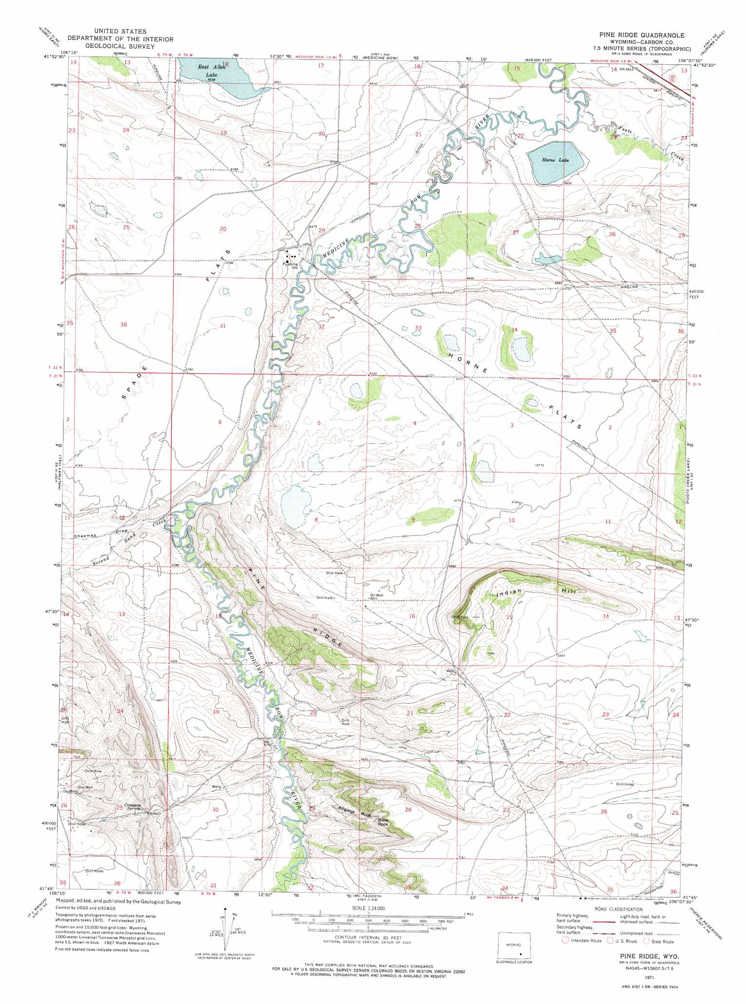
USGS Topo Quad 41106g2 - 1:24,000 scale
| Topo Map Name: | Pine Ridge |
| USGS Topo Quad ID: | 41106g2 |
| Print Size: | ca. 21 1/4" wide x 27" high |
| Southeast Coordinates: | 41.75° N latitude / 106.125° W longitude |
| Map Center Coordinates: | 41.8125° N latitude / 106.1875° W longitude |
| U.S. State: | WY |
| Filename: | o41106g2.jpg |
| Download Map JPG Image: | Pine Ridge topo map 1:24,000 scale |
| Map Type: | Topographic |
| Topo Series: | 7.5´ |
| Map Scale: | 1:24,000 |
| Source of Map Images: | United States Geological Survey (USGS) |
| Alternate Map Versions: |
Pine Ridge WY 1971, updated 1975 Download PDF Buy paper map Pine Ridge WY 2012 Download PDF Buy paper map Pine Ridge WY 2015 Download PDF Buy paper map |
1:24,000 Topo Quads surrounding Pine Ridge
Difficulty |
Windy Hill |
T B Ranch |
Walker Draw Se |
Greasewood Knoll |
Como West |
Como East |
Medicine Bow |
Aurora Lake |
Pine Tree Ridge |
Carbon |
Halfway Hill |
Pine Ridge |
Foote Creek Lake |
Wilcox |
Elk Mountain |
T L Ranch |
Mcfadden |
Pierce Reservoir |
Rock River |
Elk Mountain Sw |
White Rock Canyon |
Arlington |
Bengough Hill |
Big Judson |
> Back to 41106e1 at 1:100,000 scale
> Back to 41106a1 at 1:250,000 scale
> Back to U.S. Topo Maps home
Pine Ridge topo map: Gazetteer
Pine Ridge: Canals
Thornton Ditch elevation 2147m 7043′Pine Ridge: Dams
Chace Number 1 Dam elevation 2030m 6660′Pine Ridge: Flats
Horne Flats elevation 2067m 6781′Spade Flats elevation 2055m 6742′
Pine Ridge: Lakes
East Allen Lake elevation 1994m 6541′Horne Lake elevation 2010m 6594′
Pine Ridge: Reservoirs
Chace Number 1 Reservoir elevation 2030m 6660′Pine Ridge: Ridges
Pine Ridge elevation 2178m 7145′Pine Ridge: Springs
Cronberg Spring elevation 2142m 7027′Pine Ridge: Streams
Foote Creek elevation 2007m 6584′Second Sand Creek elevation 2041m 6696′
Pine Ridge: Summits
Alligator Rock elevation 2127m 6978′Bible Rock elevation 2170m 7119′
Indian Hill elevation 2204m 7230′
Pine Ridge: Valleys
Chapman Draw elevation 2046m 6712′Pine Ridge digital topo map on disk
Buy this Pine Ridge topo map showing relief, roads, GPS coordinates and other geographical features, as a high-resolution digital map file on DVD:
Eastern Wyoming & Western South Dakota
Buy digital topo maps: Eastern Wyoming & Western South Dakota