Halfway Hill Topo Map Wyoming
To zoom in, hover over the map of Halfway Hill
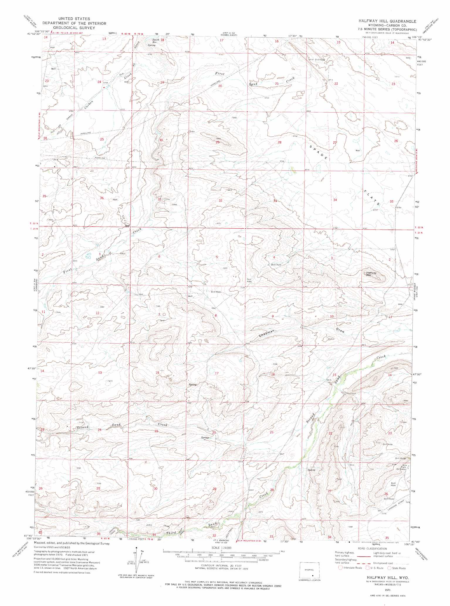
USGS Topo Quad 41106g3 - 1:24,000 scale
| Topo Map Name: | Halfway Hill |
| USGS Topo Quad ID: | 41106g3 |
| Print Size: | ca. 21 1/4" wide x 27" high |
| Southeast Coordinates: | 41.75° N latitude / 106.25° W longitude |
| Map Center Coordinates: | 41.8125° N latitude / 106.3125° W longitude |
| U.S. State: | WY |
| Filename: | o41106g3.jpg |
| Download Map JPG Image: | Halfway Hill topo map 1:24,000 scale |
| Map Type: | Topographic |
| Topo Series: | 7.5´ |
| Map Scale: | 1:24,000 |
| Source of Map Images: | United States Geological Survey (USGS) |
| Alternate Map Versions: |
Halfway Hill WY 1971, updated 1975 Download PDF Buy paper map Halfway Hill WY 2012 Download PDF Buy paper map Halfway Hill WY 2015 Download PDF Buy paper map |
1:24,000 Topo Quads surrounding Halfway Hill
T E Ranch |
Difficulty |
Windy Hill |
T B Ranch |
Walker Draw Se |
Elmo |
Como West |
Como East |
Medicine Bow |
Aurora Lake |
Hanna |
Carbon |
Halfway Hill |
Pine Ridge |
Foote Creek Lake |
Rattlesnake Pass |
Elk Mountain |
T L Ranch |
Mcfadden |
Pierce Reservoir |
Coad Mountain |
Elk Mountain Sw |
White Rock Canyon |
Arlington |
Bengough Hill |
> Back to 41106e1 at 1:100,000 scale
> Back to 41106a1 at 1:250,000 scale
> Back to U.S. Topo Maps home
Halfway Hill topo map: Gazetteer
Halfway Hill: Mines
Carbon Basin Mine elevation 2093m 6866′Carbon Number Seven Mine elevation 2112m 6929′
Carbon Number Six Mine elevation 2075m 6807′
Carbon Number Two Mine elevation 2098m 6883′
Kyle Mine elevation 2096m 6876′
Whistler Mine elevation 2050m 6725′
Wissler Mine elevation 2049m 6722′
Halfway Hill: Streams
Third Sand Creek elevation 2072m 6797′Halfway Hill: Summits
Halfway Hill elevation 2140m 7020′Halfway Hill digital topo map on disk
Buy this Halfway Hill topo map showing relief, roads, GPS coordinates and other geographical features, as a high-resolution digital map file on DVD:
Eastern Wyoming & Western South Dakota
Buy digital topo maps: Eastern Wyoming & Western South Dakota