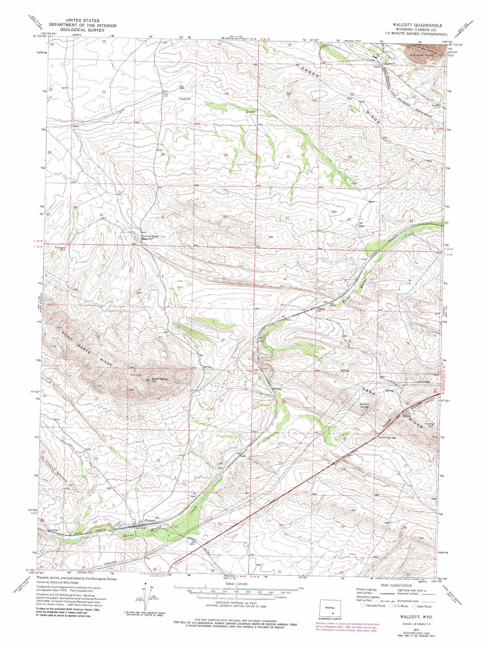
Walcott Topo Map Wyoming
To zoom in, hover over the map of Walcott
USGS Topo Quad 41106g7 - 1:24,000 scale
| Topo Map Name: | Walcott |
| USGS Topo Quad ID: | 41106g7 |
| Print Size: | ca. 21 1/4" wide x 27" high |
| Southeast Coordinates: | 41.75° N latitude / 106.75° W longitude |
| Map Center Coordinates: | 41.8125° N latitude / 106.8125° W longitude |
| U.S. State: | WY |
| Filename: | o41106g7.jpg |
| Download Map JPG Image: | Walcott topo map 1:24,000 scale |
| Map Type: | Topographic |
| Topo Series: | 7.5´ |
| Map Scale: | 1:24,000 |
| Source of Map Images: | United States Geological Survey (USGS) |
| Alternate Map Versions: |
Walcott WY 1971, updated 1976 Download PDF Buy paper map Walcott WY 1971, updated 1983 Download PDF Buy paper map Walcott WY 2012 Download PDF Buy paper map Walcott WY 2015 Download PDF Buy paper map |
1:24,000 Topo Quads surrounding Walcott
Wild Horse Mountain |
Seminoe Dam Sw |
Seminoe Dam Se |
Schneider Ridge |
T E Ranch |
Lone Haystack Mountain |
Ferris Lake |
Pats Bottom |
Tenmile Spring |
Elmo |
Sinclair |
Fort Steele |
Walcott |
Dana |
Hanna |
Smith Draw East |
Savage Ranch |
Meads |
Coal Bank Basin |
Rattlesnake Pass |
Kindt Reservoir |
Overland Crossing |
Overland |
Oberg Ranch |
Coad Mountain |
> Back to 41106e1 at 1:100,000 scale
> Back to 41106a1 at 1:250,000 scale
> Back to U.S. Topo Maps home
Walcott topo map: Gazetteer
Walcott: Mines
Seminoe Mine elevation 2055m 6742′Walcott: Populated Places
Coyote Springs elevation 2082m 6830′Edson elevation 2054m 6738′
Walcott elevation 2020m 6627′
Walcott: Reservoirs
Point of Rocks Reservoir elevation 2042m 6699′Walcott: Ridges
Edson Ridge elevation 2136m 7007′Walcott: Springs
Coyote Spring elevation 2109m 6919′Sulphur Spring elevation 2100m 6889′
Walcott: Summits
Saint Marys Hill elevation 2269m 7444′Walcott: Valleys
Coyote Canyon elevation 2073m 6801′Walcott digital topo map on disk
Buy this Walcott topo map showing relief, roads, GPS coordinates and other geographical features, as a high-resolution digital map file on DVD:
Eastern Wyoming & Western South Dakota
Buy digital topo maps: Eastern Wyoming & Western South Dakota